


Looking south as Bruce climbs the Green Loop. Photos and trail review by Bruce on March 19, 2019.
Fruit Loops
Fruit Heights Mountain Bike Trail System
The Fruit Heights trail system lies between the homes of Fruit Heights and the Bonneville Shoreline Trail. It consists of an easier loop on the outside and three downhill flow trails inside that loop. Trail options range from Beginner to High-Expert. The trails are well-engineered and a lot of fun.
The trail system lies at 4900 feet elevation on the foothill slope between Fruit Heights and
the steep slopes of Shepherd Peak. In 2019, there are 2.8 miles of trail.
The top of the outer
loop connects to the lower Bonneville Shoreline Trail for longer rides.
Depending on snowfall and temperatures, the trails may be ready to ride in March. The entire trail surface is sun-exposed and dries quickly.
Depending on snowfall and temperatures, the trails may be ready to ride in March. The entire trail surface is sun-exposed and dries quickly.
 is seen ab...")
Looking south on the Green Loop. The BST (Bonneville Shoreline Trail) is seen above.
Green Loop

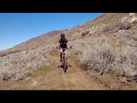
Climbing the Green Loop and almost to the top. At the far left side of the photo, the trail crosses the doubletrack 1080 East access trail. The cars at top left are in the BST parking area.
The Green Loop is a one-way loop 1.7 miles in length with 200 feet of elevation change. It's
an easier ride suitable for experienced beginners. The Green Loop is the
key to the entire
trail system. It encloses the downhill flow trails and provides both access
to and return from
these trails.
The Green Loop should be ridden clockwise, so you climb the northern side and descend the southern
side. The upper (eastern) side of the loop traverses the mountain just
below the doubletrack
BST and is the access-trail for the downhill flow trails.

Southbound on the Green Loop riding clockwise. A powerline corridor transects the riding area.

We've just left the short stretch where the Green Loop and the BST join. The shrubs downhill from the trail are wild rose.
On the top side, the loop will join the BST for a very short distance as it skirts a ravine.
On the bottom side, it will dump onto a doubletrack for about 150 feet
before resuming the
singletrack. The navigation for these spots is obvious.
As you pass the entries to the flow trails from north to south, the flow trails get more technical.
The northernmost Blue trail would be considered easier-intermediate, while
the south Blue trail
is upper-intermediate. The southernmost flow trail, designated Black Flow
on my map is solid
expert-level with a couple of double-black high-expert features.

Rolling a nicely-bermed turn as we reach the bottom of the descent.
Blue Flow North

Approaching the trail fork for the northern Blue trail.
The northernmost flow trail is an intermediate-level trail 0.3 miles in length. It forks to
the right from the Green Loop at 0.1 miles from the doubletrack crossing
of the 1080 East access
trail.
As you reach the bottom, keep straight as the Green Loop joins you on your left. Then keep
right again as you pass the Eastoaks access trail. A loop around the northern
Blue Trail is
0.7 miles with 170 feet of climbing.

The northern intermediate trail has a lot of rollers and bumps but can be done by a well-experienced beginner.
Blue Flow South
 trail.")
The drop-in to the southern Blue (upper-intermediate) trail.
The southern intermediate trail forks away from the Green Loop 0.2 miles after the temporary
merger of the BST and Green Loop. That's 0.4 miles from the 1080 East
entry to the loop. It's
significantly more technical than the northern Blue trail.
The southern Blue trail is 0.5 miles long -- but with a shortcut option that would cut it to 0.4 -- with 200 feet of elevation change.
The southern Blue trail is 0.5 miles long -- but with a shortcut option that would cut it to 0.4 -- with 200 feet of elevation change.
As you approach a big rock on the left side of the trail at mile 0.35, an alternate line rolls
up and over the rock. It's not as hairy as it looks as long as you keep
the bike rolling. This
rejoins the main trail, but then hooks to the right to join the Green
Loop. This spot can be
a bit confusing, as there are no signs here in March 2019.

A big rock roll-over near the bottom. The ramp is about 15 feet. With the right speed, it only LOOKS hard. But definitely not for newbs.

Hitting a fast turn. The berms are nicely done!
Meantime, the main Blue trail heads south and dumps onto the end of the Black trail as it joins
the Green Loop. Keep right as it joins the Black flow trail, and right
again as it reaches
the Green Loop.
A loop around the full Blue trail would be 1.5 miles with 200 feet of climbing.

A minor rock roll-over on the upper part of the southern Blue trail.
Black Flow Trail

The drop-in to the Black trail.
The Black Flow trail forks to the right from the Green Loop about 100 yards past the fork for
the southern Blue Trail (0.45 miles from the 1080 East entry). It's 0.4
miles long with 200
feet of elevation change.
Most of the technical features on this trail can be rolled by a competent intermediate rider.
But (March 2019) there are two drop-offs that can't be rolled, true do-or-die
drops.
The first isn't a big deal. It's about 2 feet and any expert rider should be able to take this one. The second, at mile 0.2, is preceded by a trail fork. To the right, you'll rocket off a rock for a vertical drop of between 8 and 15 feet depending on your speed. The left fork is a none-too-easy cheater route around the rock.
The first isn't a big deal. It's about 2 feet and any expert rider should be able to take this one. The second, at mile 0.2, is preceded by a trail fork. To the right, you'll rocket off a rock for a vertical drop of between 8 and 15 feet depending on your speed. The left fork is a none-too-easy cheater route around the rock.

The smaller rock drop. This one isn't a big deal, as long as you maintain your speed and keep the bike from nosing down.

Lots of fun stuff here!
A loop using the Black trail would be 1.4 miles with 200 feet of climbing.
Bottom Line!
Very nicely built trails, fun to ride for all ability levels. Not a lot of mileage, but to hit all the downhill routes, you're looking at around 6 miles and 800 feet of climbing. It could use a few more signs to tell you where you are on the lower half, for example the spot at the bottom of the southern Blue Trail with the rock rollover and hook connector.
Highly recommend this trail system.

At the far south end, I'm rolling a downhill turn on the Green Loop.

Map of Fruit Loops
Getting there:
From I-15 near Farmington, turn onto US-89 northbound. In 1/2 mile, take the Main Street Fruit Heights exit. After turning right onto Main Street, immediately turn left onto Mountain Road. Drive northbound around a mile, then spot Eastoaks Drive on your right and follow Eastoaks all the way up to a T intersection with 1080 East. Turn right.
Eastoaks: If you plan to start at the Eastoaks access trail near the flood basin, after turning right onto 1080 east, turn quickly right again as Eastoaks descends to a parking circle.
BST/1080 East parking: After turning onto 1080 East, continue straight to the end of the pavement. You can do a U-turn and park on the uphill side of the street, then head for the ride-around to the right of the gate. Or you can head steeply uphill and slightly left to the BST parking area -- and backtrack downhill to the gate. (There's no direct connector trail from BST parking in March 2019.)
Alternate (Bella Vista BST) access: When exiting US-89 onto Main Street, go to the right and drive around 1/3 mile to turn left on 1400 North. At a T intersection, turn right on Compton Road. Take the next left, which is Grandview Drive. At another T intersection, turn left on Bella Vista and follow it to the end. Park on the uphill side and begin riding the doubletrack Bonneville Shoreline trail. You'll reach the Green loop in 1/3 mile, on your left. Turn 180 degrees onto the trail so you're riding clockwise.
Riding resources for this trail:
Single-page riding guide
GPS track files and route (right-click and "Save as..."):
GPX multi-track area file
High-res topo map: View map (right-click to print)
Lodging, camping, shops: Links to Ogden area resources
Single-page riding guide
GPS track files and route (right-click and "Save as..."):
GPX multi-track area file
High-res topo map: View map (right-click to print)
Lodging, camping, shops: Links to Ogden area resources


