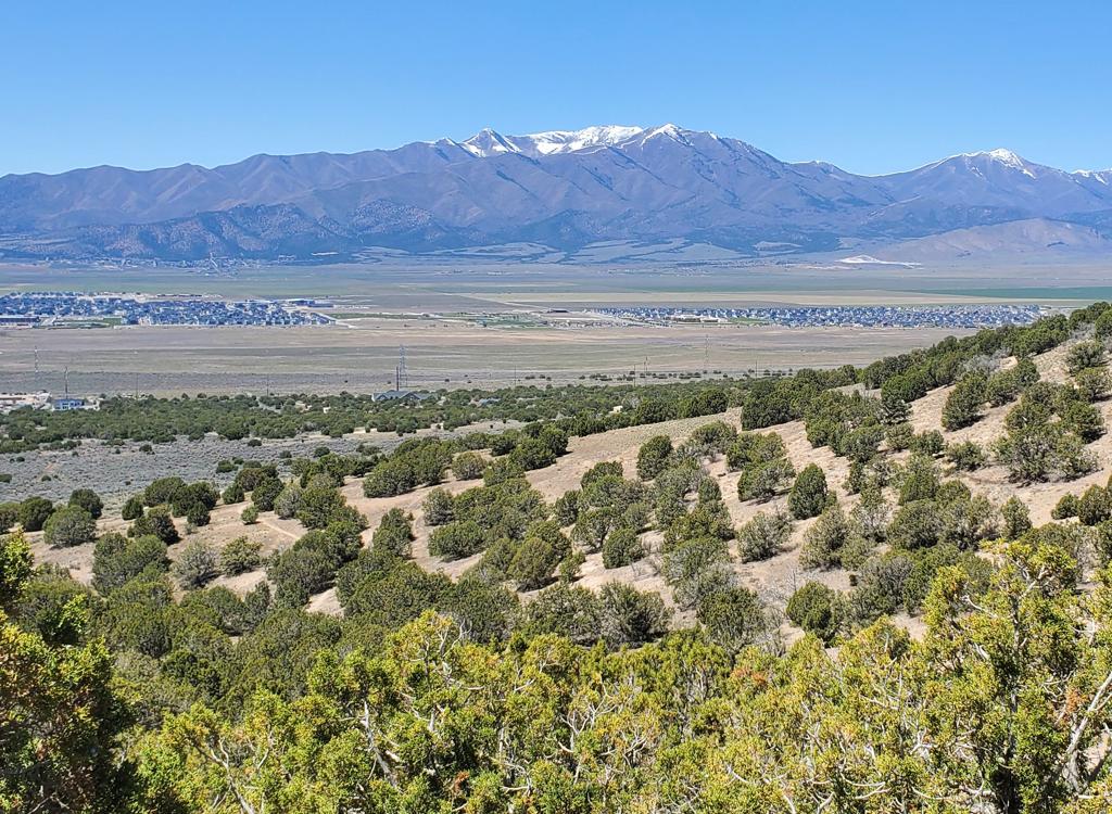
View over a ramp toward Utah Lake and Timpanogos. Ride and review by Bruce and Jackie, December 2, 2009.
Flintstone Trail
The Flintstone Trail is a mile of expert downhill singletrack with multiple man-made stunts. It lies on the northeast corner of Lake Mountain, with a trailhead in Eagle Mountain's Mountain Ranch Bike Park . A loop ride is 4.7 miles. Vertical change is 500 feet, to an altitude of 5400 feet.
Flintstone was closed for several years (starting in 2017) but now seems to be open for bicycles and hiking. Note that Shooting Gallery (south of Flintstone) remains closed.It's probably possible to shuttle this ride with a drive around the northern end of the mountain.
Below I have driving instructions to reach the singletrack via Hidden
Canyon Road. (See GPS
multi-track file.)
There's also a singletrack route from the Pony Express Parkway using the Hidden Canyon and Cow Tracks Trails, with a bit of doubletrack at the end. See the second ride description below. You can also reach it by forking uphill where either Jackrabbit or Roadrunner cross the doubletrack. GPS tracks for these trails are found in the multi-track file.

The ridgeline ride that connects to Flintstone has long areas of loose rock, and some largish embedded rock. This is not a ride for soft intermediate bikers.

View northeast over Saratoga Springs, with the clouds of a cold front kissing the top of Lone Peak (mid left), Pfeiferhorn (mid) and Box Elder (just to R of middle).
The loop starts at the bike park. As you enter the park from the kiosk at the north end, ride
the broad gravel path southward along the west border of the park. Turn
left as the path ends
on gravel doubletrack. Follow the DT as it turns southwest to climb to
the top of the hill.
(Extra point route: as the DT turns, go L on ST, then R at the fork, R
at the next fork, then
straight to where the ST hits the DT, where you'll turn L.)
At the top of the mountain, turn left on continuing doubletrack. At the next couple of forks,
keep left and straight as you climb up the ridgeline. It's a bit of a
grunt. The surface has
a lot of small angular rock. In general, you want to stay close to the
east side of the rim.
Small roads forking to the west (right) may take you off the mountain.

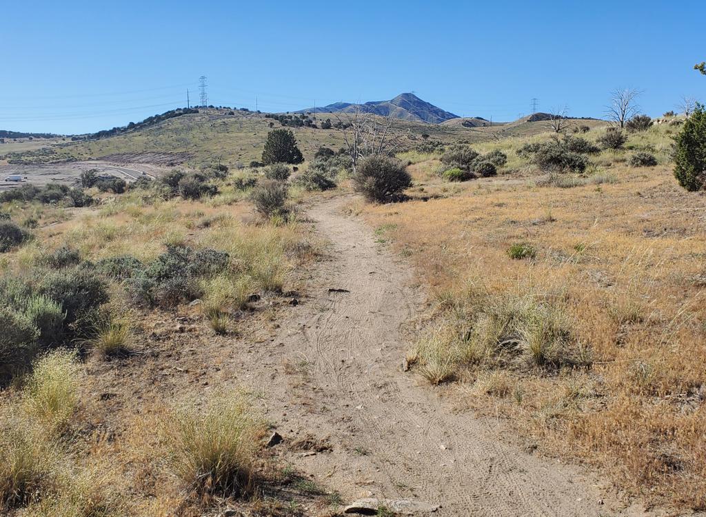
View southwest from the ridge. Good views, even in winter.

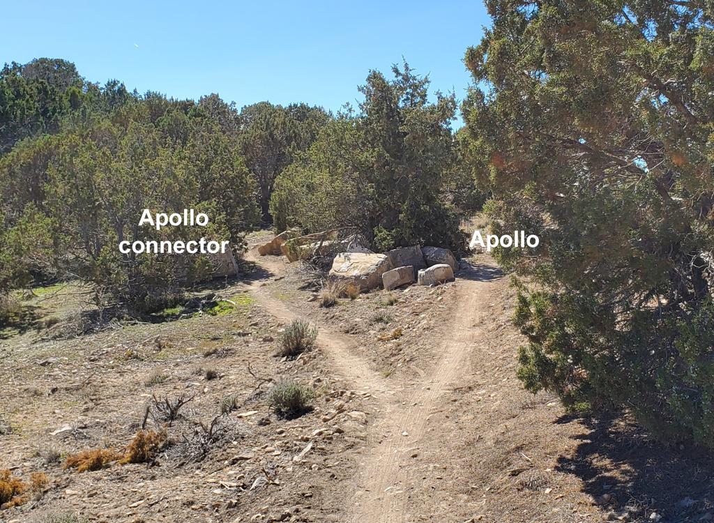
This is the beginning of the Flintstone trail form the ridgeline doubletrack, aiming toward Provo Canyon. As you cross over the top, the trail becomes very obvious.
The ridgeline DT will wind around through juniper trees and pass a newly-constructed water
tank (wet cement on the top December 2, 2009). Keep left and on the ridge.
As you reach, you'll see a singletrack on your left, heading toward the edge. Easy to miss. Hopefully,
you'll see tire tracks turning into the trail.
To arrive via singletrack, park in the paved lot and take Rock-a-Billy, Cow Tracks, then Bugs Bunny, then Paintball City. At the doubletrack, turn uphill and pedal to the top of Flintstone.
To arrive via singletrack, park in the paved lot and take Rock-a-Billy, Cow Tracks, then Bugs Bunny, then Paintball City. At the doubletrack, turn uphill and pedal to the top of Flintstone.
Note: If you're riding the
ridgeline doubletrack from the bike park, the trail is located a lot
further south along the ridge than you'd think. If in doubt, keep going!
Those who get lost are those who quit looking too soon. You'll pass five
small valleys to your left (with a continuous broad valley to your right)
as you follow the long ridge. If you're looking for this trail by
yourself, I strongly recommend an odometer or GPS!
Now it's time to change from Grind-it-Out gear to Downhill-Flight. The trail is designed for
expert downhillers. Turns have high banks for speed. And you need to take
them with speed.
The apex of the turns have steep slopes, so you can't crawl through with
your brakes on. And
you can't put a foot down. The loose stuff on top of hard clay guarantees
that you'll slip
and go down hard. Get the idea? No Beginners!

Jackie waits while I snap a photo as the trail veers northwest. Not to the steep part yet.

A diving board jump, about a foot wide, with its landing transition. The ride-around is just uphill of the photo.
Most of the man-made stunts have ride-arounds. On the other hand, in some spots the trail reaches
control points (such as little cliffs) that function to keep horses, ATVs,
and other trail-destroyers
off the route. You won't be able to see what's downhill from that rock
ledge on your first
ride.
As you reach the bottom, turn left on the dirt road. When you reach the subdivision, find your
way to the northwest corner. Here the Golden Eagle Road takes you over
a low pass (unpaved
in 09 up to the pass). Follow the road back to your car.

At right, a four-footer. The riding line is between my bike and Jackie.

Teeter totter awaits below.
Flintstone Trail from Bike
Park via ridgeline doubletrack:
0.0 Uphill from kiosk, N40 21.414 W111 58.695
Stay on broad gravel path
0.4 R on DT, N40 21.144 W111 58.961
Follow DT around turn and uphill
0.6 Fork L uphill on DT N40 21.060 W111 59.076
0.7 Keep L (follow ridgeline)
N40 21.038 W111 59.034
0.8 Keep L N40 21.021 W111 58.929
In general, stay L on ridgeline
1.6 Pass water tank
2.0 Flintstone ST on L, N40 20.328 W111 58.152
3.0 At fence, L on DT, N40 20.452 W111 57.665
3.3 Enter subdivision, follow streets to NW corner
Aim for gravel road going over rise to NW
4.1 On gravel road, becomes paved
4.7 Back at parking
Riding notes, Singletrack route
from Pony
Express
0.0 From Hidden Canyon Rd, east on paved trail
Veer right uphill on Hidden Canyon trail
N40 21.344 W111 59.483
0.7 Cross DT N40 21.069 W111 59.065
100 feet, then fork R (Cow Tracks)
N40 21.049 W111 59.032
50 feet, cross DT N40 21.038 W111 59.036
1.0 Keep R (L = Ridgeline ST)
N40 20.943 W111 58.911
0.0 From Hidden Canyon Rd, east on paved trail
Veer right uphill on Hidden Canyon trail
N40 21.344 W111 59.483
0.7 Cross DT N40 21.069 W111 59.065
100 feet, then fork R (Cow Tracks)
N40 21.049 W111 59.032
50 feet, cross DT N40 21.038 W111 59.036
1.0 Keep R (L = Ridgeline ST)
N40 20.943 W111 58.911
1.6 Straight on DT to stay level along hillside
N40 20.597 W111 58.592
1.8 Turn R (southbound) on DT
N40 20.512 W111 58.408
2.1 Keep straight (Road Runner ST crosses)
N40 20.341 W111 58.265
2.2 Keep straight (Jackrabbit ST on R)
N40 20.341 W111 58.184
2.3 Top of ridge, Flintstone on L
N40 20.327 W111 58.151
N40 20.597 W111 58.592
1.8 Turn R (southbound) on DT
N40 20.512 W111 58.408
2.1 Keep straight (Road Runner ST crosses)
N40 20.341 W111 58.265
2.2 Keep straight (Jackrabbit ST on R)
N40 20.341 W111 58.184
2.3 Top of ridge, Flintstone on L
N40 20.327 W111 58.151
Getting there, bike park TH: Take the I-15 Lehi Main Street
exit and turn west. Continue west on SR-73, crossing Redwood Road (11600
West). Just after climbing the hill, turn left at the stop light onto The
Ranches Parkway. Stay on that road as it narrows and turns. When you come to a T intersection at the end of The Ranches
Parkway, turn right on Golden Eagle Road. Drive about 1/3 mile and watch
for the trail kiosk on your left. Park by the trail kiosk and begin your
ride by climbing up the trail heading south. (The only bathroom is here by
the jump line.)
Singletrack route: Turn right off Ranches Parkway onto Pony Express Parkway. After 1.1 miles, turn left to Hidden Canyon Road and find a parking spot. Start on the eastbound paved trail on the south side of Pony Express.
Shuttle to top: As above, head south on Ranches Parkway. At Pony Express Parkway, turn right. Just over miles later, turn left on Hidden Canyon Road. Keep heading generally southwest, staying along the edge of the hill to your left. (Mile 0.4 keep L, 0.5 keep R, 0.8 keep L, 1.3 L then quick R -- don't take steeper DT up hill -- to continue southwest, 1.5 turn R, 1.8 you're there.)
Drive to bottom: From Ranches Parkway, go east on Pony Express Parkway about 3/4 mile to Porter's Crossing Parkway and turn right (south). Go about 1/2 mile south on pavement, then keep straight onto dirt road. At mile 1.5 from Pony Express, the exit from Flintstone will be on your left.

Map of area
Riding resources for this trail:
Single-page riding guide
Website: www.mountainranchbikepark.com
GPS track files and route (right-click and "Save as..."):
Flintstone only
Flintstone area tracks
Multi-track GPX area file
Topo map: View simple map View area multi-trail topo
Lodging, camping, shops: Links to Provo area resources
Single-page riding guide
Website: www.mountainranchbikepark.com
GPS track files and route (right-click and "Save as..."):
Flintstone only
Flintstone area tracks
Multi-track GPX area file
Topo map: View simple map View area multi-trail topo
Lodging, camping, shops: Links to Provo area resources
updated 2015