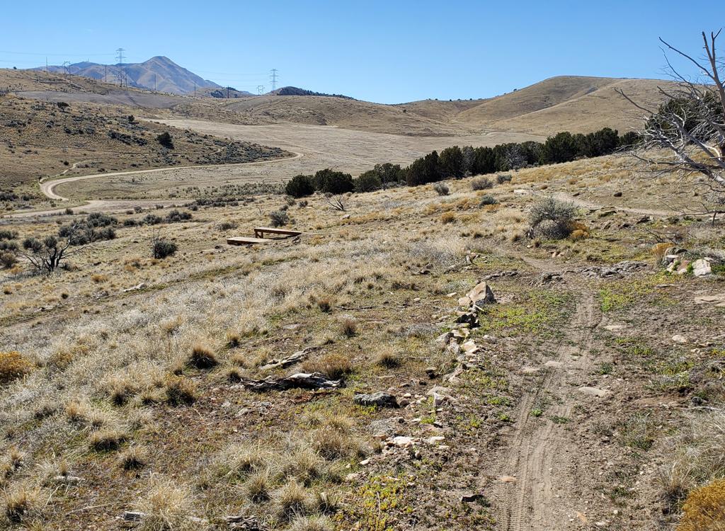
Looking up the broad doubletrack, a few pink flags for the upcoming race flutter in the breeze. April, 2002.
Five-mile Pass
This is a route we all used to ride during the winter months. But there are now TONS of new singletrack trails nearby, so very few cyclists hit this route any more.
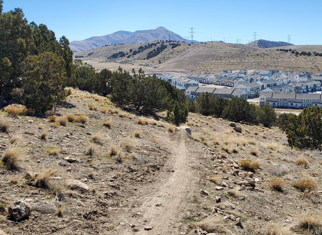
Five-mile Pass is a popular 4-wheeler recreation area about 20 miles west of Lehi. Terrain is rolling rocky hills covered with sage brush and juniper. The track is 4-wheeler trail, complete with dust, ruts, and loose rock. Trails join and branch off constantly, making it a navigation challenge for newcomers. Sound like your idea of Mountain Biker's Hell? Well, hold on.
This is a route we all used to ride during the winter months. But there are now TONS of new singletrack trails nearby, so very few cyclists hit this route any more.
Five-mile Pass is a popular 4-wheeler recreation area about 20 miles west of Lehi. Terrain is rolling rocky hills covered with sage brush and juniper. The track is 4-wheeler trail, complete with dust, ruts, and loose rock. Trails join and branch off constantly, making it a navigation challenge for newcomers. Sound like your idea of Mountain Biker's Hell? Well, hold on.
Five-mile Pass is the site of a popular springtime Intermountain Cup race. The trail can be
biked in early spring when even the lowest Wasatch foothill trails are
locked in with snow.
And it's one place you can go with your ATV-loving neighbors for a day's
outing. They can choke
on dust and gas fumes while listening to the engines roar -- meantime
you get in a nice bike
ride before lunch.
Our trail riding description (below) assumes you'll want to follow the official race course. (Although the course may change in future years.) But there's plenty of track to ride, so feel free to explore. Length of the race course with one lap is 11.0 miles. Altitude change is 400 feet, but you'll roll up and down for total climbing of about 1000. Base altitude is 5200 feet.
Our trail riding description (below) assumes you'll want to follow the official race course. (Although the course may change in future years.) But there's plenty of track to ride, so feel free to explore. Length of the race course with one lap is 11.0 miles. Altitude change is 400 feet, but you'll roll up and down for total climbing of about 1000. Base altitude is 5200 feet.

Jackie, the UtahMountainBiking mascot, looks back at the wash, two miles of raging downhill.

Looking back, we've come about 3 miles. Behind us, the Oquirrh mountains rise in the north. All photos by Bruce Argyle, April 2002.
There are some scenic vistas of basin-and-range topography. On the mountain, sage and juniper are interrupted by protruding bands of dark limestone from the Pennsylvanian Period (320 million years ago), with a cap of lighter Permian-period (285 million years ago) rock near the top. Fossils of ocean-dwelling corals, crinoids, and bryozoans can be found fairly easily in this rock.
Did I mention that this trail is hard to follow? In the first 4 miles, there are at least 24 alternate pathways, and it's usually not obvious which way you're supposed to go. If you're riding without a guide, you should copy our by-the-mile riding description. Calibrate your odometer.
Did I mention that this trail is hard to follow? In the first 4 miles, there are at least 24 alternate pathways, and it's usually not obvious which way you're supposed to go. If you're riding without a guide, you should copy our by-the-mile riding description. Calibrate your odometer.
Trail surface is chunky rough limestone rock and clay. When it's dry, the ATVs churn things
up, so good downhill surfing control is recommended. When it's wet, this
clay sticks like glue,
creating a real bog. Usually the trail dries quickly after a rainstorm.
Winter riding is often possible. Snow melts quickly here. In late winter, ride in the early morning when the ground is frozen. South-facing slopes, open to sun, are usually dry in February. If you ride according to the directions below, the north-facing slopes on the first half of the ride are uphill. They're frozen and easily ridden in the early morning, but can become a hike-a-bike bog by noon. If you're a "leave no trace" biker, don't sweat the mud-riding -- this trail is used by 4-diggers and ATVs, so any petite bike tracks you leave here make no difference.
Winter riding is often possible. Snow melts quickly here. In late winter, ride in the early morning when the ground is frozen. South-facing slopes, open to sun, are usually dry in February. If you ride according to the directions below, the north-facing slopes on the first half of the ride are uphill. They're frozen and easily ridden in the early morning, but can become a hike-a-bike bog by noon. If you're a "leave no trace" biker, don't sweat the mud-riding -- this trail is used by 4-diggers and ATVs, so any petite bike tracks you leave here make no difference.

At the Intermountain Cup race, a rider emerges from the wash near the finish line. May 2003.

Paintbrush blooms among the sage along the northern slope.
General plan: You're going to be going around the mountain area south of you. At first, you'll
head southwest between two small mountains, then follow the western edge
of the mountains further
southwest. At 4 miles, you'll hike your bike over an insanely steep ridgeline
(Yellow Page
Hill) to the east and drop into a sage valley, where you turn northeast.
You head up a long
narrow valley, then drop down a wash. Arriving at open land around mile
7, you turn back westward
and follow the northern edge of the mountains to get back to the start
of the loop.
One option: Instead of heading up the impossibly steep ridge at mile 3.9 (Yellow Page Hill
a.k.a. "You-gotta-be-kiddin-me"), you can head around it in a big 2.5-mile
loop. This also
avoids the spookily steep, loose-rock descent off the ridge. See the map.
Every race course
needs something absolutely insane, and with almost 300 vertical feet in
1/10th of a mile, this
up-and-over is even hard to walk.

The trail ahead drops into a ravine on a not-too-steep but still raging descent.
Riding directions, Counterclockwise loop:
0.0 Begin southwest on broad dirt road
0.3 Fork R, climb (alt = continue up road, rejoin A)
0.5 Fork R, west
0.55 Hard L, back to east
0.65 Turn R back onto main road, southwest (A)
0.85 Straight at 4-way (south) = point C
(Left = return loop GPS N 40° 13.596' W 112° 09.954')
0.95, 1.1 Keep L as veers eastward
(View of valley to southwest)
1.4 Straight at 4-way (south-southeast)
1.55 Keep R up over hill
1.70 Keep straight (right) (alt = rejoin B)
1.75 Hard L to northeast
1.85 Straight as trail rejoins left (B). Going east
GPS check N 40° 12.964' W 112° 09.755'
2.05, 2.1 Keep R as trail heads south
2.15 Turn L to southeast
2.25 Turn R to southwest
2.6 Fork L to go over small hill
2.9 Go R on last (leftmost) of 3 roads to your right
(going west and down)
2.95 Fork L to head back southward
GPS check N 40° 12.151' W 112° 10.131'
2.98 Fork R again downhill
3.05 Left at 4-way to head over small ridge
3.15, 3.4 Keep straight (L), go over knoll
3.9 Fork L and go UP THE WALL (east)
(Alt = R into valley, then L at intersections, add 2.5 miles)
4.0 Top of ridge GPS N 40° 11.337' W 112° 10.407'
4.4 Turn L at 4-way to go northeast up long valley
4.7, 5.25 Keep straight (left)
5.65 Keep straight (track joins on L)
5.95 Keep straight (R) to continue northeast
6.1 Keep straight and head down wash
7.15 Straight (trail joins from R), out onto flat
GPS check N 40° 12.428' W 112° 08.143'
7.5 Turn L away from valley, going west
7.8 Keep straight as doubletrack crosses
8.8 Keep straight as track joins on R
9.8 Keep straight at 4-way
10.0 Fork R downhill
10.1 Keep straight (R) downhill
10.15 Fork L
10.25 Fork L, aiming towards big dirt road
10.35 Back at loop-return C, turn R
Roll straight down road, don't do small loop at A
11.0 Back at the parking area
Five Mile Pass resources:
One-page riding guide
High-resolution (large!) topographical maps:
FiveMileTopo.gif (877 KB)
Satellite photo with overlying trail colored by elevation: FiveMile-Photo.gif (37 KB)
Track data files for your GPS unit -- never make a wrong turn!
To download, please right-click and select "save target as...":
FiveMile.gpx
Lodging, camping, shops: Links to Provo area resources

Five Mile Pass
Getting there:
From I-15, take the Lehi Main Street exit. Turn west and drive through Lehi. After crossing the Jordan River, you'll come to a traffic light in the middle of nowhere. This is Redwood Road. Set your odometer, and continue straight on SR-73. 19.2 miles after the traffic light, you'll see dirt parking areas on both sides of the road. Turn left. The broad dirt road heading southwest is the beginning of the trail. GPS N 40° 14.179' W 112° 09.956'
From I-15, take the Lehi Main Street exit. Turn west and drive through Lehi. After crossing the Jordan River, you'll come to a traffic light in the middle of nowhere. This is Redwood Road. Set your odometer, and continue straight on SR-73. 19.2 miles after the traffic light, you'll see dirt parking areas on both sides of the road. Turn left. The broad dirt road heading southwest is the beginning of the trail. GPS N 40° 14.179' W 112° 09.956'