Joel looks out towards Fisher Valley from the eastern Rim of Fisher Mesa. (Photo received by email, thanks!)
Fisher Mesa
Fisher Mesa has two rides: There's a 9-mile out-and-back singletrack ride, and the old classic 21-mile doubletrack out-and-back to the end of the mesa. The singletrack is wonderful. The mesa road is brutal.
My suggestion is to do the singletrack. If you want a real hammerfest, follow the mesa road from the singletrack to the end of the mesa and return the way you came.
The ride starts on the bench of the La Sal mountains at 8200 feet. It's a great ride when Moab
is too hot. The trailhead will usually be snow-bound until May, but with
luck, you can sneak
past a couple of drifts to reach dry singletrack in April. The singletrack
ride drops 1000
vertical feet over 4.5 miles. Then you get start the uphill crank for
a fun 9-mile round trip.

Handlebar view of a section of open rock in the singletrack course. In the distance, you can catch glimpses of Castle Valley.

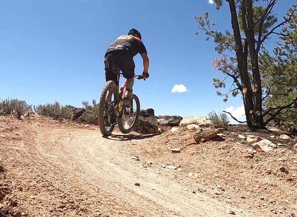
Here's Randy cruising one of the few straight dirt sections of the singletrack trail. (Photo received by email.)
Fisher Mesa is a "reverse profile" ride. You head downhill, having the time of your life, then
you have to crank back uphill. If you're planning to visit the end of
the mesa, it can be a
very brutal proposition. There's plenty of sand and loose dirt to suck
the life out of your
legs. There's 1500 feet of absolute altitude change and 2200 feet of climbing
for the long
mesa ride. If you're going via the road, the last two miles are at almost
10% slope.
You can grab an extra 1/2 mile of singletrack (and another 100 vertical) by starting at the pullout 1/2 mile north of the dirt road. Ride down past the outhouse, and go right on the mesa road.
You can grab an extra 1/2 mile of singletrack (and another 100 vertical) by starting at the pullout 1/2 mile north of the dirt road. Ride down past the outhouse, and go right on the mesa road.
Most riders start from the dirt road. Go north until you drop right down a long ramp. At the
bottom (about 1/2 mile into the ride) the singletrack forks right. (There's
a sign. Can't miss
it.)
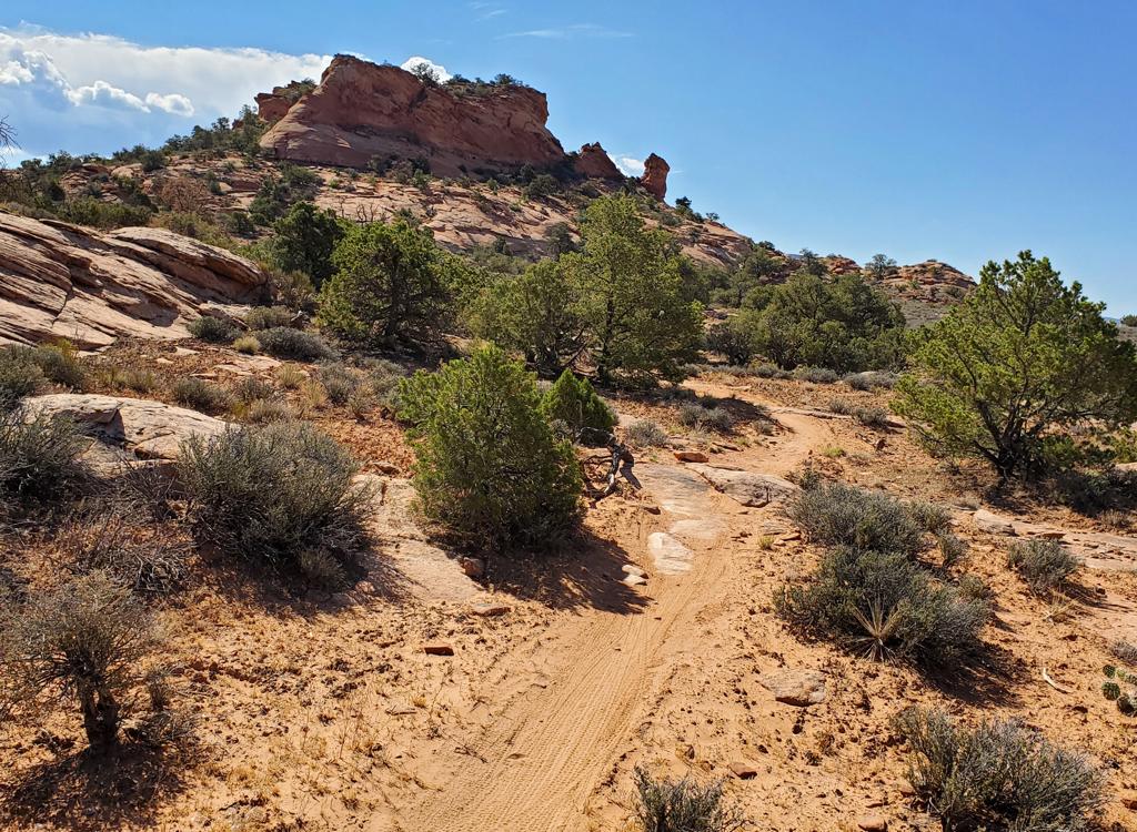
The singletrack is well-designed, and it's great fun. Straight "cruiser" areas are rare. Most of the track is twisting, turning, up-and-down, flirting with the cliffs on the mesa edge. There are plenty of rock outcrops to clear, and even a little open rock where small rockpiles mark the way.
The singletrack is well-designed, and it's great fun. Straight "cruiser" areas are rare. Most of the track is twisting, turning, up-and-down, flirting with the cliffs on the mesa edge. There are plenty of rock outcrops to clear, and even a little open rock where small rockpiles mark the way.

View north, as the Fisher Valley breaks into the Onion Creek narrows.

Here's an incentive to ride further north. We've joined the mesa road, and are at one of several viewpoints overlooking the Onion Creek Narrows.
When you come up a small hill onto a huge open grassy area, you're at the end of the singletrack.
Fork right to go to a viewpoint. Double back here if that's all you wanted.
Some riders absolutely MUST do a loop ride. If so, be my guest and ride back via the mesa road. You'll find it in a sandy dip, just back downhill from the viewpoint at the singletrack's end. But be warned: The mesa road is NOT easier than the singletrack trail. It's longer, involves more climbing, and has an absolutely rotten riding surface. Imagine riding in the talus pile of a rock quarry.
Some riders absolutely MUST do a loop ride. If so, be my guest and ride back via the mesa road. You'll find it in a sandy dip, just back downhill from the viewpoint at the singletrack's end. But be warned: The mesa road is NOT easier than the singletrack trail. It's longer, involves more climbing, and has an absolutely rotten riding surface. Imagine riding in the talus pile of a rock quarry.
Multiple angular rocks sit in a silty soft bed; tires sinking in like mud, while the rocks
roll and steal your momentum. (But keep in mind, my experience might not
be typical. I rode
it just after the snow cleared in April -- not a single other bike tire
track. After 4x4s have
packed it and knocked the rocks around, it might be better.)

End of the mesa. We've gone over five miles past the end of the singletrack, and we're looking down into the Onion Creek narrows.

View west from the end of the mesa.
The trip from the singletrack's end to the end of the mesa is a tough ride. You'll dip through
three valleys, so even as you're going "downhill," it seems like you're
climbing constantly.
The soft roadway surface and chunky rocks make for tough riding. And when
you hit the final
mile, sand. But it's a pretty view from the end of the mesa into the Onion
Creek Narrows and
across Fisher Valley.
Trailhead GPS N 38° 37.018' W 109° 13.810'.
Trail Fork GPS N 38° 37.329' W 109° 13.712'.
Singletrack End GPS N 38° 39.447' W 109° 15.856'.
Road meets ST GPS N 38° 39.354' W 109° 15.801'.
Mesa End GPS N 38° 39.995' W 109° 16.364'
Trail Fork GPS N 38° 37.329' W 109° 13.712'.
Singletrack End GPS N 38° 39.447' W 109° 15.856'.
Road meets ST GPS N 38° 39.354' W 109° 15.801'.
Mesa End GPS N 38° 39.995' W 109° 16.364'
Riding Resources for Fisher Mesa:
Single-page riding guide.
Large-format topo map (3.5 MB):
View
GPS track files (right-click and "Save as...")
GPX
Lodging, camping, shops:
Links to Moab area resources

Returning via the main mesa road. This is an easy section.

Map of Fisher Mesa
Getting there:
At the Colorado River (2.4 miles north of Center Street in Moab), turn east on highway 128. Drive along the Colorado for 15 miles. Turn right on the paved Castle Valley - La Sal Loop road. Zero your trip odometer. At mile 10.5, keep left (straight) as the La Sal Loop Road forks south. At mile 16, you'll see a small dirt road on the left, and a "wide space in the trees" on the right, which is parking for the Fisher Mesa Trail. For the longer singletrack option, continue up the road another 1/2 mile and park at the big gravel turnout on the left side of the road.
At the Colorado River (2.4 miles north of Center Street in Moab), turn east on highway 128. Drive along the Colorado for 15 miles. Turn right on the paved Castle Valley - La Sal Loop road. Zero your trip odometer. At mile 10.5, keep left (straight) as the La Sal Loop Road forks south. At mile 16, you'll see a small dirt road on the left, and a "wide space in the trees" on the right, which is parking for the Fisher Mesa Trail. For the longer singletrack option, continue up the road another 1/2 mile and park at the big gravel turnout on the left side of the road.