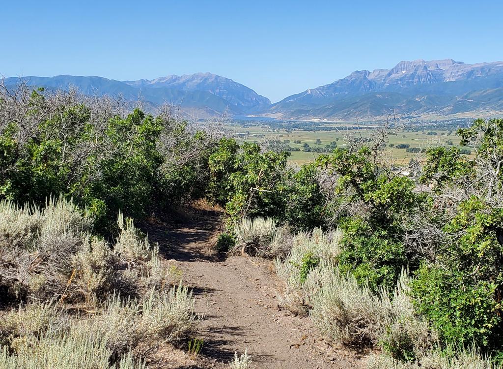
Typical trail view on Dutchman Way, with narrow singletrack twisting through small groves of trees -- usually gambel oak, but occasional maple and choke cherry. Original photos and trail write-up June 2, 2003 by Bruce. Updated June 2017.
Dutch Hollow Trail System
Dutch Hollow Trail System is a series of interconnected singletrack loops. The typical segment
of trail is about 1.5 to 3 miles, so you can put together an amazing variety
of rides. The
full system offers over 20 miles of singletrack. These trails were built
specifically for riding,
not as a route to a destination.
Note that Dutch Hollow lies in a state park and is a fee area. You'll need to deposit a fee envelope at the trailhead if your vehicle is parked within the
Hollow.

The Cottontail Trail forms an easy loop beginning at the trailhead in the hollow.
 Loop as we approach the overlook.")
View from the Overlook (Lookout) Loop as we approach the overlook.
The Dutch Hollow trails are located in a foothill area just northeast of Midway, southwest
of Jordanelle Reservoir. Trailhead altitude is 5750 feet. Peak singletrack
altitude is 6800.
Trail distance is up to you. There are dozens of riding combinations --
and the same trail
is a completely different experience when taken in the opposite direction.
One issue! Trail signs here are often bassackwards. Many give the name of a destination for
the trail you're about to enter, not the actual trail itself. So as you're
entering the Cottontail
trail, the sign may say "Sage Loop" -- the name of the next trail you'll
reach if you ride
Cottontail. Hopefully, somebody will fix this eventually.

There are many ridgelines from which to grab a fabulous view. The snow-covered tops of Provo Peak (left) and Timpanogos (right) are visible from many trails.

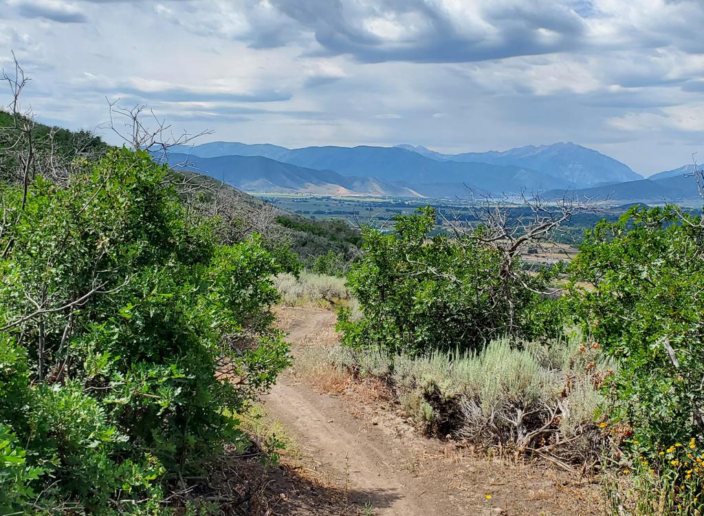
View back towards the farms of Midway from lower altitude, on Dutchman Way.
You're riding through a scrub forest of Gambel Oak, with an occasional maple and choke cherry.
Areas between oak groves are filled with sage. The trail base is mostly
red dirt, with occasional
outcrops of rough conglomerate. The dirt is veeeerrrry soft and sticky
when wet. Horses can
severely damage these trails in early spring.
You can create loop rides from trails that are smooth and reasonably easy (Aqueduct, Cottontail,
Sage). Or hit the tough stuff (Boneyard, 1000 Turns, Enchanted Forest)
if you want something
narrow and rough with roots, rocks, and stumps. Or Barrel for a buckaroo
DH. It's your call.
The tougher singletrack on the "backside" is very narrow, with close-in
oak, so you can have
yourself a pretty mean ride.

View from the Boneyard trail, looking northeast towards US-40. The tan area is the Jordanelle Dam.

View of the newer The Barrel, a downhill-only trail. There aren't any drops, jumps, or rock gardens -- just dipping swerving singletrack.
Easiest stuff:
Cottontail Loop. Go either direction. Clockwise, find the Sage/Cottontail trail as the road
enters the parking area on the north. Shortly after starting the climb,
fork left on Cottontail.
Pass Aqueduct and merge again with Sage, then rapidly fork right on Cottontail.
As the trail
reaches Burnt Ridge, consider doing the loop to the viewpoint, or just
drop down the other
side of Cottontail back to parking.
Hardest stuff:
From the trail kiosk, take the southern end of Cottontail up to Burnt Ridge. Do the loop, then
head UP the rocky ridge trail. Pass Connector, Gobblers, and merge with
Sage. Now turn left
right on Enchanted Forest. At the bottom, climb up 1000 Turns. Merge with
Enchanted Forest
and turn left on Sage then left on Gobblers/Boneyard. Fork R on Boneyard
and ride it to the
bottom, then climb UP Enchanted Forest. This time, drop right (west) on
Sage and take Aqueduct
to Barrell.

Paintbrush and scarlet gilia dot the trail sides with red color.

From 1000 Turns, we're looking out over the Provo River along US-40 north of Heber.
Intermediate stuff:
Take Cottontail at the kiosk up to Burnt Ridge. Do the loop at the viewpoint, then drop off
on northbound Cottontail. At Sage, turn uphill and climb to the top. Turn
left, then keep left
to drop west down Sage to Aqueduct. Fly down Aqueduct to Cottontail again.
Loops:
There are a lot of linked loops for riders or varying endurance. North of Sage is higher difficulty;
south is easier. The race loop is a good intermediate-distance ride combining
a variety of
terrain. See the 2011 Intermountain Cup race loop GPX link below and follow
the GPS track for
a nice tour of the east-side trails.

View north on Prospector, new in 2012. This trail is now the longest cruise in the Hollow, and makes it worthwhile heading over to the west side of the road.

View of Heber to the south from the high ridge on Prospect.
Another good loop is the Prospect Loop. Take Donkey Ridge on the west side to Prospect and
head north. When you hit the doubletrack at the far north, drop down the
road to Sage. At the
top of Sage, take Enchanted Forest to 1000 Turns. Cross the bottom of
the valley to climb up
the east side of Boneyard. Head to Burnt Ridge, loop around, then drop
down on Cottontail.
See the track file below.
New in 2015, the
Phosphate Trail
offers a nice loop for stronger riders. From the trailhead, take Donkey Ridge over to Prospect.
Turn left when you reach the Phosphate Trail for the clockwise loop. When
you rejoin Prospect,
you can keep right to complete the loop. But I suggest you make a hard
left and take Prospect
up to the top of Dutchman for a bigger ride.

Looking northwest from the saddle north of Phosphate Hill at the highest spot on the Phosphate Trail.

5 miles and 1500 vertical feet above the Wasatch Mountain State Park campground on the WOW trail.
Add-on: WOW TrailAt the far west side of the riding area, a connector joins the western
side of the
Phosphate Loop
to the
WOW
(Wasatch Over Wasatch)
trail. The
connector descends 1-1/4 miles to SR 224 just uphill from the campground
in the Wasatch Mountain State Park. The WOW trail is across the road.
As
of 2016, 10.7 miles of trail are complete.
Add-on: Dutchman Road
Upper Dutchman Road is pretty. After two miles the road begins climbing in earnest, 500 vertical
per mile, with rocks, creek crossings, and loose tilted stuff. As you
gain altitude, you enter
maple, then aspen forest. The ridgeline is a long 4 miles away at 7400
feet elevation.

Handlebar view on the Dutchman Road. Although you may think the "road" should be easy, it's a pretty tough ride after the first two miles.

Looking south toward the Heber Valley from Flatline.
Add-on: Flatline
At the northeast corner of the main riding area, where the bottom of 1000 Turns meets the bottom
of Enchanted Forest, the Flatline trail heads north. This trail extends
two miles -- generally
flat but very slightly uphill -- to a dirt road that passes under US-40.
And no, don't use
this "secret entrance" as a way to avoid the state park fee. Don't be
"that guy."
Bottom Line:Varied riding system with a lot of fun trails, good for a wide range of
ability levels. Route-finding can be confusing. In part, it's because
there are a LOT of trails. But trail signage is often non-existent, and
many signs will mislead you because they list the next trail you'll
encounter instead of the trail that the sign is on.
To ride all the singletrack in the Dutch Hollow system in a
single day will mean duplicating
some trail sections, and will yield about 30 miles. See if you can put it all
together!

Be on your best manners when you encounter horses on these trails -- which you probably will. Like beginning mountain bikers, "beginning horses" may be poorly trained. Give the horse plenty of warning, and a wide margin for passing. If a horse is skittish, it helps to lay your bike down in the brush and turn so you're facing away from the trail as the horse passes.
State Park FEE: In 2021, $10 per car
($5 seniors). The fee station is the self-service insert-the-envelope
type, so bring
a pencil or pen, plus exact cash or a checkbook. Before dumping your bucks
in the slot, detach the pay voucher from the envelope and put it on your
dashboard.

area map
Getting There: From Provo Canyon, drive east to
the end of Deer Creek Reservoir. Right where the water ends, turn left
(north) on U-113. Zero your odometer. Drive north 3.8 miles into Midway,
and turn right (east) as U-113 turns right in the middle of town. 0.4
miles later (mile 4.2), turn left (north) on 400 East (River Road). This
is the road that goes just to the west of the memorial hill. At
mile 5.4 you'll hit a traffic circle. Take the first exit (not the
driveway, though), so you'll turn from north to east. At mile 6.1, a sign points you to Dutchman Hollow
- Dutch Canyon. Turn left and drive 0.5 mile on pavement. The pavement
ends at a turnaround where the Dutchman Way trail begins, GPS N 40°
32.495' W 111° 27.224'. Turn right
downhill at the sign for Wasatch Mountain State Park. The preferred
parking area is 0.3 miles down the gravel road to your right. Trailhead
info, fee drop-box and bathroom are at GPS N 40° 32.704' W 111° 27.187'
From Salt Lake City, go up Parleys Canyon on I-80, then turn right
(south) on US-40. Just after descending from the dam, watch for River Road
on your right. Drive about 2 miles, turning right at the Dutch Canyon
sign. Find the trailhead as above.
Updated 2006, 2010, 2012, 2015, 2017


 Loop as we approach the overlook.")