View southwest from the parking area. The La Sal Mountains are in the background. Photos and trail review June 29, 2009 by Bruce.
Dead Horse Point - East side trails
(Includes Big Chief, Great Pyramid, and Intrepid Trails)
The Intrepid Trail System opened in 2009 in Dead Horse Point State
Park, with an expansion in 2014 adding more trails east of Highway 313.
New viewpoint trails were added in 2025. The Dead Horse Point trails were designed to please riders of differing skill and
fitness levels, and they succeed well.
For more trails in this area, see
the pages for Dead Horse Point west side
and Dead Horse Point viewpoint trails.
The trail altitude is around 6000 feet. It's usually at least 10 degrees cooler here than in
Moab (1800 feet lower). Altitude change while riding is less than 100
feet. Climbing is fairly
gentle over most of the trail. On the larger loop there are a couple of
very short (20-30 feet)
steeper climbs.
Technically the trail is easy. There are a couple of spots on the larger (Big Chief) loop that
will make beginners nervous, but they're not tricky. Most of the trail
can be ridden with a
single-gear bike.

Typical trail section. Rocks or branches define the riding line. The trail flows well, with constant gentle turns.

Looking east in the new mountain bike parking lot. The connector trail is to the left.
Mountain Bike parkingFrom Highway 191, drive up Highway 313, turning left off of the road to
Canyonlands National Park toward Dead Horse Point at mile 14. Go 4 miles to the entry gate. Then 0.9 miles later, turn left and
drive to a large parking area. There's a small bathroom and a bike-rental
shop (open during peak tourist season). The connecting trail is found near
the buildings, running 0.1 miles to the Raven Roll trail.

Visitors center. Bookstore, friendly riding directions, bathrooms.
Visitor Center parkingMany riders prefer to start at the north end of the Dead Horse
Point visitor's center parking lot. Drive another mile up the road. After a short length of two-way trail,
the route forks into a loop. (At this point, the "Prickly Pair" trail
forks left across the highway to the west
side singletrack.) Two connectors cross the main loop to create shorter
rides. The Intrepid Loop uses the first cross-link for a 1.1 mile option.
This short loop has very easy trail and is good for young children and
true beginners.
Great Pyramid and Big Chief Loops
 viewpoint, were looking past skirts of Moenko...")
From the first (Colorado Overlook) viewpoint, we're looking past skirts of Moenkopi mudstone to the evaporation ponds where potash is recovered from the Paradox Salt Formation.
The east-side trails consist of Intrepid (a short
connector to the visitor's center), Raven Roll (an easier trail on the
west), Great Pyramid (on the southeast), and Big Chief (to the northeast).
See the map!
The Great Pyramid Loop (4.2 miles) shortcuts across the middle of the larger 8-mile Big Chief
Loop. The Great Pyramid ride is suitable for beginners who have some experience
at riding and
shifting on dirt trail.
The trail is easy to follow. The trail corridor is broad with rocks and logs defining the riding
line. There are signs at every intersection.

Turning a little more to the southwest, we see a little bit of the Colorado at mid-left. We're standing on a ledge of Kayenta sandstone, as the cliffs fall away down toward the river.

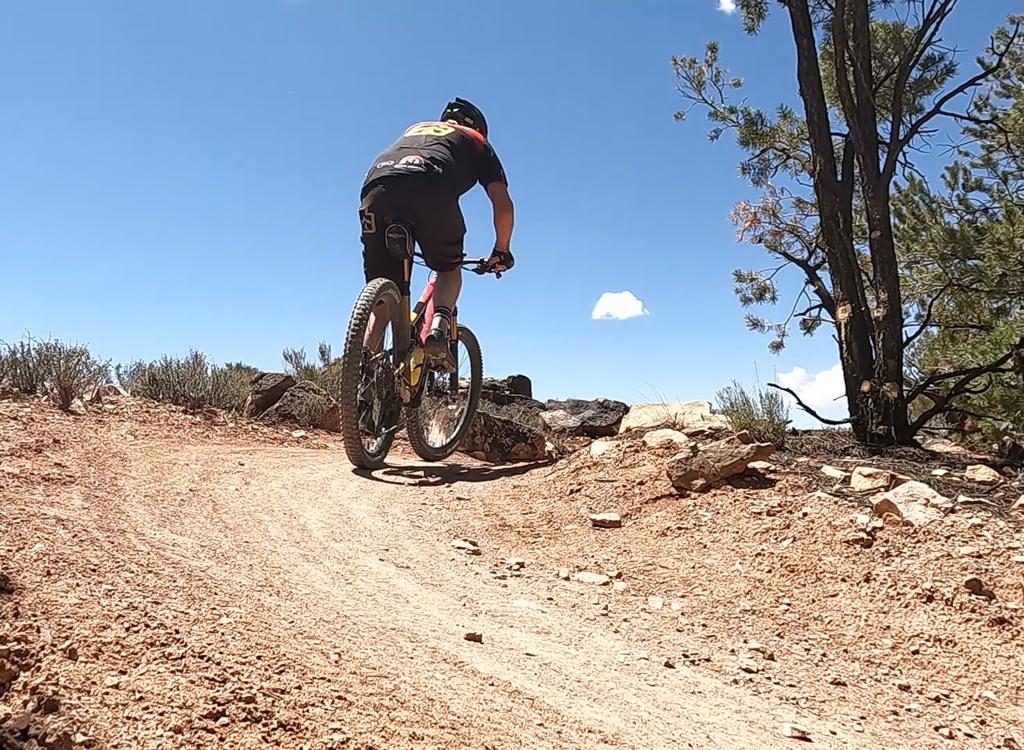
Toughest spot on the Great Pyramid Loop, and it's not that tough.
There's only one bump that beginners might not be able to ride (shown in the photo). Intermediates
will have no problem here -- it's smoother than it looks. You've just
got to know how to get
forward, find the right gear, and grind up the rock.
The trail is well-packed; but if you bobble to the side of the trail, the dirt is very soft
and your tires will dig in. Areas of loose dirt and sand in the trail
have been reinforced
with tiny dolomite rock (magnesium carbonate) which works very well to
harden the tread without
causing a "gravel road" feel. I encountered a couple of short sandy spots,
but they were easy
to ride.

Signs at every intersection show the way, but also show you where you are on the trail system.

The Big Chief loop goes past a group picnic area, where you can use a flush toilet, wash in a real sink, or stock up on more water.
The trail flows well and is a joy to ride. Riders of all ability levels will have a good time.
No, there aren't any scary tricky challenges, and there are no ugly painful
long climbs. Go
elsewhere if you're looking to suffer. This trail is where you take your
family and friends
so you can addict them to mountain biking.
The trail stays well away from the cliffs (60 feet or more), so parents can relax while biking
with kids. At two viewpoints, wooden bike-parking racks await while you
hike out to the overlook.
/

An interesting section of trail on the Big Chief loop, as you roll around and down a rock outcrop on a broad ledge. No cliffs -- the ledge is barely a foot off the dirt.

View toward the La Sals from the Big Chief Overlook, the highest point on the ride. The Kayenta underlying the trail is flat here, as we're near the center of the salt dome -- see geology !)
For trail riders, there are bathrooms in the visitors center at the trailhead and at the group
picnic site.
Dead Horse Point State Park is open year-round. The park plans to keep the bike trail open
all year, but will revisit that policy if rutting and other trail damage
becomes a problem.
Dead Horse Point campground has developed campsites.
The trails of Dead Horse have become popular for bike tours. So the east-side trails may be
crowded with newb bikers, even on a weekday.

View south along the cliffs from the Great Pyramid Overlook.

A typical section of trail; dirt plus some rocks that are easy to roll over, even without getting up on the pedals. Constant turns keep experts from getting bored.
Riding notes, counter-clockwise loop:
0.0 North end of parking, N on ST. N38 29.336 W109 44.170
0.4 Trail splits, fork R. N38 29.578 W109 43.980
0.6 Keep R; L to return (Intrepid Loop). N38 29.626 W109 43.793
0.6 Colorado River Overlook on R. N38 29.622 W109 43.762
Park bikes and walk to viewpoint
1.5 Great Pyramid Overlook on R. N38 29.990 W109 43.194
Park bikes and walk to viewpoint
2.2 Keep R for loop; L for Great Pyramid Loop N38 30.243 W109 42.880
(consider out-and-back on connector
to add 1.2 miles)
3.0 Rock ledges
5.2 Highest point, Big Chief Overlook. N38 31.178 W109 43.501
6.3 Pass group site (bathroom). N38 30.361 W109 43.481
6.5 Great Pyramid connector joins, keep R. N38 30.279 W109 43.407
7.2 Intrepid connector joins, keep R. N38 29.641 W109 43.797
7.5 Back at fork, keep straight
7.9 Back at parking
While in the park, be sure to head down the road further to Dead Horse Point itself, a virtual
island of rock connected to the mesa by a 30-foot passage. There are amazing
views of yawning
canyons in every direction.

The return side of the loop is fast and smooth, with views in all directions. The gray areas in the trail are where dolomite microaggregate has been added to harden the surface.

Map of Dead Horse Point trail system
Getting there!Visitor's Center Parking: About 10 miles north of Moab,
turn west off Highway 191 towards Canyonlands National Park on Highway
313. Drive 14 miles and turn left toward Dead Horse Point. Four miles
later, pay your entry fee ($20 per car in 2025) at the gate house and
drive another two miles to the visitors center. The trailhead is at the
north end of the parking lot (at the end opposite from the actual
visitor's center building).
Mountain Bike Parking: Drive up Highway 313 as above, turning left off of the road to
Canyonlands National Park toward Dead Horse Point at mile 14 from Highway
191. Go 4 miles to the entry gate. Then 0.9 miles later, turn left and
drive to a large parking area. There's a small bathroom and a bike-rental
shop (open during peak tourist season). The connecting trail is found near
the buildings, running 0.1 miles to the Raven Roll trail.


 viewpoint, were looking past skirts of Moenko...")