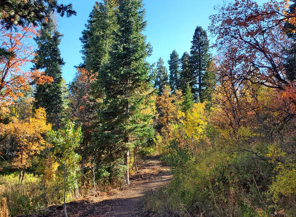
Bicentennial, Long Loop, and Middle Fork trails in North Fork Park
The Cutler Flat trails are found at the north end of North Fork Park. These include Long Loop, Middle Fork, and Bicentennial. Traildemic and the Cutler Creek doubletrack portion of Bicentennial are often included in rides of this area. Top elevation is 6300 feet; bottom is 5700. The expected riding season is June through October.
Cutler Flat will seem quite non-flat to you. Although the elevation change is not great, much of it occurs over fairly short distances. There will be some granny-gear climbs with a pitch of 9-10%. The northwest corner of Long Loop has a techy section that's for expert or confident upper-intermediate riders. But it's short enough that less-skilled riders can hike through.


If you begin from the traditional parking area down at the road fork (see map), your ride will start as a climb on "you gotta be kiddin me" ugly loose gravel road. As you approach a utility shed and pavilion, you'll pass two singletracks. One is the Cutler Springs trail, and the other is Cutler's Twist . Stay on the doubletrack and aim for the left side of the pavilion. This is NOT my recommended route, so let's backtrack for a sec.
I'm going to suggest that you start at the trailhead on the northern end of the Mule Shoe to Mule Ear loop . Catch the connector at the northwest corner of the loop and turn left onto Mule Ear climbing uphill. From there, you'll ride up Mule Ear, cross over the main gravel road, and cross over Mule Connector. (In August 2021, the trail markers at this intersection were not helpful. Of the three options, pick the trail in the middle that goes uphill.) At the next trail fork at mile 0.2 uphill from the trailhead, turn right onto Cutler's Twist.


Assuming you started via the Cutler's Twist route, the trail will head north and arrive at the group area (the pavilion) at mile 0.5 from the trailhead. Cross the first doubletrack. As you reach the second gravel road, the singletrack starts uphill to a trail fork. Don't go there. Instead, turn left onto the gravel road and ride past the pavilion.
The route veers to the west on the doubletrack that sits on top of the water line. After descending into the canyon, you'll climb gently along Cutler Creek. This is the Cutler Creek trail, here combined with the Bicentennial route.
Around mile 0.4 from the pavilion, there's a singletrack on the left that you can take for a short while. It rejoins after about 1/10th mile.

At mile 0.6 from the pavilion (mile 1.1 of the ride), there's a marked singletrack on the right. This is the Bicentennial Trail. The doubletrack Cutler Creek trail continues uphill. Turn right and pedal up to the bridge to cross the creek. (Or splash through at the horse crossing. Your call.)


Straight ahead is Long Loop. The Long Loop trail is 0.8 miles, and will drop 200 vertical feet. There will be a bit of climbing on the way downhill.


As you cross the road at mile 2.2 of your ride, the singletrack will continue another 0.4 miles down through forest of maple and oak. As you reach a dirt road, the continuing Long Loop trail is straight across. If you want though, you can turn right on the gravel road to coast down to Middle Fork. (There's a singletrack connection to Middle Fork on Long Loop as well.)
Go 0.3 miles southeast down the doubletrack. Keep left and downhill as another dirt road (the one you crossed a while ago) joins. Once you're in a sagebrush flat, watch carefully for the Middle Fork to Bicentennial trail. It will be on your right, hidden from view by a tree. You're now at mile 2.9 of the ride.
If you're tired and in a hurry, you can take the river road doubletrack all the way down to the northern entry road, bypassing the singletrack.


This segment is new in 2024. To ride the full singletrack loop, keep straight when the middle segment of Long Loop ends at the North Fork road. The newest section of Long Loop starts across the road. You're at mile 1.2 from the trail fork with the western Bicentenial trail.


 from the Traildemic trail. To the far right is a connector to the road. The trail on the left is Bicentenial.")
A very nice riding option is to continue straight onto Traildemic and follow it up to the pavilion. See the map.

Start uphill on the Middle Fork to Bicentennial trail. After cruising gently uphill through the flat, it will cross over to forest and begin climbing. There will be a bit of up-and-down riding as you work your way uphill.


There will be some stiff pitches to climb here. Over the next 0.6 miles, you'll gain 300 feet of elevation. If the trail surface is loose, some of these pitches may be hike-a-bikes for you. Once you reach the sign indicating the trail's high point (elevation 6300), descend Bicentennial another 0.3 miles back to the Long Loop trail fork.


It's now around mile 4.7 of your ride. Consider another go
around the loop. This time, you could descend dirt road all the way to
the
bottom of Bicentennial. Here you could climb back up via Bicentennial
for a
longer loop, or take the very-much easier climb back to the pavilion on
the
Traildemic trail
.
To
follow the traditional loop ride, turn left away from the top of Long
Loop
and descend Bicentennial back to Cutler Creek and climb out to complete
your 6.2 mile ride.

0.0 ST from parking off North Fork Park road
Immediate left uphill on Mule Ear
Cross gravel road
0.1 Cross Mule Connector
0.2 R on Cutler's Twist
0.5 Onto DT, pass L of pavilion
1.1 R onto Bicentennial ST
1.4 Keep L to descend Long Loop
2.2 Cross dirt road
2.6 R on DT
2.9 R on Middle Fork trail
3.7 R on Bicentennial
4.7 L to continue Bicentennial
5.0 Keep L on DT Cutler Creek
5.7 L onto Cutler's Twist
6.0 L to descend Mule Ear
6.2 Back at TH fork
Mule Ear trailhead (recommended): Turn left again at the North Fork Park sign. At the campground entry gate, you can turn left into the 365 Trail trailhead for a longer ride. To park at the Mule Loop trailhead, go 1.8 miles on the main North Fork Park road from where you turned off the main road. Look for a the trailhead sign on your right. Pull into the little loop and park. Connect to the trail on the northwest side of the parking area.
Traditional road-fork entry: Pass the first entrance into the North Fork Park (on your left). Go another mile up the road and turn left at the second entry N41 22.986 W111 54.298. Fork left at the T intersection. When you reach a hairpin turn with a gate at the apex (north side) of the turn, N41 22.979 W111 55.187, you're there. There's a singletrack on the right as you face the gate. That's a shortcut for a counterclockwise loop. Ignore it. The trail is the ST that sneaks around the left side of the gate, and the trail is the soft cindered DT.

GPS track files (right-click, "Save as..."):
Multi-track GPX area file
Area map in separate window for printing: View map
Lodging, camping, shops: Links to Ogden area resources