Typical scenery on the Cobblestone Loop. Aspens with occasional dry spots of scrub oak. Riding surface is smooth and mellow.
Cobblestone Loop
The Cobblestone Loop is a lariat-shaped extension off the Glenwild Trail, with a connection at the top to the newer Flying Dog trail. Most riders don't do Cobblestone alone as a ride, but combine it with Glenwild or Flying Dog. But you CAN drive to the loop.
The loop itself is in a heavily-wooded area. The top of the loop nicks a new development, where (as of 2007) roads are in place, but no homes. It's pretty, and the trail is nice, if short.
The trail is worth doing as an extension off the Glenwild Loop -- up, around the loop, and
back down, then backtracking on Glenwild (milder ride, if you came up
counterclockwise on Glenwild)
or continuing through the full Glenwild loop (hammerhead ride). If you're
doing Flying Dog,
you'll hit one side of the loop then ride the connector down to Glenwild.
The connector to Glenwild isn't as scenic, but it's smooth and easy riding. The bottom portion near Glenwild is fairly flat with sagebrush and grass. Near the loop itself, you're in a small canyon among small cottonwoods.
The connector to Glenwild isn't as scenic, but it's smooth and easy riding. The bottom portion near Glenwild is fairly flat with sagebrush and grass. Near the loop itself, you're in a small canyon among small cottonwoods.

Small pond on the connector to the loop.

This is what the trail looks like as it begins the climb uphill. Nice gentle climb, smooth trail. And don't worry, it gets considerably more scenic as you approach the loop itself.
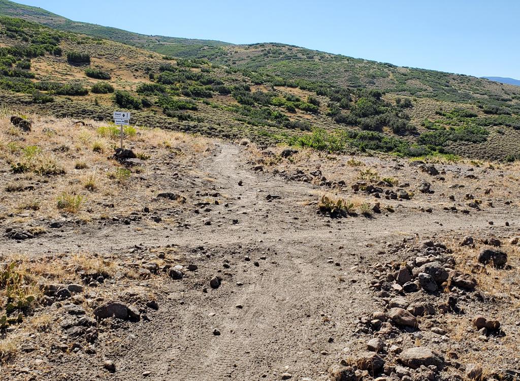
Location of Cobblestone on the Glenwild
Loop:
If you started on Stealth and went over the top of Glenwild clockwise, look for the trail at mile 4.4, about 1/2 mile after descending to the sage-covered valley. Go L uphill on Cobblestone.
If you went counterclockwise around Glenwild, find Cobblestone in sage brush at mile 3.8 as you approach the hills. Go R uphill.
0.0 Fork off Glenwild N40 44.756 W111 31.279
0.6 Cross paved road N40 45.204 W111 31.558
0.9 Fork Cobblestone Loop N40 45.365 W111 31.750
Left 1.4 Cross road N40 45.549 W111 31.793
1.7 Fork R (L=Flying Dog) N40 45.704 W111 31.573
2.4 L at fork, bottom of loop
Right 1.6 Fork L (R=Flying Dog) N40 45.704 W111 31.573
1.9 Cross road N40 45.549 W111 31.793
2.4 R at fork, bottom of loop
3.3 Back at Glenwild trail
Getting there, Glenwild Trailhead: At the I-80 Park City exit, go north (left from the
exit if you're coming from SLC) to the frontage road. Turn right. About
1/4 mile later at the second road on your left, turn left. Find the trail
parking area just before the northbound road crosses the creek. (You'll
see the trail map kiosk and bathroom). GPS N 40° 43.662' W 111° 32.051'.
Head up the road to start your ride. To begin on the Stealth Trail, turn
right on singletrack just past the bridge. To ride counterclockwise up
Glenwild to Cobblestone, turn right and climb the hill.

zoomed map
Directly to Cobblestone by car:
At the I-80 Park City exit, go north (left) as you exit, then immediately turn right on the frontage road (Bitner Road). Continue east until the road turns L (north) and becomes Bitner Ranch Road. About mile 3.1 from the freeway (shortly after passing the golf course), the road will veer L (approx N40 44.79 W111 30.595). At mile 3.4, turn left (west), N40 45.016 W111 30.885. Watch for the trail to cross the road at about mile 4.1, N40 44.929 W111 31.433. Park and start uphill. If you continue on the same road, keeping left at forks, it will curve around from west to east and intersect the top of the loop at N40 45.549 W111 31.793.
At the I-80 Park City exit, go north (left) as you exit, then immediately turn right on the frontage road (Bitner Road). Continue east until the road turns L (north) and becomes Bitner Ranch Road. About mile 3.1 from the freeway (shortly after passing the golf course), the road will veer L (approx N40 44.79 W111 30.595). At mile 3.4, turn left (west), N40 45.016 W111 30.885. Watch for the trail to cross the road at about mile 4.1, N40 44.929 W111 31.433. Park and start uphill. If you continue on the same road, keeping left at forks, it will curve around from west to east and intersect the top of the loop at N40 45.549 W111 31.793.
Riding resources for this trail:
Single-page riding guide: view
GPS track files (right-click and "Save as..."):
GPX course Cobblestone only
GPX area tracks
GPX multi-track Jeremy Ranch wider area
Large-format area topo map (600K): View
Lodging, camping, shops: Links to area resources
Single-page riding guide: view
GPS track files (right-click and "Save as..."):
GPX course Cobblestone only
GPX area tracks
GPX multi-track Jeremy Ranch wider area
Large-format area topo map (600K): View
Lodging, camping, shops: Links to area resources