

View south towards the wash where you rolled underneath the freeway, with the town of Washington in the distance. May 6, 2000 by Bruce Argyle. Latest update of this page October 2018.
Church Rocks
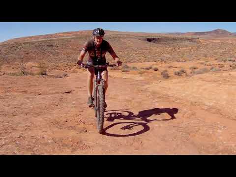
The Church Rocks Loop is a popular trail just north of Washington (about 10 miles north of St. George). The loop itself is 3.1 miles of 80% slickrock. It's a fairly rapid ride, with little elevation change (about 150 feet), so you may want to do the loop section a couple of times. Because of some steep and rough spots, Church Rocks ranks upper-intermediate overall in skill level, but less-skilled riders manage by walking the tricky spots.
The Church Rocks Loop is a popular trail just north of Washington (about 10 miles north of St. George). The loop itself is 3.1 miles of 80% slickrock. It's a fairly rapid ride, with little elevation change (about 150 feet), so you may want to do the loop section a couple of times. Because of some steep and rough spots, Church Rocks ranks upper-intermediate overall in skill level, but less-skilled riders manage by walking the tricky spots.
Your overall ride will be longer. Church Rocks doesn't have its own trailhead, so you'll have to plan to ride there via Prospector, Grapevine, or The Tunnel. Most riders now connect to Church Rocks via the Prospector Trail through the Cottonwood Trailhead. More on that later.

Heading up into the sandstone on a clockwise ride of the Church Rocks loop.

The rolling slickrock on the top of the cliffs is why riders come here again and again.
First up: the old "classic" Tunnel Route!
This is how we got there 20 years ago. Now the first part is paved trail from the Coral Canyon subdivision. With the connector road and the spooky ride through the "haunted I-15 pipe", you'll do about 8.2 miles if you ride the loop only once.
The ride starts at Heritage Park in Coral Canyon. First, you head up the road toward the freeway,
then find the cement bike trail between two homes at the end of Grasslands
Parkway. Ride straight
uphill, then along the freeway to the southwest. Go up the hill (Black
Ridge). After the main
trail veers left, find your way to the right, around the water tank. Finding
the descending
road 200 yards east of the water tank and head straight towards the freeway.

Bruce takes air on the lower side of Church Rocks in 2017.

Bruce cruises above the sandstone cliffs on the bike known as Banana Thunder. Photo by Diane Argyle, May 6, 2000.
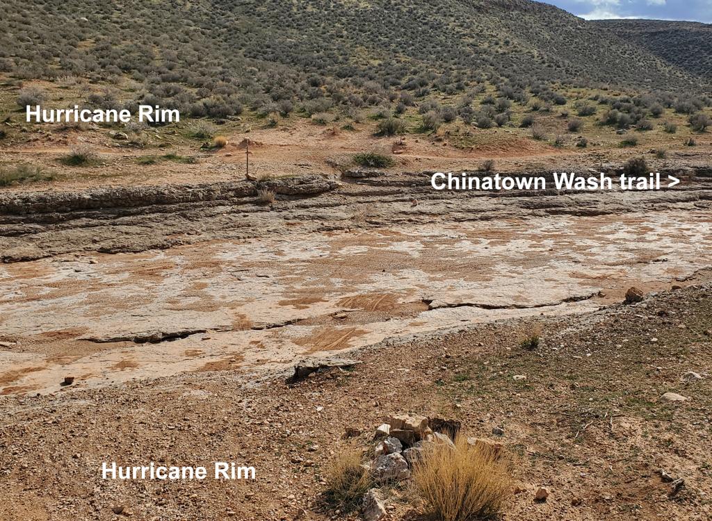
Right at the western corner of the ridge as it bumps against the freeway is the drainpipe that's
the underground path to the slickrock. (Don't descend further along the
freeway! The drainpipe
may be hard to see due to willows, but it's right there.) Drop into the
wash and head straight
into the round drainpipe that goes under the freeway. Insane? You bet.
After exiting the drainpipe
(hopefully, with all your skin intact), walk your bike through deep sand
and volcanic rock
until the trail climbs out of the wash on your left.
When the trail crosses over to the right side of the wash, immediately fork left and follow
the trail up onto the slickrock. Watch carefully for stacked rocks and
old painted dashes on
the rock. Once you've found the trail, decide which direction you want
to ride. I like to go
clockwise.

Climbing on domes of Navajo sandstone on the westernmost edge of the loop.

Most of the slickrock is fairly smooth and flat. Bruce is riding a custom-build Rocky Mountain Element from the UtahMountainBiking store in Lehi.
Church Rocks from Prospector!
This is the most popular way to get there. Start at the Cottonwood trailhead (see below). Follow the Cottonwood Trail 0.5 miles then veer left at two forks that are about 50 feet apart. The Prospector Trail will parallel the freeway heading south 3 miles. Turn left when it intersects the Church Rocks Loop and ride the loop clockwise. The ride will be about 11 miles.
This is the most popular way to get there. Start at the Cottonwood trailhead (see below). Follow the Cottonwood Trail 0.5 miles then veer left at two forks that are about 50 feet apart. The Prospector Trail will parallel the freeway heading south 3 miles. Turn left when it intersects the Church Rocks Loop and ride the loop clockwise. The ride will be about 11 miles.
From Grapevine!
From the Grapevine trailhead, take Grapevine (the continuation of Prospector) east. At the top of the hill, there are two options. Straight ahead takes you down some ugly switchbacks. If you fork to the left for about 100 yards, you'll find another route descending through the ravine that's much more mellow. It ties into the western corner of the Church Rocks loop.
From the Grapevine trailhead, take Grapevine (the continuation of Prospector) east. At the top of the hill, there are two options. Straight ahead takes you down some ugly switchbacks. If you fork to the left for about 100 yards, you'll find another route descending through the ravine that's much more mellow. It ties into the western corner of the Church Rocks loop.
Some riders will come in via Dino Cliffs. From the north end of Dino, jog east on the doubletrack to pick up the Grapevine trail. See the Dino Cliffs trail page .

There are a couple of climbs that will challenge intermediates, but they're short and very walk-able.

View to the north of the actual Church Rock in this year 1998 photo.
Riding the loop...
Church Rocks' northern side is the "upper side" of the loop. The trail follows the break between the sagebrush of the mesa and the slickrock cliffs. This area isn't hard to navigate -- follow the tire marks on the slickrock. If you're riding clockwise (my favorite) you just aim your bike east and follow the edge of the rock. The trail descends to the bottom of the cliffs near Church Rocks -- the domes you see rising up to the east.
Church Rocks' northern side is the "upper side" of the loop. The trail follows the break between the sagebrush of the mesa and the slickrock cliffs. This area isn't hard to navigate -- follow the tire marks on the slickrock. If you're riding clockwise (my favorite) you just aim your bike east and follow the edge of the rock. The trail descends to the bottom of the cliffs near Church Rocks -- the domes you see rising up to the east.
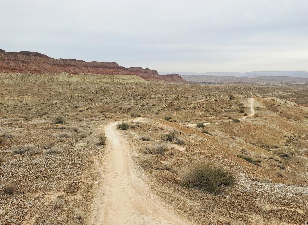
The southern (lower) side of the loop is a combination of high-speed smooth desert singletrack
and slickrock. After descending bumpily from the rock on the clockwise
ride, the trail turns
immediately back west and winds through exposed rock and singletrack.

The drop off the north end of the cliffs has a lot of ledges, then the trail smooths out to nice ribbon.

Heading back to the south under the cliffs to close the loop on a clockwise ride.
The Prospector Trail ties into the middle of this singletrack area (a right fork when riding
clockwise). The next trail fork as you go west is the continuation of
Prospector. As you turn
and drop into a small canyon, you'll see a fork in the trail. If you keep
right, more level,
and straight, you're headed to Church Rocks. If you go left and climb
slickrock, that's Prospector.
In 2017, there's a carsonite post on the Prospector side.

Desert Marigold bloom in the "oasis" in the bottom of the wash.
Bottom Line!
Very fun ride, quick and scenic. Popular, so expect company.
Very fun ride, quick and scenic. Popular, so expect company.

Getting there:
Prospector Trail from the Cottonwood Trailhead: This is a great ride! Take the UT-9 exit from I-15 (highway 9 goes to Hurricane, Zion Canyon, Grand Canyon) about 15 miles north of St. George. Turn towards Hurricane and pass Coral Canyon. Instead, drive to the traffic light in 0.7 miles. Turn left on Old Highway 91. Now go exactly 2 miles north. Watch on your left for a gravel road that enters a tiny single-lane slot under the freeway, with a sign that says "Cottonwood Trailhead". It will be between a beer warehouse labeled Winkel Distributing and a Rocky Mountain Power office. Turn left and drive 0.25 miles under both lanes of the freeway to reach the trailhead.
For a bigger ride, start at the northern Prospector Trailhead on the road to Red Cliffs. See the Prospector Trail page. The trailhead is just across the freeway from Harrisville (use the Leeds exit and go south, or follow Old 91 north from Highway 9). This makes the ride just over 16 miles.
Via Coral Canyon Trail: Take the UT-9 exit from I-15
(highway 9 goes to Hurricane, Zion Canyon, Grand Canyon) about 15 miles north of St.
George. Turn towards Hurricane, but immediately turn right in 0.2 miles onto Coral
Canyon Blvd. (If you pass the golf course, you missed it.) Go south
through the roundabout and continue 0.6 miles, then right on Territory
Canyon Drive. Immediately turn left on Grasslands Parkway. Heritage Park
is 0.1 miles. Find a spot to park. On your bike,
head north uphill on Grasslands (toward the freeway). Find the cement
trail on your right, just before the road turns left and becomes North
Bend Drive. Keep straight as you pass two paved trails that fork off. The
paved trail will take you to the top of the water tank hill.
Slick Rock Road in Coral Canyon: Go to Heritage Park as above, but as you climb up Grasslands Parkway, turn left on Slick Rock Road. Keep going south until the road turns north toward the freeway. Watch for the cement trail between two homes just before Slick Rock Road turns back east and becomes Sprint Canyon Drive. Once on the trail, fork right uphill, then take the next fork left to climb up Black Ridge toward the water tank.
Grapevine via Washington Parkway: Go to the north end of Washington Parkway (at the new exit 13 off I-15). Keep straight into the dirt road through a two fences, then park. Head east (to your right as you drive through the second fence). Follow the Grapevine Trail to the Prospector connector, then grab Bracken's for 0.1 mile, then fork R to head for Church Rocks. See the Dino Cliffs trail page for specific instructions.
Riding resources for this trail:
Single-page riding guide
GPS track files (right-click and "Save as..."):
GPX
Topo map for Prospector route: View
Connections via Grapevine, Dino Cliffs: View
Lodging, camping, shops: Links to St. George area resources
Single-page riding guide
GPS track files (right-click and "Save as..."):
GPX
Topo map for Prospector route: View
Connections via Grapevine, Dino Cliffs: View
Lodging, camping, shops: Links to St. George area resources
Updated 2006, 2009, 2017