At Chicken Corner, we're looking down at the Colorado. The boat is a full-sized tour boat -- with several rows of benches each filled with 4 or 5 people. Photos and description based on a ride by Bruce on May 4, 2011.
Chicken Corner
Chicken Corner is a dirt-road ride that can be just about any length you want. Go to the spot where you want to start, then ride. For example, you can do the ride from a camping spot in Kane Springs Canyon.
Chicken Corner is a dirt-road ride that can be just about any length you want. Go to the spot where you want to start, then ride. For example, you can do the ride from a camping spot in Kane Springs Canyon.
I'll tag the "official" starting point as the parking lot at the bottom of Kane Springs Canyon.
This will give you a ride of about 43 miles. (You can easily start from
Moab itself. It's 5
miles from the McDonalds on 191 to Kane Springs Canyon. This will add
10 miles to the round-trip
riding distance.)

As the gravel road starts into Kane Springs Canyon, walls of sandstone tower above.

As leave the narrows of Kane Springs Canyon to the west, we enter a broad flat area. Moenkopi slopes appear at the bottom, with Chinle steps leading up to a nubbin of Wingate sandstone at the top.
Kane Springs Canyon is pretty. I don't think you should skip it. At first, towering Navajo
and Wingate sandstone walls enclose the canyon. Wildflowers bloom among
cottonwoods lining
the creek. As you begin to leave the canyon to the west, you enter the
Chinle formation.
As you exit the canyon, you'll turn south in a broad valley. To the south, mesas formed of
Wingate sandstone with Chinle skirts line the sides of Kane Springs Canyon
as it continues
south.

We won't be going into the southern half of Kane Springs Canyon. We'll be turning to the north to approach Hurrah Pass.

Approaching Hurrah Pass. We'll be following a hard layer in the tilted strata. As we ride north, we get gradually higher while riding on the same rock layer, until we pop over the pass.
At the fork in the road, turn away from Kane Springs Canyon and ride northwest toward the Moenkopi
slopes of Hurrah Pass.
Enjoy the views as you climb toward the pass. It's never very steep, but is a steady grind.
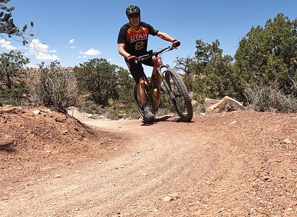
The riding isn't technical. A beginning rider can manage this climb if
they have the endurance.

Looking down at Kane Springs Canyon to the south.

Goblins, vultures, and assorted beasties hide among the bands of the rock formation.
After a climb of 700 vertical feet over two miles, you'll reach the summit of Hurrah Pass at
an altitude of 4700 feet.
You can see lower Kane Springs Canyon to the northeast, upper Kane Springs Canyon to the southeast,
Jackson Hole to the northwest, and the Colorado River (with your continuing
trail) to the southwest.

Looking southwest from Hurrah Pass. We'll be riding along the dark slash in the valley, which is the Colorado.

Descending the right turns on the west side of Hurrah Pass. The potash plant across the river can be seen peeking above the slope at mid-right.
The banded slopes of mudstone and sandstone are visually interesting. Don't go off the road.
There are sheer drops to the side of a couple of tight turns.
As you arrive on the valley floor, you'll drop into a wash. At the sign in the wash, keep left.
(The right fork goes to the Jackson Hole trail and Bass Camp.)

When we first approach the Colorado, we're almost at river level.

The trail meanders along the junction between the hard base-rock of the valley and the skirts of softer mudstone. The cliffs are Wingate, the skirts are Chinle.
The trail will climb out of the wash and turn south. Several times it will approach the edge
of the river. The general direction will change from south to westbound.
The cliffs over the river become gradually higher. You're climbing uphill, but it's so gradual
you don't notice it until you turn around for the return trip and seem
to fly back.

There you can see the slight tilt to the valley floor, which is a flat layer of hard stone. We're beginning to climb higher above the river.

In what was probably once a sandy depression on the seafloor, brachiopod fossils glisten in the hard limestone layer.
You're riding on a shelf of hard stone that resists erosion. While it forms a shelf above the
Organ Rock Formation like the White Rim sandstone of the nearby
White Rim Trail
, it's not quite the same rock. This is band of a sandy limestone filled with bracheopod fossils,
suggesting a shallow marine environment. Perhaps this area was ocean and
the area to the north
was beach.
Stay to the right at two forks. The cliffs and the views become more impressive as you ride
further.

We climb still higher above the river as we head south.

"No vehicles." Uh, OK.
At the end of the trail, a foot path takes you to Chicken Corner. It's that little notch on
the cliff face. The notch is just high enough to squat, and barely the
width of a person. There
are no handholds.
Guides named it Chicken Corner because, imagine this, some people were afraid to crawl around this simple little corner above a 300-foot cliff.
Let's go closer.I have no photo of what's just around the mountain from Chicken Corner.
Looking down at my old mountain biking shoes -- no toe spikes; front quarter of the carbon sole totally chewed away; tread worn to nubbins, old cleat worn slippery -- I decided that I would, indeed, be the metaphorical chicken for which the corner is named.
Call it "Wise-decision-not-to-proceed Corner".
, we revisit the viewpoints we enjoyed on the way...")
Heading downhill (yet up-river), we revisit the viewpoints we enjoyed on the way in.
As I fled ignominiously from Chicken Corner, the trail became a blazing downhill, with just
a few spots of pedaling. Enjoy the awesome river and mountain views on
the way out.
This is where you'll be glad you brought plenty of water. The ride is getting long, and you've
got the big climb to Hurrah Pass ahead. Up and over, once again.

The narrow road will follow the gray band to Hurrah Pass.

Make up your own names. "Thor's Hammer" is too easy. OK, on the right side, that's "The Great Wall of Monkey Faces."
The climb forces you to slow down and admire the rock formations, which are even more impressive
on this side of the mountain than they were during the climb up the opposite
side.
Drop down the mountain to Kane Springs Canyon and begin heading north and east.

As we descend from Hurrah Pass, we're looking northeast into the narrows of Kane Springs Canyon -- our destination.

Back in Kane Springs Canyon, and almost done.
There's one short but miserable little climb on the S-turn in Kane Springs Canyon, otherwise
it's slightly downhill and fast riding as you head back to your starting
point.
Riding notes, from Kane Springs Parking:
0.0 Southeast (uphill) on Kane Springs Rd
N38 31.940 W109 35.940
0.5 Amasa Back parking N38 31.711 W109 35.700
3.0 Hunters Canyon N38 30.597 W109 35.798
6.5 Keep R (L=Kane Creek)
N38 27.881 W109 36.050 Turn to northwest
9.6 Hurrah Pass N38 28.913 W109 37.492
12.2 Fork L (R = Jackson Hole, Bass Camp)
N38 28.287 W109 39.027
13.9 Keep R N38 27.342 W109 40.081
14.6 Stay straight, through wash
N38 26.752 W109 40.086
21.4 Trail end at Chicken Corner N38 26.486 W109 44.254
28.2 Through wash, then stay straight after exit
N38 26.752 W109 40.086
(don't veer L into wash or cross wash again)
33.2 Hurrah Pass
42.8 Back at entry to Kane Springs Canyon
14.6 Stay straight, through wash
N38 26.752 W109 40.086
21.4 Trail end at Chicken Corner N38 26.486 W109 44.254
28.2 Through wash, then stay straight after exit
N38 26.752 W109 40.086
(don't veer L into wash or cross wash again)
33.2 Hurrah Pass
42.8 Back at entry to Kane Springs Canyon

Map of the Chicken Corners ride.
Getting there: Head south on Moab's Main
Street. When you reach the McDonald's, turn right onto Kane
Creek Blvd. After 0.6 miles, go straight where the road seems to turn
right (500 West). Drive (or bike) along the Colorado River for 5 miles
until the road turns to gravel. Park in the ATV parking lot at the bottom
of Kane Creek Canyon, or if it's too crowded, go on up the road 1/2 mile
to the Amasa Back parking area.
Riding resources for this trail:
Single-page riding guide
GPS track file (right-click and "Save as..."): Chicken Corner
High-res topo for printing (2 MB): View
Lodging, camping, shops: Links to Moab area resources
Single-page riding guide
GPS track file (right-click and "Save as..."): Chicken Corner
High-res topo for printing (2 MB): View
Lodging, camping, shops: Links to Moab area resources