

View from the ridgeline, about 3 miles down from Brian Head Peak. Review ride July 19, 2001 by Bruce Argyle. Page most recently updated on September 2, 2022.
Bunker Creek Trail
The Bunker Creek Trail is an epic downhill at Brian Head. The trail begins atop Brian Head Peak at 11,300 feet, and heads east to Panguitch Lake 3000 feet below. The trail can be done by intermediate riders with a shuttle for the return trip.
The Bunker Creek Trail is an epic downhill at Brian Head. The trail begins atop Brian Head Peak at 11,300 feet, and heads east to Panguitch Lake 3000 feet below. The trail can be done by intermediate riders with a shuttle for the return trip.
In 2017, a massive fire hit the area east of Brian Head. The burned area includes the last
1/2 mile of Sidney Peaks trail and over 90% of the Bunker Creek trails.
Both the right and
left forks of the Bunker Creek ride required rebuilding because of flooding
following the fire.
Four new miles of singletrack was added below the spot where the two forks
of Bunker Creek
rejoin in 2019, bypassing the dirt road that was formerly the last 5 miles
of the ride.

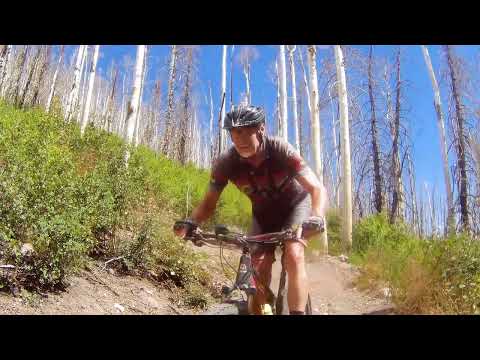
Bruce rides through burned trees on Sidney Peaks.

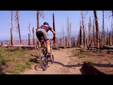
Descending Bunker Creek in September 2022.
As of my latest update ride, the Bunker Creek ride still suffers from the aftermath of the
2017 fire. Heavy rainstorms continue to damage the trail as water runs
off the burn scar. The
skeletons of trees are interesting, but they're no substitute for the
lush forest that used
to be here. So this famous classic trail is seeing fewer riders these
days.
A note: Be prepared for cold. On my July 19 2001 ride, the 10 a.m. temperature at the trailhead
was 52 degrees F with a 20 mph wind, even though the sky was clear and
sunny. On July 30 2018,
a toasty warm day turned to low-60s with wind and cold rain by 4 pm. Thunderstorms
can pop
up quickly at Brian Head, and they're very ugly at this altitude. Bring
a rain jacket. I suggest
full-fingered gloves. Also come prepared for some serious sun exposure.
Use a potent sunscreen
and UV-protective sunglasses.

Penstemmon blooms in one of countless small meadows alongside the trail.
Ride Overview

View from the cliffs.
The singletrack trail is 11.6 miles long, and is best done with a shuttle vehicle. The bike
shops in Brian Head provide shuttle service for (2018 rate) $25 per rider,
which includes the
trip up to the trailhead on Brian Head peak, then a pick-up at Panguitch
Lake after the ride.
If you're morally opposed to shuttling, you can loop via Highway 143, a 28-mile sufferfest
with 3400 feet of climbing. Been there, done that. I've even ridden the
whole singletrack as
an out-and-back. It's a 22-mile round trip up and back down, with around
3300 feet of climbing
overall. About half-way up, you'll note that grunting uphill at this altitude
is brutal. You
can also drive Sidney Peaks road to the viewpoint, then do North Fork
and Bunker Creek as a
7.2-mile loop ride with 1500 vertical feet of climbing.

View over the parking area on Brian Head Peak, looking northeast.
Sidney Peaks trail section

Threading the needle through volcanic tuff.
The first couple of miles are actually the best part of this ride, because it was spared from
the fire. Brian Head Peak is formed of a light-colored soft volcanic rock,
deposited during
last 20 million years. The bright pink cliffs of Cedar Breaks are formed
of Claron-formation
limestone from about 40 million years ago during the Tertiary Era. This
limestone was deposited
at the bottom of a large fresh-water lake, before the plateau area was
uplifted away from the
valleys of the Great Basin.
Occasionally, there's a little bit of gentle climbing to roll over a small ridge, but in general
it's a downhill cruise that's fast and fairly straight. Technically, it's
not tough, but there
are a couple of sections where there are loose and slightly rough downhill
steeps.

View to the north at 11,000 feet, heading east along the high ridge.

Heading towards the Lowder Ponds fork. The dead trees are courtesy of a bark beetle. (Stay tuned for the fire scar!)
The first few miles on ridgeline, coming down from Brian Head Peak, is unlike any other ride.
You're cruising through a world of odd rocks, tiny flowering alpine phlox,
mosses, and stunted
spruce trees. There are some fun rock rollovers and drops on the edge
of the trail, if you
look for them.
The first fork you'll encounter is at 1.5 miles, where the Dark Hollow trail forks left and Lowder Ponds forks right. As you drop off the ridge, wide meadows alternate with dense spruce forest.
At mile 4.3, you'll skirt a large cindered parking area for the Sidney Valley viewpoint. Just
after you cross the dirt road, the trail splits. Both routes were rebuilt
after the fire and
flooding, and they are now easier to ride.

Looking south as we cross a meadow approaching the Sidney Valley road area.
 and to the rig...")
At the trail fork. To the left is the North Fork (old Right Fork) and to the right is Bunker Creek (old Left Fork). Take your pick.
On your the left is Bunker Creek's North Fork (also confusingly called the Right Fork -- because
it was on the right as pioneers climbed uphill). It's 3.4 miles to where
the trails rejoin.
At this time, the North Fork is the more popular route.
The fork to the right is the rebuilt Left Fork, now just called Bunker Creek. It's a little longer at 3.6 miles. It's less popular as a downhill option, but it's the easier route if you're riding uphill.
The fork to the right is the rebuilt Left Fork, now just called Bunker Creek. It's a little longer at 3.6 miles. It's less popular as a downhill option, but it's the easier route if you're riding uphill.
North Fork (historic Right Fork) Bunker Creek
The North Fork trail is 3.5 miles long from the Sidney Peaks viewpoint parking area down to
the junction with Bunker Creek. In this distance, it will drop just under
1500 vertical feet.
Almost everyone does this section as a descent. If you're doing the two
limbs of the trail
as a loop ride from Sidney Peaks parking, most riders would recommend
climbing Bunker Creek
and descending North Fork.

A carpet of little aspen trees has sprung from the ground among the skeletons of the former forest.

Looking east downhill.
The trail is a bench-cut with a fairly constant rate of descent. Most of the descent will be
in regrowing burned forest, but there's undamaged forest for the last
half-mile.
The historic Right Fork ride ended on the dirt Bunker Creek Road. Just 0.1 miles before the
North Fork trail ends on dirt road, you'll find a trail fork on the right.
This is the new
2019 singletrack, and it will take you across the North Fork creek to
join the main Bunker
Creek trail..

On a non-burned area of the Right Fork, we're approaching the fence that starts the doubletrack.

Bunker Creek and North Fork merge, as seen from downhill. That's Bunker Creek on the left, and North Fork on the right.
About 1/10th mile from the trail fork you'll merge with Bunker Creek at an unmarked (as of
2022) intersection. From there, the continuing singletrack will take you
downhill 4 miles before
it joins the dirt road about a mile before the highway. (Note: on my last
ride in September
2019, at the top of the new singletrack, the bridge across both the Right
Fork and Left Fork
were not yet completed. I expect that now you won't need to get a shoe
wet.)
Bunker Creek main trail (historic Left Fork Bunker Creek)
The Bunker Creek trail is the trail to the right as you leave the parking area for the Sidney
Peaks viewpoint. It's a less-popular option than the North Fork, possibly
because it was rebuilt
two years later and riders aren't aware that it's open.
This section of the trail is 3.6 miles long and has the same 1500 vertical feet of elevation change as North Fork.
This section of the trail is 3.6 miles long and has the same 1500 vertical feet of elevation change as North Fork.

Bruce rolls down Bunker Creek shortly after the North Fork trail fork.

Looking uphill on Bunker Creek. As you see, it's not bad as a climbing route.
Almost all of Bunker Creek was severely burned. You'll reach undamaged forest only in the last
1/2 mile before the North Fork and Bunker Creek merge.
North Fork will join on your left, then when you dip through Bunker Creek, you're on the way down the final stretch.
North Fork will join on your left, then when you dip through Bunker Creek, you're on the way down the final stretch.
While most riders do Bunker Creek as a shuttled downhill, some will climb it. You can do a
loop of North Fork and Bunker Creek by parking at Sidney Peaks viewpoint
parking.

Heading toward the fork where we'll join North Fork.
Lower Bunker Creek

Splashing through Bunker Creek.
Lower Bunker Creek has 4.2 miles of singletrack. It's much less steep here. The trail will
drop only 650 feet in elevation.
As you head down, the air will get warmer, and the ecosystem will change to larger pines. The
temperature at Panguitch Lake may be 30 degrees warmer than it was at
the top at Brian Head
Peak.

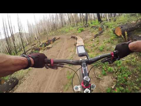
A log ride alongside the new lower Bunker Creek singletrack extension in 2019.

Some fun twisty berm work as I approach the end of 12 miles of singletrack.
The new lower portion of Bunker Creek makes a nice loop ride. You can crank up the dirt road
-- starting from a parking spot on the dirt road 0.15 miles past the forest-boundary
cattleguard
-- then turn onto the lower Bunker Creek about 0.2 miles uphill on the
Right Fork trail. The
loop is 8.3 miles with 1100 feet of climbing, top elevation 9300 feet.
This portion of the
trail may be snow-free a month or two before the full shuttled ride can
be done.
Bottom Line!
A classic ride. Do it. Bunker Creek is still very much worth doing despite the burn damage, and the new 4 miles at the bottom make it even better! Where else are you going to find 11 miles of continuous downhill singletrack?
A classic ride. Do it. Bunker Creek is still very much worth doing despite the burn damage, and the new 4 miles at the bottom make it even better! Where else are you going to find 11 miles of continuous downhill singletrack?

Rolling through partially-burned forest.

Jackie takes a breather near a cluster of Colorado Columbine in 2001.
Trail notes, starting at Brian Head Peak (11,300 feet
elevation)
0.5 turn left uphill on singletrack across from parking lot
1.5 intersection with Dark Hollow (4-way), continue straight on Sidney
Peaks Trail
4.3 cross Sidney Valley Road loop
4.4 trail fork: north or south forks, they'll rejoin in 3.5 miles
7.3 fork right onto lower Bunker Creek ST
11.3 R onto dirt road
11.6 parking spot for loop ride or up-and-down
12.6 dirt road reaches highway, L for Panguitch Lake

Getting there, Brian Head Peak trailhead: On U-143, head up the canyon
from Brian Head to the summit. Just 1/4 mile past the summit sign, turn
left on a gravel road (GPS N 37° 40.136' W 112° 50.350'). Drive 2.5
miles to the peak of the mountain to start your ride. (Note the parking
area to your left at 1.8 miles. Once you start riding, you'll turn onto
the singletrack across the road.)
Sidney Peaks Viewpoint trailhead: On Highway 143 south of the entry to Cedar Breaks National Monument, turn to the east toward Panguitch. Descend 4.8 miles. Turn left on Sidney Peaks Road #1. (There are no signs along the highway to mark this road in 2022. If you find a kiosk 1/10th mile up the road and the designation "#1" on carsonite posts, you're on the right road.) Drive 4.5 miles to the Sidney Peaks viewpoint parking.
Sidney Peaks Viewpoint trailhead: On Highway 143 south of the entry to Cedar Breaks National Monument, turn to the east toward Panguitch. Descend 4.8 miles. Turn left on Sidney Peaks Road #1. (There are no signs along the highway to mark this road in 2022. If you find a kiosk 1/10th mile up the road and the designation "#1" on carsonite posts, you're on the right road.) Drive 4.5 miles to the Sidney Peaks viewpoint parking.
Riding resources for this trail:
Single-page riding guide
GPS track files and route (right-click and "Save as..."):
GPX Bunker Creek R, Fork ride
Area multi-track file
High-res topo map Bunker Creek route: View
Area topo (with other trails) for printing: View topo
Lodging, camping, shops:
Links to Cedar City - Brian Head area resources
most recent update 2022


