View of Navajo sandstone cliffs in the upper wash. Photos and description based on a ride by Bruce, October 19, 2010.
Buckhorn Wash
with optional add-on to The Wedge
Buckhorn Wash is a scenic ride on dirt road. It's a fairly popular mountain bike destination. As an out-and-back (to the top of the wash and back) it's 18 miles of very easy riding. The route is on an improved (graded and graveled) road.
with optional add-on to The Wedge
Buckhorn Wash is a scenic ride on dirt road. It's a fairly popular mountain bike destination. As an out-and-back (to the top of the wash and back) it's 18 miles of very easy riding. The route is on an improved (graded and graveled) road.
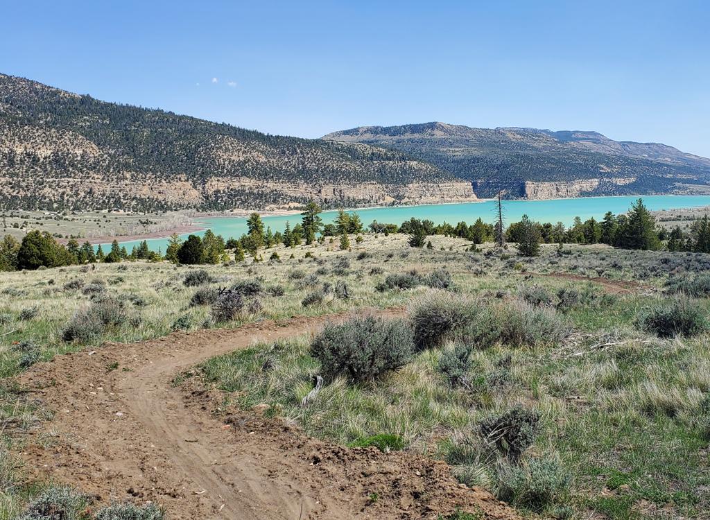
On the map, Buckhorn wash looks like a cruel climb uphill. But it's a flat ride. You'll gain
only 400 vertical feet from the San Rafael River to the top of the wash.
That's an almost-flat
50 vertical feet per mile, or a slope of 1%.

The photo sequence will be top-to-bottom. I started from the top late in the day. The whole wash was in shadows for the return trip. Here the cross-hatched Navajo sandstone is breaking through as we enter the draw.

Further south, the rock layers have tilted upward and are high above you. The Navajo forms tall cliffs.
The cliffs at the southern (downhill) end tower 1500 feet above you. But the rock layers in
the northern San Rafael tilt downward towards the north. So as you ride
north, the cliffs drop
down until finally you're on top of them. So on the map, and in your brain,
it seems like you're
climbing a big vertical distance.
Because this ride is so easy, many groups combine it with a trip to the
Wedge Overlook (Little Grand
Canyon)
This option does involve some climbing. As you turn southward toward The Wedge, you'll climb
1700 vertical feet. At the overlook, you're on the top of the cliffs you
were seeing from below.
The combined ride will be about 33 miles, depending on how much exploring
you do once you reach
the Little Grand Canyon Overlook.

Still further along, the horizontal layers of the Kayenta are seen under the Navajo, and the smooth Wingate is beginning to appear at ground level.

Primitive campsite. The cliffline at left shows how the horizontal layers of Kayenta protect the underlying Wingate and allow it to create cliffs.
There's developed camping and bathrooms along the San Rafael River at the bottom of Buckhorn
Wash. This is "dry" campground, so campers must bring their own water.
In the middle of the draw, there's a more primitive camp site with a "fence-and-pit" bathroom. (The next bathroom is at the Wedge Overlook if you're making the long ride.)
In the middle of the draw, there's a more primitive camp site with a "fence-and-pit" bathroom. (The next bathroom is at the Wedge Overlook if you're making the long ride.)
One of the highlights of the ride is the Native American rock art. The main pictograph panel
is half-way up the draw on Wingate sandstone, 5.8 miles from the bridge.

Pictograph panel. You can read about the experts' interpretation. But it's more fun to make up your own story.

According to the sign, this is supposed to be some serpent-thingy. Or maybe it's a guy playing with his long-necked dog.
There are several groupings of rock art, with interpretive signs. And a wooden fence so you
don't touch.
If you're a roadie who occasionally wants to ride dirt and gravel roads, a cyclocross or "gravel
bike" may be just what you want.

Evidence that this route is, indeed, used by non-polluting forms of transportation.

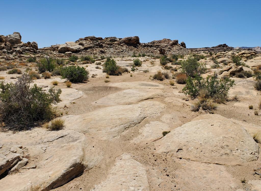
We're beginning to drop below the Wingate. Skirts of Chinle surround the cliffs.
You'll recognize the rock layers here. It's especially easy if you enter the canyon from the
top, then tick off the layers as you descend lower in the geologic strata.
At the top, the white Navajo sandstone is obvious. It changes from mounds to cliffs. Further south, the horizontal ledges of Kayenta sandstone are easy to spot. Below the Kayenta, a second line of cliffs is the Wingate sandstone.
At the top, the white Navajo sandstone is obvious. It changes from mounds to cliffs. Further south, the horizontal ledges of Kayenta sandstone are easy to spot. Below the Kayenta, a second line of cliffs is the Wingate sandstone.
Below the Wingate are the red clays and mudstones of the Chinle formation. In this area, the
bottom of the Chinle formation is the Mossback sandstone.
The Moenkopi formation here looks different. Instead of marbled reds, it's almost entirely gray. But you can recognize it by the softness of the slopes and the pattern of erosion.
The Moenkopi formation here looks different. Instead of marbled reds, it's almost entirely gray. But you can recognize it by the softness of the slopes and the pattern of erosion.

Across the valley, slopes of Moenkopi fall away from the spires.

View of the old swinging bridge, next to the modern bridge over the San Rafael.
Riding instructions, from the bottom, big
ride:
0.0 Cross the bridge and head north on the road N39 04.760 W110 40.033
5.8 Pictograph panel, bike parking, bathroom N39 07.405 W110 41.631
6.1 Camping, bathroom on your right
9.0 For out-and-back, turn around (not much to see for 7 miles beyond here)
10.0 L on main (Oil Dome) road N39 10.256 W110 45.079
10.4 L on county road toward Wedge N39 10.130 W110 45.278
12.0 L (south) on The Wedge road N39 09.080 W110 46.200
14.1 R (south) at fork N39 07.377 W110 45.431
16.3 At overlook, bathroom N39 05.582 W110 45.537
Turn L (east) for Little Grand Canyon Overlook
16.9 At overlook N39 05.731 W110 44.937
Turn around, reverse course
33.8 Back at campground
Getting there, from the north: Exit US-6 in
Price, southbound on highway 10. Go through Huntington. (In Huntington, there's an alternate road
that ends up at the trailhead. I haven't tried it.) As you approach Castle
Dale 28 miles from Price, watch for a sign that says "San Rafael
Access" and a broad dirt road on the left (heading east). There's a
huge corral near the start of the road. Once you're on the dirt road, go
14 miles. Turn right at the Buckhorn Wash road. To ride from the top, park
along the road.
From the south: On I-70, take the Sinbad or Ranch Exit 131, 25 miles west of Green River. (Note, the exit may be referred to as 129 -- the exits were renumbered a few years ago.) Head north. The road will veer east along the freeway, then turn north again. After 21 miles on dirt road, park at the San Rafael River. Start riding on the dirt road north in Buckhorn Wash.
From the south: On I-70, take the Sinbad or Ranch Exit 131, 25 miles west of Green River. (Note, the exit may be referred to as 129 -- the exits were renumbered a few years ago.) Head north. The road will veer east along the freeway, then turn north again. After 21 miles on dirt road, park at the San Rafael River. Start riding on the dirt road north in Buckhorn Wash.
Bathrooms: Campground at river, at pictographs,
and at campground in mid-canyon
Water: None
Camping: At San Rafael River, mid-canyon, other primitive sites
Bike services: Price, Moab

Map of Buckhorn area
Printable
one-page
riding guide
GPS track files (right-click and "Save as..."):
GPX
(track continues to Wedge Overlook)
Topo map for printing (includes Wedge):
View
Lodging, camping, shops:
Links to Price and San Rafael area resources