
Singletrack leading up to the first rock challenge. Original review May 4, 2000, with updates by Bruce in 2008, 2017, and 2021.
Bluff Street Cliffs (Owen's Trail)
The Bluff Street Cliffs trail has been renamed Owen's Trail. This is a short but fun expert-level ride on the cliffs along the north edge of St. George. Owen's Trail is a quick out-and-back lariat ride of 3 miles (1.5 miles each way) that features some very nice rock.
The Bluff Street Cliffs trail has been renamed Owen's Trail. This is a short but fun expert-level ride on the cliffs along the north edge of St. George. Owen's Trail is a quick out-and-back lariat ride of 3 miles (1.5 miles each way) that features some very nice rock.
The trail requires good technical skills. There's a lot of rough rock -- some so tough and
steep that you'll carry your bike at least a couple of times. It's for
expert riders only.
Because it's within a couple of bicycle-minutes from most of St. George's motels, you can hit this trail during the morning chill and be back before your roommates have shaken off the morning groggies.
Because it's within a couple of bicycle-minutes from most of St. George's motels, you can hit this trail during the morning chill and be back before your roommates have shaken off the morning groggies.

Bruce rolls above Bluff Street on the little loop at the end of Owen's Trail.

Looking north over the golf course to the Pine Valley Mountains.
This trail is used by hikers for the fabulous views and the rock-scrambling. It's not likely
you'll see another bike rider there, because well, this trail has a high
techy-tricky to cruising
ratio.
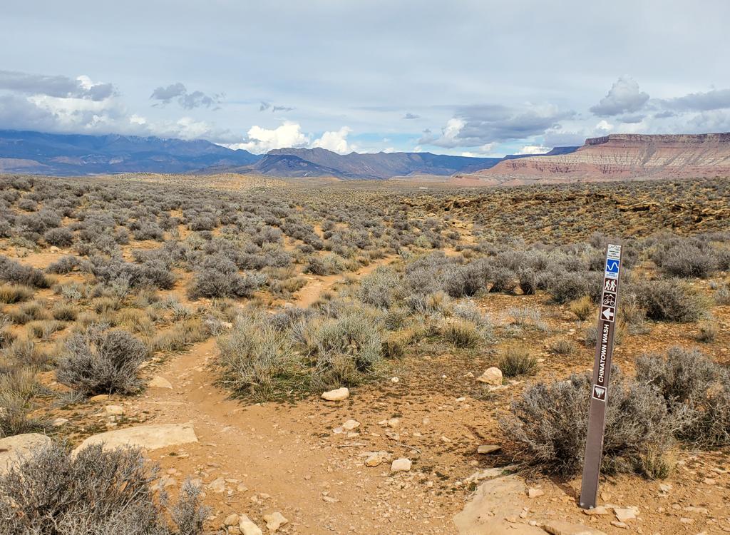
Owen's Trail can be reached via several connector trails. The most direct route is from the
Pioneer Park parking on the north side of the Red Cliffs Parkway. Take
the trail under the
parkway then turn right (uphill) on the paved Red Cliffs Parkway Trail.
Shortly after crossing
Skyline Drive, Owen's Trail begins at a step-over on your left.

View south as the trail turns from the west Pioneer Park parking area and descends under Red Cliffs Parkway.

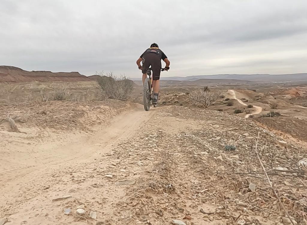
Bruce climbs away from the city in this May 2017 photo.
The trail begins as a dirt single-track. Keep right and uphill as connectors join from streets
below. Continue up onto the slickrock. About 1/3 mile up the trail, you'll
need to pack your
bike up a rocky chute. Once on the rock, the trail isn't too hard to follow.
When in doubt,
keep your eyes open for the rockpiles that mark the way.
Most of the rock in the St. George area is from the late Triassic to early Jurassic Era (the
early age of the dinosaurs, around 200 million years ago). This area was
a flat plain near
the seashore, so most of rock is layered from successive deposits of dirt
and rock laid down
by floods in river flood-plains and deltas. You'll climb from the valley
bottom Chinle shale,
through the red multi-layered Moenkopi formation, to the capping layer
of Kayenta Sandstone
that forms the broad bluff.

Intermediates will usually manage this trail, but will likely walk through a significant number of little tech challenges.

Heading west as the trail gets more techy.
At GPS N 37° 07.206' W 113° 35.332', keep left at the fork (right loops up to the ridgetop
and the City Creek Trail, with links to the highway). If you notice a
second fork at GPS N
37° 07.353' W 113° 35.420', keep left. (Forking hard right goes to the
bottom of a wash 1/2
mile later. There also used to be a route straight over the top here.
If bikes start riding
it again, you might notice another route heading uphill.)
The slickrock becomes more technical, and much more fun. The side-slope becomes steeper on
both the uphill and downhill sides as the trail contours a small shelf.
The trail has become a bit harder to follow in recent years, as the little rockpiles (cairns) that marked transitions have been removed. You may follow some false paths a time or two on the way out. The trail is much easier to follow when coming back.
The trail has become a bit harder to follow in recent years, as the little rockpiles (cairns) that marked transitions have been removed. You may follow some false paths a time or two on the way out. The trail is much easier to follow when coming back.

For about 1/4 mile the trail hugs a shelf on the slope. Despite the appearance, this is actually a fairly easy area to ride.

Approaching the chute area.
As you come up to the top again, the route continues west on top of the now-narrow ridge. You'll
reach a spot with some drop-offs where the trail seems to disappear. This
isn't the end!
Watch for a narrow 20-foot chute descending steeply on the left. For me, the chute was unrideable -- my handlebars would not fit through the drop-off area in the chute. As you hit the bottom, veer right again.
Watch for a narrow 20-foot chute descending steeply on the left. For me, the chute was unrideable -- my handlebars would not fit through the drop-off area in the chute. As you hit the bottom, veer right again.
Follow a twisting course west through the rocks, aiming for the top of the next hill. As you
begin climbing, there are some ledges and the trail becomes hard to follow.
Pick your way uphill
-- probably on foot -- until you get above the rocks and find a singletrack
in the sage brush.

Taking a drop.

Rolling down from the circle.
When you reach the singletrack, celebrate by circling around the cliffs over the golf course.
In 2017, the passage up to the singletrack was a guessing game, and the
circle route itself
wasn't seeing as much traffic as in years past.
After completing the loop, backtrack. On the way, consider hitting one of the connecting trails
up to the
City Creek
trail
or try a bit of the
Pioneer Park
trail across the parkway.

There are many areas with unusual erosion patterns in the rock. Fun stuff.

Don't ramp off the smooth green bumps. This is a desert tortoise protection area. Here a mojave tortoise strolls right down the middle of the trail. May 4, 2000.

In the spring, you'll enjoy blooming cactus and other wildflowers. Here, a cactus "tree" shows its yellow-green blossoms. This is called a cholla (choy-uh) cactus.

Yucca blooms above the St George homes.
Pioneer Park trailhead: From St.
George Blvd (the main drag), head north on Main Street (towards the
"Dixie" painted on the big rock above the cliffs). When you
reach Hope Street, turn right, then immediately take the left fork and
climb Skyline Drive to the top of the cliffs. Turn right. Just east of
the junction of Skyline Drive with Red Cliffs Parkway, there's paved
parking at the west end of Pioneer Park. Hop on the paved path on the
south side of the parking lot and descend under the parkway. Now turn
right uphill, cross Skyline Drive, and find the step-over entrance to
Owen's Trail just a bit uphill.
You can also park on the far west end of the picnic loop in Pioneer Park -- east of the trail parking lot above. (To get on the loop, go east on Skyline Drive past the Pioneer Park parking lot and take the next left.) Head straight west onto the slickrock, keeping on the edge of the small cliffs that are to your right. You'll dump out onto the west parking area, where you'll take the paved route as above. This adds about 1/3 mile of rock riding to your trip. And, the Pioneer Park area is a good spot for non-riders to have a little fun while you skin your legs up.
Via City Creek trailhead: You can also get to
Owen's Trail by parking in the big lot at the top of the hill, starting
out on City Creek, then forking left on the connector as shown on the map.
But you'll miss the fun technical rock-garden on Owen's at mile 0.3 to
0.5.
Bathrooms and water: east end of Pioneer Park

Area map
Riding resources for this trail:
Single-page riding guide
GPS track files (right-click and "Save as..."):
GPX
High-res topo of trail system (500 KB): View
Lodging, camping, shops: Links to St. George area resources
Single-page riding guide
GPS track files (right-click and "Save as..."):
GPX
High-res topo of trail system (500 KB): View
Lodging, camping, shops: Links to St. George area resources
Page updated 2008, 2017, 2021.