Bruce cruises through aspen groves as the Mules Ear blooms. Original review and photos October 26, 1999 by Bruce. Latest update June 19, 2017.
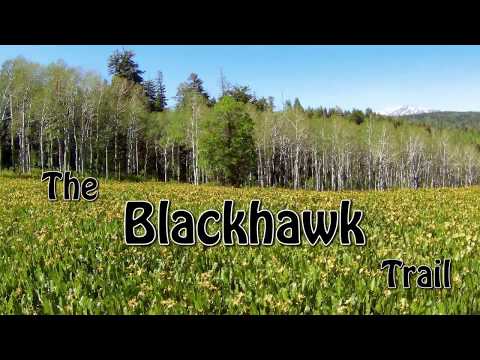
Blackhawk Trail
The Blackhawk Trail is a narrow singletrack that twists through aspen and pine along the top
of the Nebo Loop in Payson Canyon. Almost unknown to northern Wasatch
Front bikers, this trail
is among the nicest alpine rides in the state.
Snow clears from the top of Blackhawk in early June, but many sections stay wet with springs
and bogs until late summer. Most of the creeks that cross the trail have
a solid base, but
if you see deep horse hoof prints, you'd better bail and walk.
The Nebo Loop is famous for its beautiful trees and mountain vistas -- especially in late September
to early October when the red maples and golden aspens draw Sunday-afternoon
gawkers from around
the state. Elevation is 8000 feet.
The loop I describe on this page uses the
Rock
Spring
and
Jones Ranch
trails. At 18 miles with 2400 vertical, it's for very strong riders.
It requires only good
intermediate technical skills. You can make a shorter loop by connecting other trails in
the area (see below).

Chris rides south toward Mount Nebo on October 9, 2002. This ride climbed Bennie Creek from Birdeye and descended Beaver Dam.

Climbing Blackhawk.
The Blackhawk Trail itself is 8.6 miles long. At the bottom end, it forks off the Loafer Mountain
Trail. (The trailhead is on the downhill side of the road, just below
the Payson Lakes campground
area.)
As Blackhawk climbs, there will be a spur to the Nebo Loop road to connect to the Rock
Spring trail, and a spur to doubletrack at the Guard Station. Long portions
of this trail -- about 3/4 of the trail's course -- were severely affected by forest fire in 2018 and are still recovering.
At it's southeast corner, the Blackhawk trail winds around the Blackhawk Campground. There
are several spurs that connect the campground to the trail. If you're
in a hurry, a shortcut
trail (Bennie Creek Ridge) bypasses the long loop around the campground,
but at the cost of
some extra climbing.
The upper end of Blackhawk is on the Nebo Loop Road, just west of the Beaver Dam Overlook and
across the road from the Tie Fork (Frank Young) trail. This trail heads
to the middle of the
Rock Spring trail, offering a shorter loop.

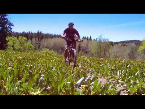
There are several meadows of Mules Ear flowers. This is one of the attractions that brings riders here in June. Here Kris rides through the big meadow, about 1/2 mile uphill from the Loafer trailhead. Photo received by email, 2005.

As you drop onto the east side of Bennie Creek Ridge, there are a lot of meadows. This area is easy cruising.
Much of Blackhawk is easy cruising. But what you'll remember are the horse-trenched, boulder-strewn
stretches. And at 8000 feet elevation, the uphills will seem steep, even
if they're not. It's
a solid ride for intermediates.
Because Blackhawk has multiple connections, you can assemble
a ride that's mellow and easy, or a monster of a sufferfest. Your call.
Payson Canyon is a favorite for those who ride horses. There's plenty of trail here to "thin
the herd." And the trailside usually has generous open space for horses
and bikers to move
off-trail for passing. And although you'll see plenty of horse trailers,
actually seeing riders
on-trail is rare. But be prepared to yield and always be courteous.

In the early season, horses will pit the swampy areas. By July, these spots have usually smoothed out.

Approaching the Blackhawk Campground.
The Blackhawk Loop rideThis loop uses
Blackhawk,
Rock
Spring
, and
Jones Ranch
. While there's only 800 feet of
absolute elevation change, but you'll climb that amount three times! You'll
need strong thighs, plenty of water, and
some calories.
Shorter options are offered below, with additional information on the
Rock
Springs Loop
page.
From the Loafer Mountain trailhead, you roll down 0.15 miles, where you take the right fork
to the Blackhawk Trail. You'll now climb south 1.5 miles through aspen,
maples, and pines to
Bennie Creek Ridge. Dropping over the back side, it's up and down through
meadows, springs,
and small creeks until you reach the Blackhawk Campground at mile 4.75.

The trail passes directly through the campground -- conveniently, right past this group picnic area where you'll find water.

After the campground, the nature of the trail changes. Westbound, it's steeper, narrower, and more overgrown. As you climb toward the ridgeline at 8400 feet, it's a bit of work.
As you approach the campground, go straight onto the double-track until you reach a paved road.
Go straight across to a single-track. Cross paved road again, and fork
right in the middle
of the large meadow. At the next road, find the continuing trail at GPS
N 39° 53.246' W 111°
37.557'.
Keep right at the next trail intersection. Next is a 4-way intersection. Straight ahead takes
you up the hardest section of the trail, to the ridge at the top of the
Nebo Loop. (Forking
right takes you up to the Black Campground road, just off the Nebo Loop
Road. From here, you
can turn left to take paved road to the summit, or go straight across
to the Bennie Creek Ridge
Trail. This trail returns you to the Blackhawk Trail for a short loop
of around 9 miles.)

View down into Beaver Dam Creek Canyon from the west-bound trail. While most of the mountain is aspen forest and meadows, there are some stands of fir.

OK, we're at Lizard Lake on the Rock Spring trail. Kinda pretty. The flowers will be blooming in a week or two. Photo June 5, 2006.
As Blackhawk ends on the Nebo Loop road, turn left on pavement and ride over the crest of the
Nebo Loop. After 2 miles, turn right on the gravel Santaquin Road. Exactly
one mile later at
GPS N 39° 54.398' W 111° 41.624', the Rock Springs Trail drops down on
your right, taking you
back east. Keep straight at all trail intersections.
Save some muscle to climb Done Ridge, the last mountain between you and your car. Then roll
two delightful miles along the creek through beautiful aspens and pines.
Again, keep straight
at all trail intersections, (unless you want to visit Payson Lakes as
an alternate return route).
When you reach the Nebo Loop road, turn right and head uphill to your
car. (There are a couple
of alternate singletracks near the end of the trail. They all take you
down to the road.)

Almost back to the car.

View of Payson Lake from the ridge top, on a spur off the main trail. October 26, 1999.
Blackhawk-Bennie Ridge Loop: After the Blackhawk
Campground, keep right at the next two intersections. As you come up through the log
fence, you encounter the campground road (the Nebo Loop road is about 1/4 mile to your
left). Go straight across the pavement to the Bennie Ridge (campground
bypass) trail and run the ridge back to
the Blackhawk trail. Length 9 miles.
Tie Fork to Rock Spring: After Blackhawk,
go right at the first intersection, straight at the second. Arriving at the Nebo Loop road
at the ridgetop, go straight across to the singletrack trail (Tie Fork Spur
or Frank Young trail). You'll join
the Rock Spring trail near a gate at the ridgetop. Turn right, grind over Done Ridge, and
run straight down the canyon. Length 13 miles.
East Rock Spring Trail: Another option to shorten the ride is to start
the ride at the ranger station, joining the Blackhawk Trail via the connector
east of the road. (This skips the whole Bennie Creek area.) When returning, go
right on the continuing Rock Spring Trail, instead of left down the Jones Ranch
Trail. Based on the tire tracks and wearing of the trail, MOST bikers on the
Blackhawk Loop seem to select this option!

Bruce emerges from an aspen grove. The leaves are just beginning to unfurl, but the mule's ear blossoms are at peak.

Logged section near campground. October 26, 1999.

Same spot on September 30, 2002. Recovering nicely.
Note that Payson Canyon is a "working canyon." In addition to recreation, area is used for
livestock grazing and lumber extraction. So yes, the trails will occasionally
be wide and hoof-tromped
with loose rock. Your tires will flip some poop. You may ride past some
stumps. This is the
price you pay to live in a house and eat hamburgers. So ride with a good
attitude.

View toward Mount Nebo from the trail. If you like a nice mix of pretty trees and meadows, this is the trail for you! September 30, 2002.
The geology of these mountains is a bit more complex than the rest of the Wasatch Front. From
this area south to Nephi, a "thrust fault" -- an earthquake zone that
pushes a block of land
up and over-top of another -- shoved limestone of the Mississippian and
Pennsylvanian Era (before
the age of dinosaurs, when western Utah was covered by deep ocean, around
300 million years
ago) over top of younger rocks. The younger rocks are actually turned
upside-down. Later, the
land to the west of the Wasatch Fault subsided, leaving the limestone
high above the valley,
forming the sharply-rising eastern mountains seen from American Fork to
Payson. Rocks of the
Triassic Era (the early age of dinosaurs, about 210-240 million years
ago) are found on the
eastern side of the Mt. Nebo area, while the front face is formed from
the older limestones.
Getting there, Loafer Mountain trailhead: Going south, take the Payson
exit
250 from
I-15 and turn left. Head into Payson on U-115 to the traffic light, then turn left (100
North, U-198). About 1/3 mile later, at the top of a small hill, turn right at 600 East.
Drive 11.7 miles up the Nebo Loop Road to a small turnout on your left at GPS N 39°
56.447' W 111° 38.652', with a sign "Loafer Mountain Trail."
Rock Spring trailhead: Drive past the Payson Lakes
campground. Watch for the sign on your right and turn into the dirt road
to the parking area. To reach Blackhawk, go back across the road and find
one of two connector trails.
Campground trailhead: Continue uphill and turn left on the
campground road. There are several spots at the campground where you can
pick up the trail.
West end: Just past the Beaver Dam Overlook, the trail
reaches the road on doubletrack, with some undeveloped parking. The Tie
Fork (Frank Young) trail is just across the road.

Map of the Blackhawk loop area
Riding notes, from the Loafer Mountain
Trailhead:
0.15 Fork R uphill through gate
N 39° 56.497' W 111° 38.499'
1.5 Fork L downhill (R = out to road + Rock Springs Tr)
N 39° 55.819' W 111°
37.822'
2.2 Keep straight as trail comes in from R
N 39° 55.410' W 111°
37.574'
2.5 Fork L N 39° 55.147' W 111° 37.617'
4.7 Gate, Blackhawk Campground
Continue to parking, cross road
N 39° 53.568' W
111° 37.203'
Trail always continues across
pavement
leaves CG at N 39° 53.246' W
111° 37.557'
5.9 Cross trail at top of ridge (R=down to road)
N 39° 53.479' W 111° 37.788'
6.7 Fork R (L= to Beaver Dam Trail)
N 39° 53.955' W 111° 38.085'
7.1 Straight at fork (R=road, L=Beaver Dam)
N 39° 54.155' W 111° 38.337'
8.9 R on DT to road, turn left on road
N 39° 53.824' W 111° 39.324'
10.4 Right on Santaquin Canyon Rd
11.4 Fork R on Rock Springs Trail
N 39°
54.398' W 111° 41.624'
13.2 Keep straight (L=Schram Tr)
13.4 Straight (R=Lizard Lake Tr to Road)
14.2 Straight (R=Tie Fork or Frank Young Tr)
15.4 Fork L on on Jones Ranch
Alternate loop = R = Rock
Springs
17.0 At paved road, turn R uphill
17.8 Back at vehicle