View west as we finish a mile of great downhill singletrack. Original singletrac...
View west as we finish a mile of great downhill singletrack. Original singletrack review April 2006, with most recent update April 2016. All photos by Bruce.
Baby Steps Loop

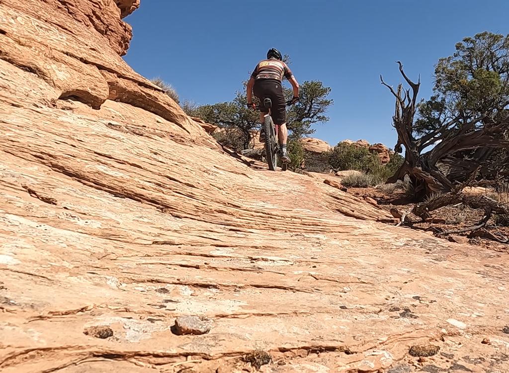
The Baby Steps Loop is a classic ride in the Klondike Bluffs mountain bike trail system . It was the first addition to the old Klondike Cliffs doubletrack route. Newer trail options mean that fewer bikers are doing the classic loop -- which includes a dirt road on the back side of the bluff. The Baby Steps trail features some long stretches of slickrock riding, narrow desert singletrack, and fun boulder-rocking downhill singletrack.

The classic loop is 15 miles if ridden from the southern Klondike Bluffs trailhead, or 20.5 miles if you start from Highway 191. (You can also easily reach the loop starting at the northern trailheads.) Total climbing is around 1200 vertical feet. With the narrow track and loose trail sidewalls, plus some technical features, I'd give the trail a rating for upper-intermediate to advanced riders.
Section of smooth slickrock as we climb east. The lower trail is marked with roc...
Section of smooth slickrock as we climb east. The lower trail is marked with rockpiles on the sandstone. Higher up, there are paint spots on the sandstone.
View of the La Sals from a high point on the singletrack. The terrain slopes gra...
View of the La Sals from a high point on the singletrack. The terrain slopes gradually uphill towards the Bluffs.

This first uphill part of the Baby Steps singletrack can also be used as a longer, more technical climb to Klondike Bluffs . Elevation change for that ride is 900 feet. There's some up-and-down on the singletrack. The trip to Klondike and back via Baby Steps is about 14 miles, 12 if you descend via the official Klondike Bluffs trail.

From the trailhead gate (2.7 miles from US 191) cross the cattleguard and go 0.8 miles on Klondike Bluffs Turn left on the doubletrack Copper Ridge Road. (Alternate: take Dino Flow or EKG to Baby Steps.) About 0.9 miles later, fork right uphill to begin the counterclockwise loop. Shortly after the turn, you'll enter a long slickrock climb. The trail is marked by blue paint stripes on the rock.
Trail view early in the singletrack. The shoulders are soft, so youll dig in and...
Trail view early in the singletrack. The shoulders are soft, so you'll dig in and dump if you don't control your riding line. There are a few rock hazards that require good handling skills. All photos April 2006.
In many areas, rock stunts keep things interesting. While theres a lot of open-r...
In many areas, rock stunts keep things interesting. While there's a lot of open-rock riding, other sections have barriers that force the rider to take a specific line, with tight turns and stunts.
When you reach the EKG Trail fork, you can select a variation on the classic ride. Sidestep North is a technical trail that connects to Baby Steps uphill. You can shortcut 1.5 miles off the ride by cutting through, or you can turn onto Instep to reconnect -- bypassing a boring 0.5 doubletrack miles in favor of 1.5 miles of more-technical trail. Sidestep South is found 1/10 mile uphill on Baby Steps, and is a technical singletrack option to the Baby Steps doubletrack. (See the map below.)

Baby Steps itself takes you 1/2 mile uphill on doubletrack (to the point where the Sidestep/Instep route rejoins). Fork right on the singletrack. When the singletrack drops onto sandstone marked with white hash-marks, turn left (right connects to Klondike Bluffs ). The trail will now alternate between rock and doubletrack.

As you climb a tiny hill on doubletrack, watch for the next section of singletrack branching off on the left. There will be some technical sections here. After a couple of miles, the singletrack will dump you back onto the same doubletrack you were riding earlier. A short bit later, the UFO trail forks to the left. This trail offers a shorter alternative loop ride -- now a favorite -- that does NOT dump you off the back of the mountain. (After UFO, you'll turn uphill on Little Salty to reconnect to Baby Steps on the ridgeline. Again, see the map.) Keep right for the classic loop.
Heres a cute section. Plaster your body onto the frame -- you can ride under thi...
Here's a cute section. Plaster your body onto the frame -- you can ride under this tight squeeze.
Plunging down the east side of the mountain.

Baby Steps will rejoin the Klondike Bluffs trail, then continue straight uphill as Klondike Bluffs turns east (right). If you decide to pay a visit to Klondike Bluffs, it's about a mile to the Arches National Park border. You'll have to leave your bike at the park boundary and hike a half-mile hike to the overlook.
To continue with the Baby Steps Loop, grind up and over the hill. Drop down a steep descent toward a broad valley. At the dirt-road intersection on the valley bottom, turn left.

Cruise the speedy dirt road for about 1-1/4 miles, then fork uphill at the intersection. What goes down must come up, and you've got about 300 vertical feet to gain back. There will be a "sucker summit" after which you'll climb some more. If you're pooped, the Little Salty trail heads downhill here. Stay left on doubletrack to finish Baby Steps.
After a high-speed cruise down the valley, its time to climb back up the hill to...
After a high-speed cruise down the valley, it's time to climb back up the hill to get to the top of the singletrack.
The singletrack starts smooth and fast, then gets steeper and more technical.
As the doubletrack turns on the west end of the mountain, you'll spot Baby Steps singletrack on your left. Another singletrack straight ahead is the Mega Steps trail, an alternate route downhill.
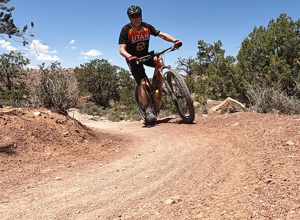
Hop on the Baby Steps North singletrack and get ready for a great ride. Navigation is straightforward: go down. The trail rocks and rolls over sandstone outcrops in the Salt Wash formation.
When you're almost to the bottom, you'll cross the EKG trail and the Dino Flow trail. Keep downhill for the classic loop (or grab one of these trails for a more-fun variation). At the bottom of the singletrack, turn left on the Copper Ridge road. About 1-1/2 mile later, you'll pass the fork where you started uphill. Care for another go at the loop?
A rider descends the rolling technical sandstone.
View south on Jurassic. Smooth swooping singletrack sure beats riding Copper Rid...
View south on Jurassic. Smooth swooping singletrack sure beats riding Copper Ridge!
Another nice variation on the classic loop ride is found where Baby Steps hits the Copper Ridge road. Instead of turning down the road, cross over to a singletrack connector heading west. This will take you to the Jasper loop. Head south on either West Jasper or East Jasper. Drop onto the connector at the south end of the loop. Turn right on Jurassic , which will take you back to the Klondike doubletrack just south of the big wash.
Riding notes for the loop, South Trailhead:
0.0  From upper parking, east over cattleguard
       N38 46.417 W109 42.735
0.8  Fork left on DT Copper Ridge Road
       N38 46.997 W109 43.072
1.7  Fork R on ST Baby Steps South
       N38 47.545 W109 43.603
       Climb through slickrock area
2.1   Straight uphill (EKG crosses)
        Option = Sidestep North
        N38 47.741 W109 43.285
2.2   Stay in wash (R = Sidestep S)
        N38 47.832 W109 43.171
2.6  Trail veers R, N 38° 48.02' W 109° 42.88'
3.5  Slickrock, fork L following marks
       N38 47.958 W109 42.584
       (R = connect to Klondike)
3.9  L on ST, N 38° 48.28' W 109° 42.69'
5.1   Back at DT, fork L
        N 38° 48.41' W 109° 42.77'
5.3   Straight (L = UFO)
        N38 48.502 W109 42.903
6.1   Fork L to join Klondike trail
        N38 48.578 W109 42.373
6.2   Keep straight N38 48.656 W109 42.260
6.6   Keep R and descend
        N38 48.817 W109 42.085
6.8   Fork L in valley N38 48.811 W109 41.871
8.2   Fork L and climb hill N38 49.310 W109 43.045
8.8   Top of hill, R on DT (L = Little Salty)
        N38 49.102 W109 43.371
9.9   Fork L onto ST downhill (St = Mega Steps)
        N38 49.480 W109 43.797
10.8 Cross EKG, keep straight
        N38 48.964 W109 44.612 
11.1 Fork L on DT Copper Ridge Rd
        N38 48.804 W109 44.837
12.1 Straight (L= Little Salty)
        N38 48.180 W109 44.195
13.0 Straight (L=Baby Steps)
        N38 47.545 W109 43.603
13.9 Stay R on DT N38 46.997 W109 43.072
14.7 Back at parking
Getting there, South Klondike: Starting at the Colorado River, drive 15 miles north from Moab. Look for a turnout on the right. There will usually be cars parked there. GPS N 38° 44.452' W 109° 44.037' Go through the gate and drive 2.7 miles. Keep left at the fork. At 2.8 miles, park your car at the gate and begin your ride.

Single-page riding guide for printing.
GPS Track Files:
      Baby Steps Loop
      Baby Steps up, Klondike down.
     Altered Baby Steps Loop w UFO bypass
      GPX Klondike Area all trails
High-res topo maps for printing:     View Klondike area
Lodging, camping, shops:      Links to Moab area resources
Water: None
Camping: None
Bathrooms: Dino Tracks TH

Kondike area map
Kondike area map
Northern Klondike Trailheads:   On Highway 191 8.5 miles south of I-70 and 6.5 miles north of the southern Klondike Bluffs road (about 5 miles north of the airport), watch for a "Northern Klondike" sign at N38 49.504 W109 46.893. Turn east (toward the sandstone bluff). Keep to the right as the road winds south around a small hill.
Chilkoot TH:   1.2 miles from the highway as the road is heading east toward the bluff, the Chilkoot trailhead is on your right.
Agate TH:   Go a bit past the fenced parking area then fork right on a fainter jeep road at N38 49.103 W109 46.061. (The main road continues to the dinosaur tracks, with an alternate trailhead here for the Dino Flow trail.) At mile 1.6 from the highway, you'll come to the TH for the Jasper and Agate loops (N38 49.087 W109 45.625) on your right.
Mega Steps TH:   Continuing past the Agate TH, at 2.0 miles you're at the bottom of Mega Steps at a larger parking area N38 49.179 W109 45.417.
Dinosaur Tracks TH:  At the trail fork at mile 1.2, keep left on the main road toward the dinosaur tracks. About 1/2 mile further, turn to the right into the parking area. The Dino Flow trail is up against the mountain, to the left of the pit toilet.