This is Balanced Rock, where the dirt Willow Springs Road hits pavement in Arches. This spot is also noteworthy because there's a bathroom just before the dirt road arrives at pavement! Photos April 2006.
Arches Loop
This ride is also known as Courthouse Wash. It's a big loop that includes a section of paved trail, some old broken-down highway, some ATV track, a tiny section of singletrack, a section of rocky roadway, and finally, paved road in Arches National Park. It's a substantial chunk of riding. Nothing too hard, but a long 28 miles. Absolute altitude change is 1000 feet; with ups and downs, you'll climb 2300.
This ride is also known as Courthouse Wash. It's a big loop that includes a section of paved trail, some old broken-down highway, some ATV track, a tiny section of singletrack, a section of rocky roadway, and finally, paved road in Arches National Park. It's a substantial chunk of riding. Nothing too hard, but a long 28 miles. Absolute altitude change is 1000 feet; with ups and downs, you'll climb 2300.
The ride starts from the parking area just north of the Colorado River on Highway 191. Cruise
on the cushy paved bike trail past the entrance station to Arches National
Park. (You'll be
coming back down that road in a few hours.) Pass the end of
Killer B
and later
Deadman's Ridge
Keep on the paved Old 191 to the top of the hill.

View north as we ride uphill away from Moab on the Old 191 paved bike path. Nice.
 on the eastern side of the Bar M loop")
View down the trail (the smooth area) on the eastern side of the Bar M loop
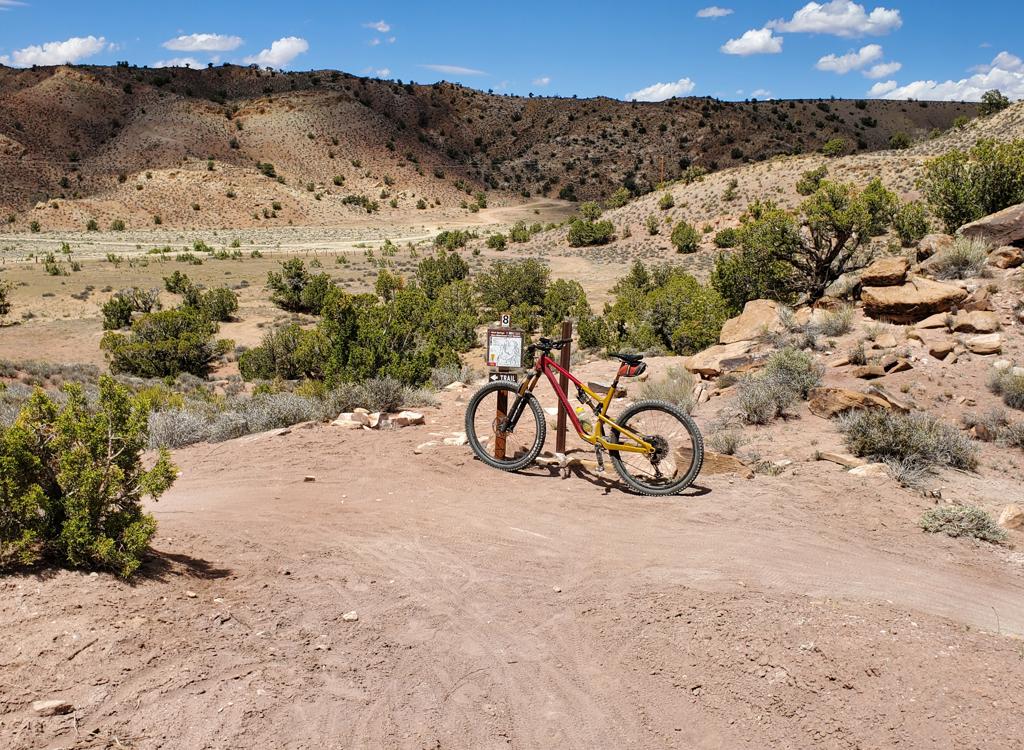
At mile 5.0, watch for the
Bar M
trail on your right. A fence separates the paved path from the Bar M. Slip through to the Bar
M trailhead and fork right (as though you're riding the loop counterclockwise.
The Bar M route
is absolutely worth doing. (If you're hammering through in a hurry, you
can continue straight
on the old highway to the north end of the Bar M and jog over to the continuing
trail.).
The Bar M trail heads over the ridge, then follows the edge of the slickrock slope that drops
towards Courthouse Wash. There are several "short circuits" possible.
The quickest is to take
the Copper Ridge trail (watch for the sign on the left of the trail) over
the ridge. But I
think you'll want to ride as much of the Bar M as possible. The Bar M
track turns back southwest
for a long slow climb.

Looking back up a portion of the spooky singletrack descent towards Willow Springs. Most of this ride would rate "easy." This section is short, but very technical.

That's Bruce with his Scalpel near the dinosaur trackway just before the entrance to Arches. Photo taken by a passing sauropod fancier.
After dropping from the ridge, you'll do an "almost 360" to turn and follow the slickrock.
(Going straight takes you about a mile further to the park boundary, with
connections to several
other 4x4 tracks going south.)
At the north end of Bar M, Seven Mile Canyon will yawn open to your right. As the trail turns west (toward the highway) catch a doubletrack northeast across the wash. You're riding along the pipeline route.
At the north end of Bar M, Seven Mile Canyon will yawn open to your right. As the trail turns west (toward the highway) catch a doubletrack northeast across the wash. You're riding along the pipeline route.
The pipeline will drop abruptly just above the Sovereign Singletrack trailhead. The trail will fork. Left is a more technical singletrack route. Right is ATV-width tread and much easier. The trails reconnect, then head north to Willow Springs Road. Turn right (east) on the road way and head towards Arches.

Three-toed footprint of a predatory dino. Both carnivorous and lunchable dinosaur tracks are found in the same trackway.

Inside Arches, Willow Springs road undulates over rock and sand through small stone outcrops.
You'll run across a few areas of slickrock. Play while you can -- there's absolutely NO off-road
riding once you reach Arches. Just after the first fence, check out the
dinosaur trackway next
to the trail (to your right as you ride on the "machine-chopped" path).
Inside the park, Willow Springs Road is a great ride for a couple of miles, going gently up,
down, and around on dirt and rock. Then it "goes straight" and becomes
an ordinary dirt road.
You'll reach pavement at Balanced Rock. Turn right. Watch for idiots in
cars. There's no shoulder
here. I'd suggest a helmet-mirror.
Of course, you can visit the sites in Arches on your bike. But if you're riding in the middle
of weekend tourist-season traffic, I think you'll want to spend as little
time on pavement
as possible. It's about 9 miles to the entry station. There's a long downhill,
then a long
uphill before you drop over the edge.

Here's the scary part: eight inches of shoulder, on a road where the Winnebago drivers are busy looking at the rock spires as they blow past at 50. Be careful. I used a mirror, and if I didn't see a car pull left as it approached, I risked the $500 fine and went "off-roading" with my bike.
Trailhead N 38° 34.945' W 109° 30.587'
Bar-M turnoff N 38° 38.444' W 109° 39.462'
Bar-M turn-north N 38° 38.311' W 109° 38.500'
Bar-M turnoff N 38° 38.444' W 109° 39.462'
Bar-M turn-north N 38° 38.311' W 109° 38.500'
Bar-M meets pipeline N 38° 39.905' W 109°
40.631'
Pipeline to Willow Springs N 38° 41.920' W 109° 39.754'
Arrive Balanced Rock N 38° 42.121' W 109° 34.029'
Pipeline to Willow Springs N 38° 41.920' W 109° 39.754'
Arrive Balanced Rock N 38° 42.121' W 109° 34.029'

Ride map
Getting there:
From Moab, drive north (toward the Colorado River). Cross the Colorado, then cross the Courthouse Wash bridge. About 1/4 mile later, turn right into a parking area. This is the trailhead. GPS N 38° 34.945' W 109° 30.587'. Start uphill on the paved bike trail.
From Moab, drive north (toward the Colorado River). Cross the Colorado, then cross the Courthouse Wash bridge. About 1/4 mile later, turn right into a parking area. This is the trailhead. GPS N 38° 34.945' W 109° 30.587'. Start uphill on the paved bike trail.
Riding resources for the arches loop:
Large-format topo map (3 MB):
View
to print
GPS track files (right-click and "Save as...":
GPX loop ride
Single-page riding guide.
Lodging, camping, shops:
Links to Moab area resources