View west, showing the two geographic halves of the island -- younger rock on the north, old metamorphic rock on the south. May 18, 1998 by Bruce Argyle
Antelope Island
Lakeside, White Rock, Split Rock, Elephant Head
Lakeside, White Rock, Split Rock, Elephant Head
Antelope Island, on the east side of the Great Salt Lake, can be biked virtually year round. Early spring and late fall are best. The island tends to be buggy in late spring and early summer. In summer, ride the day after a rain storm -- the rain hardens the loose debris kicked up by horses on the trails.
There are several riding options on the island. The easiest and most popular route is the White
Rock Bay loop. Other rides include Split Rock Bay (doubletrack but with
brutal climbing), Elephant
Head (intermediate singletrack), East Side, (singletrack above the eastern
shoreline), and
Lakeside (singletrack with sections of extremely techy rock).

Bruce rolls westbound on a smoother section of the Lakeside trail in 2017.

View from Elephant Head, looking over Split Rock Bay.
The mountainous south end of the island (seen on the left of the picture) is mostly dark highly-metamorphosed
rock such as quartzite and schist from the Precambrian Era (3.5 to 0.5
billion years ago),
while the north end is sedimentary rock such as Tufa, a conglomerate laid
down by prehistoric
Lake Bonneville. In between there's a band of lighter-colored quartzite
-- about half a billion
years younger than the Precambrian rock. The transition from light rock
(for example, the quartzite
in the photo below) to dark rock is abrupt.
In mid to late spring, you'll find plenty of biting bugs on Antelope Island, especially where
the trail runs near the shoreline. Douse yourself liberally with bug repellent
-- or be prepared
to ride very fast without stopping. When taking the photo at left, I ventured
about 50 feet
off the trail, and was covered in mosquitoes before I could snap the picture.

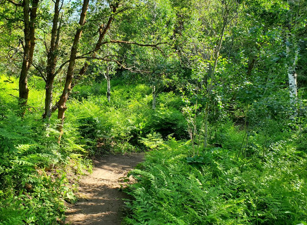
Looking west on the White Rock Bay trail, as spires of Tintic Quartzite rise through the brush. This rock dates from the Precambrian Era over a billion years ago.

Arriving at the south end of the Lakeside trail at the White Rock campground.
There's camping at Bridger Bay and White Rock. White Rock provides direct access to all the
west-side trails. For non-riders, there are picnic tables and nice swimming
beaches with bathrooms
and shaded picnic areas on the north end of the island. The visitor's
center can sell you a
Coke or a T-shirt, or teach you about the history and geology of the island.
Antelope Island functions as a game preserve. Drones are not allowed. Among the wildlife in
this nature preserve are 900 bison. The big guys aren't usually aggressive,
but they are wild,
and they are dangerous. And they're definitely BIG. Don't get close during
the calving or breeding
seasons.

One of Antelope Island's permanent residents eyeballs a biker. Photo May 18, 1998 by Bruce.
Lakeside Trail

Dominic Bria hits the Lakeside Trail. Photo Bruce Argyle March 18, 1999.
The Lakeside Trail is an excellent challenge for skilled rock-riders. Intermediates can still
enjoy the trail by walking their bikes through the tough sections. There
are 3 miles of curving
single-track beginning at the campground at Bridger Bay on the far north
end of the island,
and extending to the White Rock Campground on the west side.
North (Bridger Bay) trailhead GPS N 41° 02.394' W 112° 15.727'. South (White Rock Bay) trailhead GPS N 41° 01.669' W 112° 15.060'.
North (Bridger Bay) trailhead GPS N 41° 02.394' W 112° 15.727'. South (White Rock Bay) trailhead GPS N 41° 01.669' W 112° 15.060'.
The middle mile of the ride is insanely rocky and rates an "expert" in technical difficulty,
but you can easily hike through the areas that make you nervous. You can
ride the trail as
an out-and-back, or head overland on the paved roads to make a loop.

Handlebar view on Lakeside. No way forward except over the rocks.

Rolling up and down through ancient boulders.
One of my favorite rides is an 18-mile out-and-back starting at Bridger Bay. After doing Lakeside,
I head south past the campground to the Bone Road trail and climb to Elephant
Head. There's
around 1200 vertical feet of climbing. Nice views and enough techy riding
to satisfy.
White Rock Loop
The White Rock loop starts at the backcountry trailhead south of the White Rock campground.
The lariat loop is 6.5 miles with around 600 vertical feet of climbing.
This is the least techy
ride on the island, so it attracts the most riders.

Heading through the backcountry gate to White Rock. There are maps of the trail options at the kiosk. Straight ahead is Bone Road; to the left is White Rock.

Arriving at the junction between Bone Road and the Loop Connector from White Rock.
The "old" White Rock loop included doubletrack that is now the Bone Road trail. This doubletrack
is the main horse route on the island. Not that there's anything wrong
with that. Just expect
some loose surface and horse poop on Bone Road.
The southeast corner of the White Rock loop has a doubletrack connector to southern Bone Road for those who are continuing to Elephant Head or Split Rock.
The southeast corner of the White Rock loop has a doubletrack connector to southern Bone Road for those who are continuing to Elephant Head or Split Rock.
On a short side-trip from the middle of the White Rock loop, climb up to Beacon Knob. Impressive
views 360 degrees!

Dominic rides through the quartzite boulders on the sideslope of White Rock.
Split Rock Bay Loop

Climbing up the doubletrack.
Split Rock is a 5 mile doubletrack that descends from the ridgeline east of Elephant Head to
the shoreline, then climbs back out. The route isn't really techy, it's
just steep. You'll
climb a steep hill to get to the loop, then climb an even steeper hill
to get back out once
you drop down to Split Rock.
To reach the Split Rock loop, head out the backcountry gate. Now choose your route. You can
take either of the two limbs of the White rock loop (then the connector
trail), or the shorter
Bone Road trail. When the connector trail meets Bone Road, head south
up the grunt-of-a-hill
to the ridgeline.
Just a few feet after crossing the ridge, the doubletrack splits. This is the loop. The climb out of Split Rock Bay is easiest when done in the clockwise direction. So after you pass Elephant Head, keep left for the descent.
Just a few feet after crossing the ridge, the doubletrack splits. This is the loop. The climb out of Split Rock Bay is easiest when done in the clockwise direction. So after you pass Elephant Head, keep left for the descent.

Grunting uphill. Not the steepest part of the ride.
Elephant Head

Leaving Bone Road for the singletrack to Elephant Head.
Elephant Head is an intermediate-tech singletrack that forks off the Bone Road trail on the
ridgeline (just before Bone Road descends to the Split Rock loop). It's
a 2.8-mile out-and-back
to a viewpoint.
You'll climb about 600 vertical on Bone Road to reach the ridgeline where Elephant Head starts.
Up-and-down riding adds about 300 vertical feet on the singletrack. There
are a couple of tech
challenges on the trail, but nothing an intermediate couldn't handle (when
outgoing, the one
gnarly drop has a ride-around path).

Banging through some of the white rock on the ridgeline. Black rock coming up.

Westbound on the ridge. Our destination is the opposite side of the dark hill.
The view from Elephant Head is awesome. If you're doing Antelope Island, this trail is a must-do.
East Side
The East Side trail is singletrack curving along the eastern shore of the island. This is a
flatter area with views of the Wasatch Front across the flat bay. This
trail is still being
extended at the south end. To find the trailhead, fork left as you reach
the island (near the
marina). A tiny ways down the road, at the next fork, you'll find the
trail on the left side
of the road.

Antelope Island is a good early-season ride. Get there before the bugs, and while the foothill trails are still snow-covered or muddy. The rock near the tires is tufa, deposited by old Lake Bonneville.

Rolling over boulders. Expect to bang your pedals. A lot.
The East Side trail is 11 miles to Fielding Garr ranch with moderate up-and-down riding. It's
a fairly strenuous outing, but less-strong riders can turn around at any
time. The official
end is at the ranch.
The East Side route is not as gnarly as Lakeside, but you will have a few boulder challenges.
It's the longest continuous route on the island, with the option of continuing
south to the
southern tip of the island on doubletrack after passing Fielding Garr
ranch.

Views. A big reason for coming to Antelope.

Aerial view of Antelope.
Getting there:
Just drive I-15 towards Syracuse (south of Ogden, north of Salt Lake City). Exit at the "Antelope Island" sign and turn west (away from the mountains, towards the lake). You'll be on Antelope Drive. Just drive west until you hit the lake. There's a $10 fee (as of 2017) that includes payment to use the causeway over the lake, and your admission to the state park. With payment of the fee, you can ask for a road and trail map of the island if you need it. Roads are well-marked. Bridger Bay (Lakeside): Keep to the right at every road fork. White Rock: Follow the signs on the main road.
Just drive I-15 towards Syracuse (south of Ogden, north of Salt Lake City). Exit at the "Antelope Island" sign and turn west (away from the mountains, towards the lake). You'll be on Antelope Drive. Just drive west until you hit the lake. There's a $10 fee (as of 2017) that includes payment to use the causeway over the lake, and your admission to the state park. With payment of the fee, you can ask for a road and trail map of the island if you need it. Roads are well-marked. Bridger Bay (Lakeside): Keep to the right at every road fork. White Rock: Follow the signs on the main road.
Riding resources for this trail:
One-page printable guide to this trail
GPS track files (right-click and "Save as..."):
All GPX tracks Island
White Rock and Split Rock clockwise
Elephant Head only
East Side only
Lakeside only
Topo maps for printing: Low-res High-res
Lodging, camping, shops: Links to Ogden area resources
One-page printable guide to this trail
GPS track files (right-click and "Save as..."):
All GPX tracks Island
White Rock and Split Rock clockwise
Elephant Head only
East Side only
Lakeside only
Topo maps for printing: Low-res High-res
Lodging, camping, shops: Links to Ogden area resources
Original review 1998, latest update 2017.
For additional information, including
nearby lodging, rentals, camping, and current conditions, may we suggest:
Camping, guides, rentals:
http://www.utah.com/stateparks/antelope_island.htm
General info on all of Utah's State Parks:
http://www.stateparks.utah.gov/index.php