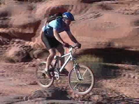
Chad Hunter rolls along a smoother stretch of slickrock trail, with the Navajo Sandstone bluffs of Kane Creek in the background. The horizontal layers at the base are Kayenta. Photo April 15, 2000.
Amasa Back
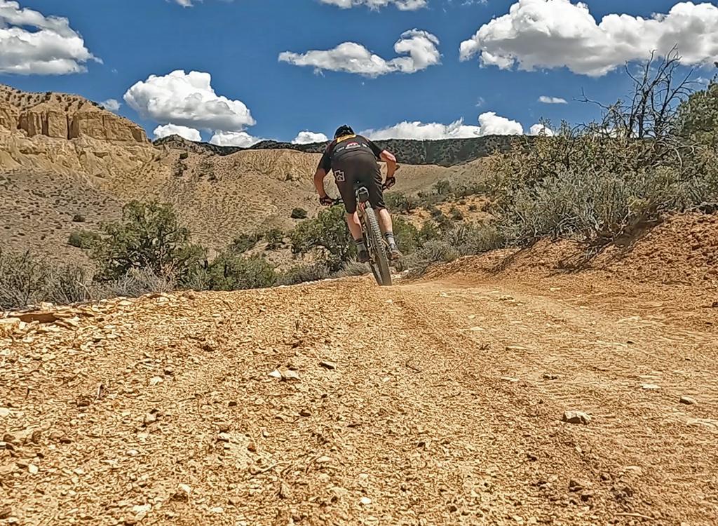
The Amasa Back trail is one of the classic rides of Moab. It ascends from Kane Creek on the
Colorado River just west of Moab, climbing up onto an outcropping of rock
surrounded on three
sides by the Colorado.
General information:The trail is a rocky Jeep trail with ledges and drop-offs. There are technical challenges that
will stop all but the most advanced riders. Strong intermediates can manage
this ride, but
will walk most of the rougher climbs. As of 2014, most cyclists prefer
to climb the
Hymasa
Trail
for the first segment of the Amasa ride.

The initial drop-in. The trail veers R off the road and drops over a series of techy ledges.

The plunge through Kane Creek.
As an out-and-back, the trip is 10 miles round trip. Altitude change is 1050 feet, with about
1300 vertical feet of tough and rough climbing. The jeeps driving this
trail create slippery
undercut ledges with chunky cobble complicating the approach.

Smoother section trail during the initial climb. A 4x4 road climbs the ledges of Kayenta sandstone.

About 1.5 miles into the ride, looking back to the east at the Navajo domes with skirts of ledge-forming Kayenta.
On the way uphill, you'll climb ledges in the Kayenta Sandstone of the early Jurassic Era (about
200 million years ago, when this area was near the ocean on the edge of
the continent). Above
the Kayenta is the Navajo Sandstone, a course-grained sandstone deposited
by the wind in a
broad, flat desert area.
As you ride uphill, the
Hymasa
singletrack will cross several times. The lower two miles of the trail is a tricky series of
ledges and rock challenges. Clearing the multiple rock obstacles will
test your skills on the
way up and again on the way down.

Lots of big ledges. Don't head for the obvious black tire marks. Instead scout for the riding lines along the sides.

View north from the ridgeline toward the potash plant.
Navigation is easy because the route is well-marked with signs, and with paint stripes in slickrock
areas. You'll run into a few side routes. Just stay on the main jeep-width
path. Follow the
route with the most bike tire tracks when in question.
Amasa Back has plenty of Moab's great sandstone to play on. At the top, there are wide areas
of slickrock. On the way, you'll have eye-popping views of the canyons,
as well as a cliff-side
cruise overlooking Jackson Hole and its rincon (called Jackson "Not-Hole".

Matt Flygare takes some air near the top of the Rock. Of course, you don't have to go over every cliff in the trail. There are easier cheater routes around most obstacles. April 15, 2000.

After cresting the ridge, riders head downhill towards a set of gnarly ledges.
The Ride!
From the Amasa Back parking, ride your bike 1/2 mile uphill on the Kane Creek road. The trail
falls quickly down a series of rock steps, then descends to the creek.
At the bottom of the canyon, you'll splash through Kane Creek, then bog down in the sand uphill.
If you succeed in powering up to the first ledge through the sand, you'll probably find it
impossible to clear the 4-wheeler cobble pile. Get used to lifting your
bike up ledges. You'll
do a bit of it on this ride.
At the first right turn above the creek (mile 1.0 of the ride), notice the
Captain
Ahab
trail coming in on your left. It's one-way -- downhill only.

View to the south, with Jackson Not Hole to the right.

Mike Engberson, manager of the UMB store, in front of "Jackson Not Hole".
At mile 2.3, you'll spot the connector to the midpoint of Captain Ahab. The
connector is two-way. It serves as a delivery system to get you to the bottom
half of Ahab for a shorter ride, to
Hymasa
for an
alternate climb, or as a bailout after riding upper Ahab.
There's a temporary reprieve from the uphill attack at mile 2.7 as you cross a ridgeline. Stop
and take in the views. On your left is the entry to upper
Captain Ahab
and
Hymasa
Descend the doubletrack along the cliffs. Pass a dead-end doubletrack on your right at mile
2.8. (It goes uphill about 1/2 mile to an overlook. Go ahead and explore
if you want.)

The top of the tilted mesa in the right half of the photo is our destination. On the left is Jackson Not Hole.

Gary Argyle cranks up the stone to where Matt Flygare and Dominic Bria are waiting. April 15, 2000.
As you cruise the cliffside, notice "Jackson Not-hole," a rincon where the Colorado formed
a gooseneck, then cut it off to form a new straighter channel past the
rock "island."
At mile 3.6, cross under a power line. One-tenth mile later, the route to
the Jackson Hole portage to
Hurrah
Pass
is on your left (mile 3.7). After another 1/10 mile at mile 3.8, the
doubletrack connector to the
Jackson Singletrack
forks right.
Just obey the signs and keep straight.
At mile 4.3, there are two options. The left (straight) fork is more direct -- in fact, you
might find yourself on a narrow bike track without knowing there was a
fork. The official jeep
road forks 90 degrees to the right. It will descend a bit before climbing
back up to rejoin
the straight path. The routes rejoin in about 0.1 mile.
At mile 4.5, keep left as the route to
Pothole
Arch
and
Rockstacker
forks off on your right. The ledgy jeep road turns to slickrock about mile 4.8. Just keep straight
southwest on slickrock as you climb, watching the white stripes. Notice
a wide circle painted
with stripes at mile 5.0. That's the official end, and the viewpoint is
just beyond the circle.

Matt overlooking the Colorado River valley west of Moab. April 15, 2000. This is the official "end of the trail."

Mike Engberson shows his jumping form. The fins above are Navajo Sandstone. April 15, 2000.
From the official top of the ride, backtrack 1/2 mile to the
Pothole
Arch
trail. This can take you to the
Rockstacker
Trail, from which you can reconnect to Amasa.
If you're looking for hairy technical riding, you can continue downhill on
Jackson
Singletrack
Another technical option for descending is
Captain
Ahab
, a difficult technical singletrack on the south side of the hill.

On the way back. We'll need to climb back up to the ridgeline in the center of the photo, which is where we'll find Captain Ahab.
Riding notes, Amasa:
0.0 Exit parking, uphill on road N38 31.710 W109 35.705
0.6 Drop R off road N38 31.435 W109 36.096
0.7 Take air off ledge, turn right on DT
Alt = ST straight shortcut
0.8 Cross creek N38 31.589 W109 36.080
1.0 Turn R (L = exit from Captain Ahab)
N38 31.521 W109 36.261
2.3 R at fork (L = mid-way Ahab connector)
N38 31.057 W109 36.804
2.7 R on DT (L = Captain Ahab)
N38 31.098 W109 37.114
2.8 L (straight), R = to view
N38 31.161 W109 37.126
3.0 Cliffside along Jackson Not-Hole
3.7 Pass Portage connector, keep straight (R)
N38 31.721 W109 37.678
(L=cliff scramble down into
Jackson Hole)
3.8 Keep L at fork (R = Jackson ST)
N38 31.761 W109 37.756
4.3 Straight (or R = jeep route)
N38 31.788 W109 38.198
4.5 Keep L on Amasa (L = Pothole Arch trail)
N38 31.876 W109 38.369
5.0 View - End of Amasa
N38 31.619 W109 38.554
Getting there:
Head south on Moab's Main Street. When you reach the McDonald's on your right, turn right onto
Kane Creek Blvd. After 0.6 miles, go straight where the road seems to
turn right (500 West).
Drive along the Colorado River about 5 miles until the road turns to gravel,
and head uphill
about 2/3 mile. Watch for the "Amasa Back Parking" area at GPS N 38° 31.329'
W 109° 35.501'.
Park here. Pedal further up the gravel road 1/2 mile, and turn right onto
the trail at the
sign.

Chad Hunter shows a group of "Jeepies" how a real man handles a trail.