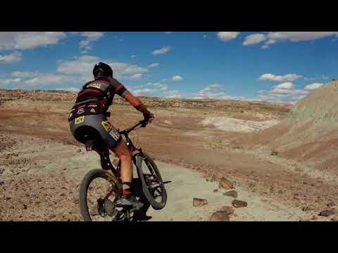
Typical trail on the Agate West portion of the ride. Photos and review by Bruce, October 6, 2012.
Agate and Jasper LoopsKlondike Bluffs Riding AreaThe Agate and Jasper Loops are
easy and short trails in gently rolling terrain west of the Copper Ridge
Road in the
Klondike Bluffs riding area
. These trails are non-motorized
singletrack, and are suitable for beginning riders. The trail system is
very well marked and easy to navigate. The loops have continuing trail in
the north (
Chilkoot Pass
) and south (
Jurassic
)
for longer rides.
The loops can be reached from the main southern
Klondike
Bluffs
trailhead (see below) for a longer but mellow ride. See the by-the-mile ride description below
for a ten-miler. Or you can drive directly to the northern trailhead and
hit both loops in
an easy figure eight of 4 miles.

Heading to the loops from the north. This is the fork off the Dinosaur Tracks road. Go right. There's a small parking spot right here, and two more down the small road.

The northern trailhead. Straight ahead is Agate West. To the left is Agate East.
There's room for a few cars right at the northern end of the Agate Loop (see photo), which
you reach by dirt road from US 191 about 4 miles north of the airport.
Watch for a sign titled
"Northern Klondike" trailhead. Turn east and follow the "Dinosaur Tracks"
signs for a mile.
(This road may not be passable when wet -- in bad weather, use the southern
trailhead.)
There will be two large fenced parking areas on your right 1.1 miles from the highway. (This
is the
Chilkoot Pass
trail. The trail to the right is 0.9 miles to the Agate TH, the left trail is 0.5 miles. Many
riders park here because there's a toilet, and they don't have to venture
onto the rougher
smaller road to the actual Agate-Jasper parking area.)
Fork right onto the smaller road and drive (or pedal) 1/2
mile to the Agate-Jasper trailhead. The main Northern Klondike trailhead
parking is about 0.2 miles further along the road, right at the base of
Mega Steps
.

Following the skirts of the mountain southbound on Agate West.

Looking south toward Klondike Bluffs. The slash on the bluff at right is the continuing trail of Agate West.
The Agate Loop is at the north end. It's 1.6 miles. The west side (Agate West) rolls along
the skirts of the bluff. The eastern half (Agate East) follows the edge
of small conglomerate
cliffs just above the Copper Ridge Road. The trail to your right from
the Agate trailhead is
Chilkoot
Pass
.
The Agate Loop gets its name from the chunks of agate you'll see as you ride along. The agate
tends to occur in thick patches, with stretches of dirt between. Agate
forms when silica-rich
water (usually near a volcanic area) intrudes into the sedimentary layers.

Bits of agate at trailside.

From the southern intersection of Midline with the Agate Loop, we're looking west at Agate West.
The ride lies in the Morrison Formation from the late Jurassic Period. Across the valley, you'll
see the Salt Wash Sandstone that supports the other
Klondike bike trails
You're riding in the clay between a couple of layers of conglomerate.
Sorry, there isn't a lot of spectacular scenery on either loop. On a clear day, you can see
the breaks of the Klondike Bluffs and the La Sal Mountains to the south.
Otherwise, it's just
gray dirt.

Looking east at the southern end of Agate East. Things get loose and sloppy here. Pedal hard if you're going counterclockwise.

Looking south down Midline at the southern end of the Agate Loop. This is the way to Jasper.
The Midline Trail forks off Agate East, about 0.2 miles from the northern trailhead. This is
an old doubletrack. It's well-packed and quick to ride. If you're doing
a figure eight ride
that includes both loops, you'll use the southern end of Midline to connect
from Agate to Jasper.
At the southern end of the Midline Trail is the Jasper Loop. (Also here is a connector trail
that drops east downhill to the Copper Ridge Road at the base of
Baby Steps North
) The dirt will change color a bit, but it's still gently rolling easy riding.

Looking south on Jasper West. This is even easier riding than Agate.

Jasper East from the junction with Midline.
The Jasper Loop is 1.7 miles in length. You can reach Jasper on the north via Midline or by
the connector trail from Copper Ridge Road at the base of
Baby Steps North
From the south, you can reach the loop via
Jurassic
or through a connector singletrack from Copper Ridge Road that you'll find just north of the
Little Salty Trail
.
The Jasper Loop is easier than Agate. True beginners and families with younger children should
consider taking Midline from the north directly to Jasper, skipping the
more-difficult Agate
Loop.
The Jasper West trail lies in the flat below the hillside, rather than rising onto the skirts
like Agate West.

Heading west on a meander of Jasper West.

The color of this area comes from the multiple chunks of jasper rock on the dirt surface.
On the Jasper Loop, you'll run into fields of red stone. Therefore the name of the loop.
You may stop and admire the rocks. Do NOT collect rocks. It's illegal. Unless you have a BLM
mining permit, leave our public resources where you found them.

Close-up of the red rock. Jasper is an opaque red crystal rock of iron-rich silica, created through the same processes as agate. Wonder how red and opaque agate needs to be before it's called "jasper?" Note: I put it back after the photo.

View from the southern end of the Jasper Loop, looking to the east as the connector heads toward Copper Ridge Road.
At the far southern end of the Jasper Loop is a 0.3-mile connector to the Copper Ridge Road
This connecting trail goes to the road a little bit north of the downhill
end of the
Little Salty
Trail
Just after dropping off the little hill, the connector ties into the northern end of the
Jurassic Trail
Riders will use this trail to connect to the figure-eight ride when coming from the southern
trailhead.
The east side of the Jasper Loop, Jasper East, winds along the top edge of a conglomerate layer
within the Morrison Formation. The track is more firm here, and the slopes
more gentle, than
on the Agate Loop. When you reach the Midline Trail, consider another
lap (maybe the other
direction).

Northbound on Jasper East, as the trail hugs the edge of tiny conglomerate cliffs.

Tracks of a big 4-legged dinosaur of the late Jurassic such as apatosaurus or camarosaurus.
For beginning riders, an easy add-on ride is the Dinosaur Tracks north of Klondike. Pedal back
to the main dirt road (the spot where Copper Ridge Rd forks off the wider
Dinosaur Tracks road).
Head toward the mountains one mile and turn right into the parking loop.
The Dino Tracks: Leave your bike at the kiosk. Find the foot trail that heads steeply
uphill. It's found on a straight line from the road just before it turned
into the parking area. Hike about 1/10
mile. (The trail is closed to bikes.)
Important family note: There's a toilet at the Dinosaur
Tracks parking area as well as at the Chilkoot trailhead.

Just uphill from the sauropod tracks are these three-toed chicken-like tracks, thought to be the predatory allosaurus. (Sorry T-Rex fans, but allosaurs were top of the food chain in this era. The T-Rex won't be around for many million years.)
Agate-Jasper Figure 8 from southern
trailhead:
0.0 Cross cattle guard east to DT
N38 46.428 W109 42.764
0.9 Straight onto Dino Flow / EKG
N38 47.006 W109 43.074
1.1 Keep L on Dino Flow
N38 47.118 W109 42.986 (R =
EKG)
1.5 Cross wash, keep L (R = EKG)
N38 47.370 W109 43.253
2.0 Cross Baby Steps South
N38 47.593 W109 43.552
3.1 L downhill on Little Salty
N38 48.233 W109 44.140
3.2 R on Copper Ridge Rd
N38 48.181 W109 44.191
3.3 L on ST connector
N38 48.244 W109 44.285
3.5 R on Jasper East
N38 48.201 W109 44.548
4.4 Take middle trail = Midline
N38 48.595 W109 44.889
(R = connect to Baby Steps)
4.7 L on Agate West
N38 48.765 W109 45.087
5.5 R on Agate East (straight = N TH)
N38 49.086 W109 45.610
5.7 Keep R (L = Midline)
N38 49.027 W109 45.488
6.3 L on Midline southbound
N38 48.767 W109 45.087
6.6 R on Jasper West
N38 48.586 W109 44.900
7.4 R on connector
N38 48.198 W109 44.552
option: next R on Jurassic
7.7 L on Copper Ridge Rd
7.8 Pass Little Salty
Stay on Copper Ridge
(Alt = back to Dino Flow)
8.7 Pass Baby Steps
9.6 R on Klondike Rd
10.5 Back at parking

Map of the Klondike Bluffs riding area.
Getting there, southern trailhead:Starting at the Colorado River, drive
15 miles north from Moab. Look for a Klondike Bluffs sign and a turnout on the right. There will
usually be cars parked there. GPS N 38 44.452 W 109 44.037. Go through the gate and drive 2.7 miles. Keep left at
the fork. At 2.8 miles, park your car at the gate and begin your ride. N38 46.428 W109 42.764
Water: None
Toilet: Chilkoot trailhead or Dinosaur Tracks/Dino Flow parking
Camping: Not here
Information: Moab visitor's center
See the
Jurassic Trail
and
Chilkoot
Pass
pages for other ride options that combine Agate and Jasper.
Getting there, Northern Klondike Chilkoot TH: On Highway 191 8.5 miles
south of I-70 and 6.5 miles north of the southern Klondike Bluffs road
(about 5 miles north of the airport), watch for a "Northern
Klondike" sign at N38 49.504 W109 46.893. Turn east (toward the
sandstone bluff). Keep to the right as the road winds south around a small
hill. 1.2 miles from the highway as the road is heading east toward the
bluff, the
Chilkoot trailhead is on your right.
Agate TH: Go a bit past the fenced parking area then fork right on a fainter jeep road
at N38 49.103 W109 46.061. (The
main road continues to the dinosaur tracks, with an alternate trailhead
here for the Dino Flow trail.) At mile 1.6 from the highway, you'll come to the TH for the Jasper and Agate
loops (N38 49.087 W109 45.625) on your right.
Mega Steps TH: Continuing past the Agate TH, at 2.0 miles you're at the
bottom of
Mega Steps at a larger parking area N38 49.179 W109 45.417.
Dinosaur Tracks TH: At the trail fork at mile 1.2, keep left
on the main road toward the dinosaur tracks. About 1/2 mile further, turn
to the right into the parking area. The
Dino Flow trail is up against the
mountain, to the left of the pit toilet.