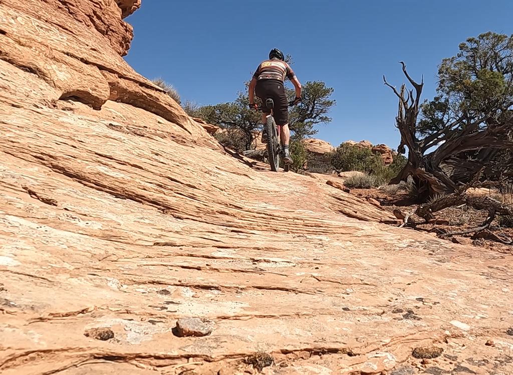
Typical trail view in the Navajo sandstone area. The trail is fairly easy to follow. On the rock, there are little stegosaur paint spots. Most intersections have trail signs. Photos April 2006.
Fins N Things
Fins & Things is a loop ride off the Sand Flats Road about a mile past Slickrock. Terrain is varied, with rolling fins of Navajo sandstone and rough doubletrack on Kayenta sandstone.
Fins & Things is a loop ride off the Sand Flats Road about a mile past Slickrock. Terrain is varied, with rolling fins of Navajo sandstone and rough doubletrack on Kayenta sandstone.
The "& Things" includes a bit of sand. Like Slickrock, this is a trail for conditioned, skilled riders with intermediate to advanced technical skills. The loop is 10.5 miles, but there are multiple "bailout" routes that take you back to the Sand Flats Road for a shorter ride. Absolute elevation change is only 400 feet, but the up-and-down riding will clock over 1000 total climbing -- and it feels like more than that.
This ride requires good sand skills. Many descents dump abruptly into sand pits. Most sandy
sections can be ridden with the right technique and fat tires. But there
will also be a few
spots where you'll hike. The sand, and the up-and-down attacks, will wear
you down faster than
you think.

Fins & Things joins the Porcupine 4x4 Trail for a few miles. Here, the trail is on Kayenta bedrock, with lots of small ledges. (The Porcupine 4x4 Trail is NOT the "Porcupine Rim Trail." It branches off it right at the trailhead.)
I recommend riding clockwise, so you cover the best slickrock while you're still fresh. The
north side of the loop is more fun, and longer, than the south end. If
you need to skip something
to save time, ride the north end slickrock, then bail onto Sand Flats
Road. Fins & Things is
primarily a 4x4 trail (as are many of the "bike trails" in Moab). But
it's a ride worth doing,
especially the north side. There's a fair amount of Jeep traffic on the
southern side of the
loop.

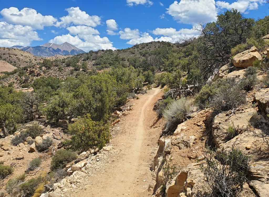
Another look down the trail, with the La Sal mountains in the background.
The north side offers a bit more solitude. I saw a group of ATVs in the distance, and three
motocross riders passed me while I was hiking in sand. And that was all,
for 6 miles until
I hit the Porcupine connector.
Parking N 38° 34.945 W 109° 109 30.587
Go east (away from Moab)
0.2 L (N) off road N 38° 34.937 W 109° 30.376
0.75 Keep L (R=shortcut)
1.0 L up wall (straight=continuing trail)
1.8 Keep L (R=shortcut back)
N 38° 35.302 W 109° 30.496
2.5 L (R=Porcupine)
4.2 L (R=Sand Flats Rd)
Go east (away from Moab)
0.2 L (N) off road N 38° 34.937 W 109° 30.376
0.75 Keep L (R=shortcut)
1.0 L up wall (straight=continuing trail)
1.8 Keep L (R=shortcut back)
N 38° 35.302 W 109° 30.496
2.5 L (R=Porcupine)
4.2 L (R=Sand Flats Rd)
5.8 R (L=Porcupine 4x4)
N 38° 35.048 W 109° 28.176
6.5 R (straight = road)7.0 R on Sand Flats Rd
7.5 At mile marker 3, L off road
N 38° 34.897 W 109° 28.982
Follow signs through camp area
9.8 Back of Campground E
N 38° 34.806 W 109° 29.969
9.9 Left at campground exit
10.5 Back at parking
N 38° 35.048 W 109° 28.176
6.5 R (straight = road)7.0 R on Sand Flats Rd
7.5 At mile marker 3, L off road
N 38° 34.897 W 109° 28.982
Follow signs through camp area
9.8 Back of Campground E
N 38° 34.806 W 109° 29.969
9.9 Left at campground exit
10.5 Back at parking

Getting there: Head uphill on the Sand
Flats Road. (Left off Moab's main drag onto 300 South. Go east on 300 South
until the road ends, then turn right. Take the second left, heading east
uphill.) Drive to the entry gate and pay your fee. From the entry gate
drive 1.4 miles (go past Slickrock). Look for "Trailer Parking"
near a tiny camping area on your right. Park here. The trail starts about
100 yards east, further up the Sand Flats Road, on the left side. You'll
finish at the back of the larger campground you can see on the right side
of the road.
Riding Resources for Fins & Things:
Large-format Topo map: View
Single-page riding guide for printing.
Lodging, camping, shops: Links to Moab area resources
Large-format Topo map: View
Single-page riding guide for printing.
Lodging, camping, shops: Links to Moab area resources
GPS track files (right-click and "Save as..."):
GPX
GPX