Bruce rides Hoj Wash. Original review by Bruce in May 2006, with latest update on November 10, 2022.
Bloomington Micro Loop Area
Bloomington Alternate, Hoj Wash, Farmers Fenceline, BupStarch LoopThis page covers less-popular rides in the Bloomington area south of
Bearclaw
Poppy
. This includes Hoj Wash (classic Bloomington Micro Loop),
Farmer's Fenceline (an out-and-back off the bottom of Hoj Wash), and the BupStarch Loop
(found off the Bloomington Alternate singletracks or by riding to the far end of the Fenceline
Trail). These trails are easy technically with little overall climbing.
The riding season for these trails is year round -- weather permitting. The surface is clay,
so like
Bearclaw
they should be avoided when soaked after heavy rain.
The Bloomington Micro Loop (Hoj Wash) is a classic loop ride that starts at
the Bloomington trailhead for the
Bearclaw Poppy
trail.
It's a fast and quick ride without much work. For most riders, Hoj Wash
is also the route to Farmer's Fenceline and
BupStarch.

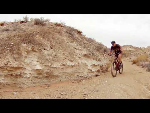
Looking east in Hoj Wash.

Crossing a small wash in the desert preserve. There are lots of dips and twists here.
The BupStarch Loop is a fun two-mile loop ride through undulating Moenkopi clay. This loop
lies between Hoj Wash and the Bloomington Alternate trails. It can be
reached from the bottom
of Hoj Wash via Farmers Fenceline, or from the top via a couple of short
connectors from the
Bloomington Alternate singletracks.
You can reach these trails by riding Bearclaw Up. This trail is designed to be ridden ONE WAY.
At the trail's west end is a 4-way where you can connect to
Stucki Springs
(straight ahead),
Bearclaw Poppy
(to the right), or Hoj Wash (left).
On Bearclaw Up are two alternate singletracks that fork away to the left. These are called
the "Bloomington Alternate" singletracks. These trails, in turn, give
rise to connectors to
the BupStarch Loop.

Heading up a wash on the Farmer's Fenceline trail. Once we're on top of the little hill, the trail will turn east for some easy cruising.

Coming back into the parking area at Bloomington.
Bloomington Trailhead
Go to the west end of Navajo Drive in Bloomington. Go across the cattle guard and drive about
1/10th mile. Turn left into the large multi-level trailhead. Around the
middle of the trailhead,
on the downhill side, there's a ride-over gate.
The gravel road past the trailhead is the Apex Mine or Curley Hollow Road, which will be your
return path from Hoj Wash if you ride the classic Micro Loop. Curley Hollow
is a popular destination
for ATVs.
From the trailhead ride-over, pedal about 100 feet straight ahead, then fork 90 degrees to
the left. This is Bearclaw Up and it's the outgoing path for the Bloomington
Micro Loop or
the Bloomington Alternate singletracks. Now ride westbound. Stay generally
straight on what
appears to be the main trail to avoid getting lost on alternate lines.

The Bearclaw Poppy Up trail and the Bloomington Microloop share this common origin. Looking north as the Up trail heads west.

Taking a plunge on the Acid Drops of Bearclaw. If you keep straight and slightly right after dropping Clavicle Hill, you'll arrive at the 4-way with Stucki and the Micro Loop trail to Hoj Wash.
From upper Bearclaw Poppy or Stucki SpringsAt
the bottom of Clavicle Hill (the last of the Acid Drops of Bearclaw) keep
straight and to the right where Bearclaw turns to the left in a fenced
corridor. Continue south to a signed 4-way intersection. To your left is Bearclaw
Up; to the right is Stucki Springs; straight ahead is the Micro Loop,
headed to Hoj Wash.
At
the bottom of Clavicle Hill (the last of the Acid Drops of Bearclaw) keep
straight and to the right where
Bearclaw
turns to the left in a fenced
corridor. Continue south to a signed 4-way intersection. To your left is Bearclaw
Up; to the right is Stucki Springs; straight ahead is the Micro Loop,
headed to Hoj Wash.
The Bloomington Micro Loop (Hoj Wash)

The trail parallels the Roller Coaster section of the Bearclaw Poppy, which is about 1/3 mile away. Some "cheater routes" forking to the north go to Bearclaw. In general, stay left when in doubt.
The Hoj Wash loop ride begins on Bearclaw Up. The loop features about 4 miles of nice narrow
singletrack, then two miles on graded dirt road to close the loop. Total
length is 6 miles
with about 200 feet total climbing. The singletrack is easier intermediate
technical.
There will be some branching trails. Some are legitimate alternates, but most are outlaw cheater routes. In general,
keep straight on what appears to be the main trail as you head northwest
through the white
and red desert soil. If you aren't absolutely sure an alternate trail
is legit, don't go there.

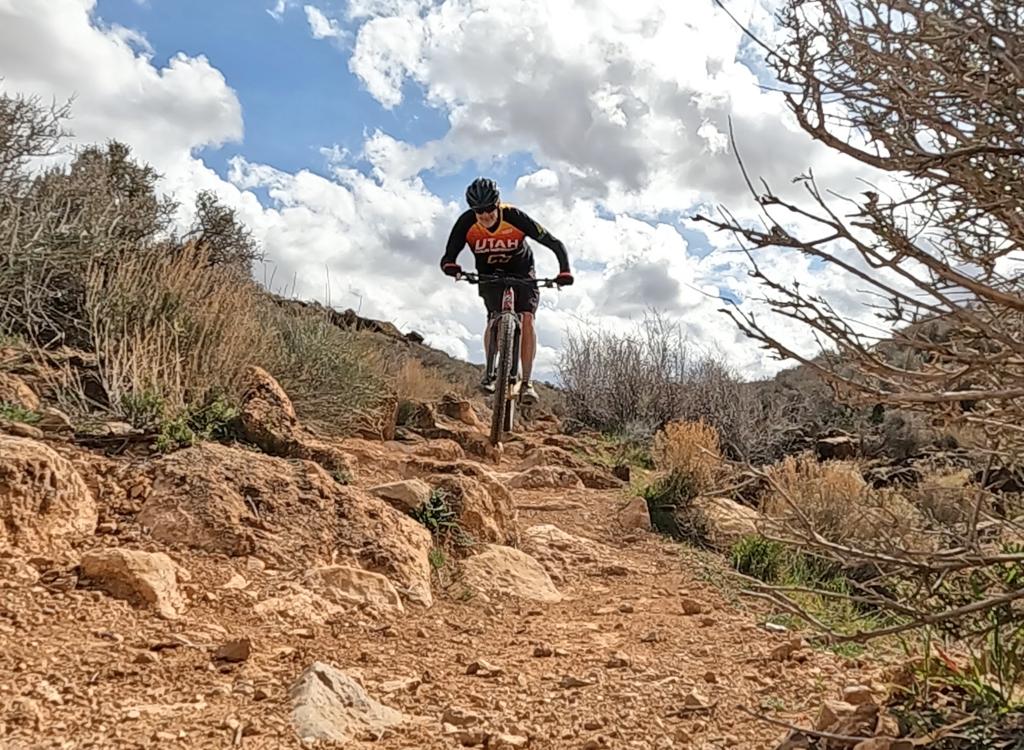
The wash bottom is usually firm and smooth. No tire-sinking sand. In this spot, the wash breaks over stone slabs. The ledges are easy for experts; a bit of a challenge for beginners.

Bruce's Superfly 100 takes a rest in the wash.
After about 1/2 mile, the trail will drop in to a shallow wash. You'll follow the wash bottom
for a mile or so, still heading northwest.
About two miles from the beginning of the loop, the trail climbs out of the wash. You're back
on the familiar white clay, still heading northwest.
After a short distance on the white singletrack, you'll cross the main Bloomington Alternate
(not marked), then reach a
four-way trail intersection. Straight
ahead is the way to
Stucki Springs
and the
Snakepit
trail; to the right is the connector to the middle of
Bearclaw Poppy
just below Clavicle Hill (where the one-way downhill section starts).

When you reach this spot, turn left. (We're looking straight -- northwest -- at the Stucki Springs trail.)

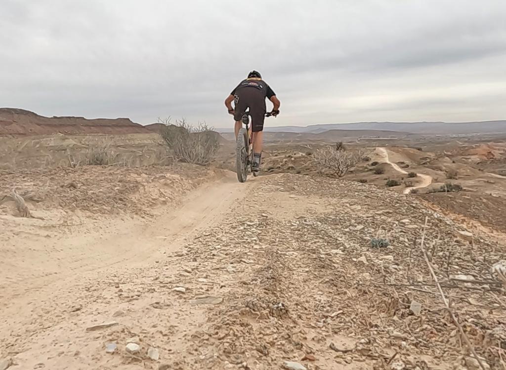
View from a small ridge where the trail shortcuts across a small rise before re-entering the wash.
To ride the Bloomington Micro Loop, turn left at the 4-way intersection. There should be a
"Bloomington Micro Loop" sign here. Follow the singletrack down into the
wash. The trail will
head to the south, following the course of Hoj Wash.
In several spots, you can either continue down the wash bottom, or follow the singletrack between
goosenecks of the wash. The riding here is pretty easy. This is a good
ride for experienced
beginners.
About half-way down the wash, there's a connector on your left (marked by a tiny rock-pile
in 2022). It's usually used as a downhill from BupStarch to Hoj Wash,
but you can climb it
if you're game for some steep slopes.

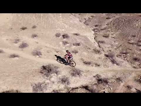
Drone view as we ride the wash bottom.

The singletrack exits and re-enters the wash multiple times.
After about a mile in the wash, you'll reach a gate at the edge of the Desert Preserve, where
the wash opens up. On your left is the Farmer's Fenceline trail.
To continue the Micro Loop, climb over the metal gate. (The step-over around the gate had been
fenced off during my last visit, probably because idiots with light motorcycles
were lifting
them into the desert preserve.)
Turn left on the gravel road (called Curly Hollow Road or Apex Mine Road) and head back to
the Bloomington Trailhead. You'll spend about two miles on the dirt road.

View on the dirt road as we head back toward the trailhead.

Looking northeast as the Farmers Fenceline trail leaves Hoj Wash.
The Farmer's Fenceline trail starts at the bottom of Hoj Wash, just before the Micro Loop hits
the Apex Mine (Curley Hollow) Road. As you approach the gate near the
road, the trail will
be on your left.
The Fenceline trail is 1.4 miles in length. There's a bit of up-and-down riding, with around
150 feet of overall elevation change from the wash to the BupStarch Loop.

Climbing up a wash to get on top of the bluff.

View southwest on the return path of an out-and-back on the Fenceline.
From Hoj Wash, the Fenceline trail will climb up a low bluff. There are two pathways, with
the trail fork just over 100 yards from the wash. The right-hand trail
is better as a climber,
the left-most is steep and should be reserved for your ride back. These
paths will rejoin in
1/10th mile on top of the bluff.
After a bit of meandering, the Fenceline trail will approach -- surprise! -- a fenceline. Continue
to ride parallel to the fence eastbound. The fence will come to a 90-degree
corner, forcing
the trail to also turn 90 degrees left, uphill and north.

Looking north as the trail rolls through cryptobiotic crust.

Nearing the top of Farmers Fenceline. The BupStarch Loop will turn to the left at the bottom of the white mound. (A connector trail drops down from the top of the white ridge. The connector joins BupStarch to an alternate Bloomington singletrack at the top where the fence again turns to the east.)
Pedal 0.2 miles uphill to find the start of the BupStarch Loop. The loop turns gently to the
left for a counterclockwise ride; hard left for the clockwise direction.
(There are several
confusing cheater trails here.) If you continue uphill and north (counterclockwise
on BupStarch),
the options to your right (just after you start the loop) are connectors
to one of the Bloomington
Alternate singletracks (see map).

Climbing uphill to the west.
There are two trails that fork to the left off Bearclaw Up that are referred to as "Bloomington
Alternate" singletracks. While considered "alternates" to Bearclaw Up,
they're not exciting
rides when used for this purpose. But these trails allow you to connect
to the BupStarch Loop
from above.
The first alternate is found at the spot where the Curley Springs (Apex Mine) road -- which
you can see to your left across the fence -- turns away from the Bearclaw
Up trail at mile
0.6 from the trailhead. The singletrack, on your left, is unmarked but
will appear to be a
fairly prominent trail.
This first Bloomington singletrack is 0.6 miles long, ending on the main Bloomington Alternate.
Once you turn away from Bearclaw Up, keep generally straight and left.
Shortly after leaving
Bearclaw, it begins following a fenceline westbound. At mile 0.4 from
Bearclaw Up, the fence
turns away to the south. There's a connector trail here that drops down
to the BupStarch Loop.
The trail splits after 100 yards. Left is a steep drop-in straight down
to Farmers Fenceline,
and the trail on the right rolls down to the top of BupStarch Loop and
is suitable for climbing
up from the loop.

Looking ahead as the Bloomington Alternate follows the edge of a low rise. The BupStarch Loop is just out of sight to the left of this photo, at the bottom of the break in the Moenkopi clay.

On the main Bloomington Alternate, heading back toward the wash of Bearclaw Up. To get back to the trailhead, we'll cross Bearclaw Up and take the Shortcut trail north to Bearclaw Down.
The main (2nd) Bloomington Alternate forks away from Bearclaw Up in the wash at mile 1.0. It's
on the left, exactly opposite the Shortcut #1 trail (on your right). The
Bloomington Alternate
rejoins Bearclaw Up after 1.3 miles. It's a rather non-interesting trail.
But at mile 0.4 from
Bearclaw Up, there's a short connector that drops off the ridge down to
the BupStarch Loop.

Looking east on the loop, riding clockwise. Bloomington Hill is seen above the clay slopes north of the trail.
The BupStarch Loop officially begins at the northeast end of the Farmers Fenceline trail. This
is the eastern corner of the loop. You can also drop down to the loop
via short connecting
trails from the Bloomington Alternate singletracks. I've shown the two
most useful entries
on my map. For mileage -- and how to find the connectors -- see the Bloomington
Alternate section
above.
The loop is 2.1 miles around and is very easy riding. But navigation is NOT straightforward,
as there are a couple of cheater trails that you might confuse with the
main loop. There are
no trail signs. Occasionally, a small rockpile designates the appropriate
trail fork. The loop
is featured on Trailforks, and I suggest you use GPS navigation to confirm
that you're making
the right trail choice.

Looking west as the trail cruises through cryptobiotic soil.

The wash connector. A nice ride, but it's not part of the loop.
At the northwest corner of the BupStarch Loop there's a 0.4 mile trail that connects the loop
down to Hoj Wash. On a counterclockwise ride, it's located at the point
where the loop turns
from westbound (and gently uphill) to south and downhill at mile 0.9 from
Farmer's Fenceline.
Because this connector trail is as prominent as the loop trail, you might
be suckered into
taking it. So if you find yourself in the bottom of a big wash after descending
100 vertical
feet, turn around and ride back uphill.
The uphill side of the loop traverses along the bottom of a low bluff. (The Bloomington Alternate
trails are on top, near the edge of the bluff.) If you're riding clockwise,
it's gently downhill
as you go east.

Looking east as the trail undulates along the edge of the hill.

Looking east toward Bloomington on the lower side of the loop, riding counterclockwise. The trail winds along the top of this low ridge.
The lower (southern) side of BupStarch Loop descends gently from west to east, following the
top of a low ridge in an area of open rolling clay desert. At the eastern
end, the loop turns
uphill and meets the top of the Farmer's Fenceline. Again, there can be
some confusion because
of competing cheater routes. Please try to stay on the main trail so you
don't make things
worse.

Wide-area view showing the Microloop in the lower right, with Stucki Springs at upper left.
Sample Bloomington ride!
"Snakepit
Figure-eight" with Snakepit, Stucki Spring, and Bearclaw:From
the Bloomington trailhead, take Bearclaw Up, then do Stucki Springs
clockwise as a loop, then join Bearclaw downhill to the trailhead.
Single-page guide
to this ride:
View
to print
GPX course file for the ride:
Download
0.0 Bloomington TH, step over gate
N37 03.125 W113 37.344
0.2 Fork L on Bloomington Microloop
N37 03.224 W113 37.504
2.4 4-way, keep straight to Stucki Spring
N37 04.160 W113 39.387
2.7 R and into wash for Snakepit
N37 04.268 W113 39.584
2.8 R on edge of wash (in wash = alternate)
N37 04.326 W113 39.699
3.1 Rejoin alternate from wash
N37 04.399 W113 39.907
3.2 Stay in wash (L = up to Stucki)
N37 04.482 W113 40.018
4.4 Snakepit Rim joins on R
N37 05.180 W113 40.836
5.0 Hard L on Stucki Spring trail
N37 05.659 W113 40.933
5.7 Alternates N37 05.387 W113 41.473
(straight = plunge, R = around)
5.2 Alternates rejoin N37 05.366 W113 41.568
6.7 Viewpoint, Cottonwood Wash, turn L
N37 05.227 W113 42.143
9.3 Keep R (L = down to Snakepit)
N37 04.619 W113 40.243
9.6 Keep R (L = to Snakepit)
N37 04.470 W113 40.184
10.3 Keep R at original Snakepit fork
N37 04.261 W113 39.620
10.6 At 4-way, turn L
N37 04.160 W113 39.387
10.7 Bottom of Clavicle Hill, fork R
N37 04.202 W113 39.313
East (R) on Bearclaw Poppy
trail
N37 04.209 W113 39.259
13.0 Back at Bloomington parking

Map of the Microloop area
Getting there:
Go to the west end of Navajo Drive in
Bloomington. Go across the cattle guard and drive 1/10th mile on the dirt
road. Fork downhill to the right into either of the trailhead entrances
and find a parking spot. The outgoing trail begins on the north side of
the lower parking lot (toward Bloomington Hill).
Classic Bloomington Micro Loop, with the alternate trails edited out for clarity.

area topo map