
Photo looking south, as we approach the Orem Bench trailhead during an April ride in 2006. New photos and updated maps, GPS tracks and riding information by Bruce on July 20, 2016.
Bonneville Shoreline Trail
(Orem Bench to Cedar Hills)This
section of the Bonneville Shoreline Trail (BST) connects the
Provo
Canyon North section
(the Orem Bench Road) to the southern end of Cedar Hills. There
are trailheads at northeast Orem, Lindon's Dry Creek, and Pleasant Grove's
Battle Creek and Grove
Creek. The singletrack sections have substantial climbing. The technical
rating is upper-intermediate because of embedded rock on narrow trail with
steep side-slopes.
The trail is singletrack from the Orem BST trailhead to 1/4 mile south of the Battle Creek
road. Then things get messier. From Battle Creek to Grove Creek, it's doubletrack among a tangle
of branching jeep roads.
Northbound from Grove Creek, there's singletrack again. Then the route follows the Cedar Hills
Bench Road for a few miles until it ends on the Canyon Road just north of the Cedar Hills city
offices.

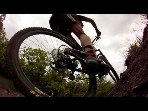
Back in April 2006 Jackie and I hit the brand-new trail descending to Battle Creek. Nothing like fresh-cut trail dirt! Looks like I was riding a Scalpel at the time.

Looking northwest from the Orem to Lindon section in April.
The trail can be done as an out-and-back of whatever distance you choose. From Orem to the
singletrack's end north of Grove Creek, it's 14 miles round trip with 2200 vertical feet of
climbing. Much of that climbing comes on the Battle Creek to Dry Canyon leg, with over 650
feet of vertical in southbound direction.
An option for those who wish to ride the whole trail -- but can't handle the return climb --
is to make it a loop ride by hooking up to the paved
Murdock Canal Trail
for the return. Direction for the loop? I like the Orem to Pleasant Grove direction for the
dirt portion. Then catch Murdock southbound as it crosses the Canyon Road south of Cedar Hills.

For each trailhead, the trail descends back to around 5100 feet, then climbs the mountain again. This is the path uphill heading south from Battle Creek.

The terrain is groves of gambel oak on dry hillside.
Many riders use the BST to reach
Crop
Circles
If that's your target, the closest trailhead is Lindon (Dry Canyon). But here's the problem.
The trail forks for these "social trails" are unmarked. But so many bikers ride there that
the size of these trails equals that of the BST.
And in 2016 at the north end of the lower crop circle, the "side route" trail is wider and
more-traveled so could be confused with the northbound BST. So a GPS or a map is handy if you're
new to this BST section.
The point of this ride is that it's close to civilization. You can easily hit this trail before
or after work, and on the off-season.
Most sections of this trail will clear of snow by April. Some muddy sections will persist until
May. The singletrack from the ridgeline down to the doubletrack near Battle Creek is the most
sensitive to wet riding -- other sections have embedded rock that resists rutting.

More typical trail, as the BST winds around the edge of the hill southbound.

Looking south as the trail approaches the Dry Canyon area.
The trail is surrounded by typical Wasatch foothill scrub. You'll ride through grass with occasional
sagebrush and isolated stands of scrub oak. On a clear day, the views over the valley are very
nice.
Orem to Lindon (Dry Canyon) Section

My Rocky Mountain rests on the rack after completing the ride. The trail is immediately right of the bathroom (not the steep thing going up the hill!).
This section is 1.5 miles. It's popular with trail runners
and walkers. So you'll deal with more traffic here than on the other
sections. Navigation for this section is the simplest of any.
Northbound from the Orem Bench trailhead, the trail is just
uphill from the trailhead toilet. The BST will gain around 300 vertical
feet on the way to Dry Canyon. Most of it comes in one ugly 1/3-mile
grunt-fest shortly after leaving the trailhead.
The steep area has little humps of the limestone rock outcrop popping up into the trail tread.
And it's littered with white powder and limestone chunks. The slope is ride-able if you keep
traction, but it's a mean climb.
When you arrive at the paved turn-around in front of the water tank at mile 0.7, go straight
across the circle to the north side for the continuing singletrack. The climbing is done for
a bit, and you're ready to coast.

Climbing up northbound through rough outcrops of limestone.

The climbing has leveled out, and we get to swoop around a bit.
There's a trail fork at mile 0.95. Left would take you downhill to the Lindon trailhead road
just above the homes. Keep right uphill.
At mile 1.5, as you approach the Lindon trailhead, turn left as you hit
a T intersection with the
Dry Canyon
trail. Go
around the fence, then cross the trailhead to the far north end for your
next segment.
from Dry Canyon, the trail is at the far south end of the paved area just west (downhill) of
the kiosk and fence. About 30 feet after starting, fork right to head south on a long traverse.
 trailhead parking.")
Looking south from the north end of the Lindon (Dry Canyon) trailhead parking.

Cruising south toward the water tank saddle, through low stands of gambel oak.
Keep straight, uphill, and southbound at the fork in 1/2 mile.
In this direction, there will
be a tiny bit of mellow climbing as you approach the high point at the water tank. The trail
tread on this portion is smooth dirt, and is probably the easiest of the Orem-section BST.
After descending the loose and steep section, the trail flattens out. When you see the tops
of Orem's water tanks, you're almost there. Just before the parking area, the trail will split
in two, as one climbs to paved parking and the other runs straight to the unpaved overflow
parking.

Approaching the scenic water-treatment facilities with the homes of Utah Valley extending south to Loafer Mountain.
Lindon (Dry Canyon) to Battle Creek Section

Here's the northbound BST. Go up the singletrack and turn 90 degrees left. Now try to stay on the right trail.
The ride between Lindon's Dry Canyon and Battle Creek is the longest
section at 3.1 miles. It's easiest south-to-north, because the Lindon
Trailhead is 300 feet higher in altitude than Battle Creek.
Northbound from the Dry Canyon trailhead, you'll go from 5400
feet elevation to 5650 in around 0.6 miles, then enjoy a long downhill.
The trail goes north from the paved road just as the road turns to enter the parking lot. Go
left of the big steel gate, taking the singletrack, not the jeep road. After turning left above
the kiosk, you'll run a gauntlet of branching trails.
These are cheater routes on the uphill (right) side, and connections to
the
Lindon Circle trails
on the downhill
left side. Take the fork that seems most likely to take you on a gentle
curve to the right and northbound. In this spot, if you find yourself
going any direction but north, you took the wrong fork.

Climbing through tall crested wheatgrass as we head north.

Looking down at Lindon from a high spot on the trail. That's Utah Lake in the distance.
At mile 0.3 the trail splits in a grass meadow on a
saddle. Take the middle route, slightly to the right and uphill. The flat
trail straight ahead will descend on a loop ride. The rightmost trail is a
cheater route.
At 0.5 miles, the trail turns left as the
lower
Crop Circle
trail goes downhill right.
You'll reach the other end of the lower crop circle at mile 1.0 -- keep
left on what looks like a smaller trail through a grove of oak. The right
fork looks more-traveled, but it's the wrong way.
After a fairly steep descent at mile 1.5, the trail veers a little left as it crosses an ATV
path. Unfortunately, there's a prominent path turning right onto the doubletrack. Either riders
didn't notice the continuing trail across the DT, or they were in such a hurry to get off the
mountain that they rode sucky trail. (This DT is the old alternate route. It connects to the
top of Battle Creek.)
The trail winds along the edge of the bench then begins descending. At 2.4, keep right at the
Splinter Cell fork, then right again as you approach the wooden fence. Join doubletrack northbound
at 2.8. When you hit paved road, go 100 feet uphill then turn left on continuing dirt road
(ignore don't-go-here signs -- they apply only to property OFF the main dirt road).

We're descending the west slope of the mountain, going north.

Ride-around at the doubletrack gate for the southbound trip.
To ride this segment southbound, find the doubletrack just uphill
from the last home. It's about 1/4 mile down the paved road from the
parking lot at Kiwanis Park. If you're finishing the Grove-to-Battle
segment, exit the dirt road, turn downhill 100 feet on the paved road,
then left on the DT. Go around the metal gate and go about 1/4 mile
further before veering left uphill on the BST singletrack.
Keep left uphill at mile 0.5, shortly after going through the wooden fence. The trail dropping
to the right goes to a city street. Keep left again as Splinter Cell forks away at mile 0.7.
(Splinter Cell drops to the south and joins southbound doubletrack along the lower bench.)
Cross the doubletrack at mile 1.6 to begin the nastiest climb of the ride. You'll gain 200
feet in 0.4 miles, then climb some more.

We're starting the climb up to the pre-historic Lake Bonneville shoreline southbound.

There's a bit of this steep side-slope stuff. Looking south.
Keep straight at mile 2.2, resisting the temptation to go
uphill on the big wide lower
Crop Circle
trail. As the trail makes a right turn at mile 2.6, again stay right as
the other end of the Crop Circle trail goes straight.
As
you approach the trailhead at mile 2.9, generally keep to the left so you
don't drop west off the mountain.
Battle Creek to Grove Creek Section

Ugly. Boring. Hot.
This piece is a short 1.1 miles. Unless you're determined to
ride the whole length of northern Utah County's BST, there's little reason
to do this section. It's just dirt roads. And the hillside is infested
with ATVs and 4x4s. There's a trail branching or crossing every hundred
yards.
Pedal north on the DT below Kiwanis Park, skirting below the
flood-control basin. Keep straight north, then veer to
north-northwest.
At mile 0.4, veer right uphill to join the higher DT under the power lines, skirting a flood-control
hole where 4x4's play in the mud during springtime. Now stay on that course until you're approaching
the trees of Grove Creek. As the DT turns left, veer slightly right and descend through the
creek.
(There's a lower road that hits Grove Creek by going through the flood-control area. To use
this path, just stay straight and downhill at the fork at 0.4 miles, then work north as 4x4
routes go everywhere.)
, from the power line DT.")
Looking northwest downhill at the lower route(s), from the power line DT.

Grove Creek trailhead. A trail runner with dogs. A guy loading horses next to me. And ATVs use the area between Grove and Battle Creek. The BST crosses the Grove Creek trail 200 feet uphill.
After climbing out of the creek, you'll arrive at the
Grove
Creek
trail. The continuing BST is straight across.
To take the trail
southbound from Grove Creek parking, go up the broad Grove Creek trail for about 200
feet. Just before the trail reaches the mountain, turn 90 degrees right and plunge down through
Grove Creek.
As you exit the trees, keep straight and follow the power line corridor on doubletrack. At
mile 0.6, just after skirting the big hole, veer to the right and coast down to the lower road.

The route down and through the creek, as seen from the Grove Creek trail.

On the power line doubletrack heading south.
As you approach Battle Creek, keep southbound and generally downhill on the main dirt road.
You'll pass west (downhill) of the flood control wall, then hit the paved road at mile 1.1
from Grove.
Jog 100 feet downhill on pavement, then turn left to continue the BST south.
Grove Creek to Cedar Hills Section

Looking north on the singletrack BST just north of Grove Creek.
This section of the BST is a work in progress as of early 2022. There are zero trail markers,
while many trails -- large and small -- fork away from the official BST route. Navigation will
be tricky, so at this time I recommend a GPS trail app to see where you are in the trail system.
April 2022: The Forest Service has made several branching trails in this area official, and
has applied for funding to begin marking them.
Because of the absence of trail markers -- and the multiple trail forks -- I will provide greater
detail for this section of the BST.
If you arrived at Grove Creek via the upper BST route from Battle Creek, the continuing trail
is just across the Grove Creek trail.

Looking north on the BST from the mouth of Grove Creek.

Looking up Grove Creek. The BST crosses right where the trail its the shoulder of the hill.
If you arrived via the lower route, either (1) turn to the right and go to the northeast corner
of the parking lot, where an (unmarked in April 2022) dirt trail takes you uphill and northbound
to join the BST, or (2) pedal straight up the big Grove Creek trail for about 150 yards then
make a hard left turn onto the official BST as the Grove Creek trail hits the mountain.
Alternate: Bench RoadMany
riders simply take the Canal Road (aka Bench Road) north. It's found at
the steel gate just below the paved Grove Creek parking. You'll have a
three-mile pedal-fest on gravel before you intercept the Canyon Road in Cedar
Hills. Because this section of the singletrack BST requires climbing
fairly on the hill, take the Bench Road if you're tired or running out of
time.
Note that there are competing dirt roads and subdivision construction
at the north end. Stay as straight northbound as possible at any trail
forks. If you find two parallel dirt roads, the downhill (west) DT is the
right one.

At the ride-around for the northbound Canal Road, just below the Grove Creek parking.

The BST is the smaller trail to the left. The trail on the right is used as a descending route, but it hasn't been included as a formal part of this trail system.
In general, where branching trails are not marked, you should take the most flat option. Contrary
to what you might expect, the larger more-traveled trail may NOT be the BST.
At a trail fork 0.2 miles uphill, the left fork is
the lower BST; the larger trail on the right is an unofficial route that's
often used as a downhill. This trail is sometimes referred to as the upper BST
or Dropout. If you climb it, the last bit will be hike-a-bike until it joins
the Mahogany Bench Climb trail. See the
Mahogany
Mountain trail page
for details on this area.
There will occasionally be bits of grunt climb as the trail rolls over the skirts of the mountain.
Through this area, you can reliably stay on what appears to be the main trail.
The terrain in this area is almost entirely grass mixed with small stunted sage. There will
be occasional tiny groves of gambel oak.

Depending on your fitness and gearing, some climbs may turn into hikes.

View back to the south as we climb away from Grove Creek.
At mile 0.6 from Grove Creek, there's a trail on the right at the top of a rise. It curves
to turn 150 degrees from your direction of travel. This is the Mahogany Bench Climb trail.
The BST will now veer right and descend into a valley.
As the BST turns left and begins to climb up from the bottom of the valley, it will turn hard
to the right and begin climbing up the valley on the south-facing slope. When the BST makes
its right-hand turn, the smaller trail that continues straight is unofficial.

Looking down at Utah Lake where the BST is climbing up to the bench area.

Critical trail fork. The BST is on the left, and will now descend.
After 0.1 miles of climbing to the east, there's a smaller trail on the left. This smaller
trail is the official route for the BST. (If you went past it and arrived at a complex major
intersection about 100 feet later, just turn hard left downhill and it will rejoin the official
BST.)
Assuming you forked left on the official BST, the trail will reach a crossover 100 feet later.
Turn left here and you're on the downhill section of the BST. (The trail straight ahead is
the Mahogany Bench Connector and it will take you uphill to the Rojo Rolling trail.)
Now navigation becomes easier. Stay on the main trail until you reach the upper Bench Road
in a small valley. You're now at mile 1.4 from Grove Creek. Keep to the right and go north.
Fork right on the upper doubletrack at a fork 0.2 miles later.

Once you're hit the high point on the northbound BST, the downhill is constant until you hit the old upper Bench Road. Looking northwest over Utah Valley.

Descending on the BST at around mile 2 from Grove Creek.
The trail will narrow as it heads north on the lower shoreline bench. Pass Sneaky Shiz on your
right at mile 2.0.
Around mile 2.2, there's a trail fork. The larger left fork descends a ravine to the Bench
Road. The smaller right fork is (I believe) the BST. It will climb a tiny bit and go under
a log fence, then descend down to the Bench Road. We're at mile 2.4 now.
At the Bench Road, you can either turn right to head to the Canyon Road near the fire station
in Cedar Hills, or you can turn left to head back towards Grove Creek on the Bench Road. If
you continue north, it's 1.9 miles to the Canyon Road.

Looking north at the Bench Road in Cedar Hills.
Riding notes, from the Orem
Trailhead:
0.0 N just uphill from toilet building
N40 19.508 W111 40.219
0.6 Cross road circle at water tank
N40 19.932 W111 40.398
1.1 Keep R uphill (L = to Dry Creek road)
N40 20.191 W111 40.456
1.5 L for Dry Creek trailhead
N40 20.487 W111 40.594
Cross to N end of parking
N40 20.527 W111 40.640
1.6 Keep on main trail
1.8 Middle trail climbing N
N40 20.598 W111 40.843
(L = descends mountain)
2.1 Keep L (R = to Crop Circle)
N40 20.721 W111 40.807
2.5 Keep L (R = to Crop Circle)
N40 20.900 W111 41.099
3.0 Veer L to cross DT!
N40 21.192 W111 41.625
4.0 Keep R (L = Splinter Cell)
N40 21.329 W111 41.778
4.2 Keep R (L = descends to street)
N40 21.337 W111 41.931
4.4 Join DT northbound
4.6 R uphill on paved road
100 feet, then L on dirt road
N40 21.674 W111 42.165
4.9 Keep L and level N40 21.855 W111 42.166
5.1 R and climb to DT along basin
N40 22.027 W111 42.266
Now keep level and north at
forks
5.7 Veer slightly R towards trees
N40 22.459 W111 42.642
Drop through creek
5.8 Cross Grove Creek trail
N40 22.500 W111 42.646
5.9 Trail from parking joins on L
N40 22.551 W111 42.734
5.95 Keep L (R = upper BST)
N40 22.603 W111 42.760
6.4 Fork L to go N
N40 22.863 W111 43.139
6.9 Join Canal Road northbound
N40 23.002 W111 43.530
9.9 Canyon Road

Aerial map of the Lindon and Pleasant Grove area
Getting there, trailheads south to north:Orem trailhead: Drive towards the mountains on 800 North. At 800 East, turn left and drive north about 1
mile. Immediately past the fence at the uphill edge of the cemetery, turn right (east) on Cascade Drive.
Drive 1/2 mile, then turn uphill to the left as you approach the water
treatment buildings. Go up 2 short switchbacks to the paved parking area
with the bathroom. The
trail begins on the north end of parking right next to the bathroom.
Dry Canyon trailhead: Turn east off State Street at 200 South in
Lindon, which also
happens to be 2000 North for Orem. Keep straight as you approach the
mountains. When the road forks, veer left, then keep straight uphill
heading northeast. After a turn to the right you'll enter the parking
area. The northbound BST is at the far north end, right were the road
entered parking. The southbound trail is at the southeast end near the
mountain. After exiting the pavement and going about 30 feet east uphill
on Dry Canyon, fork right (south) for the BST.
Battle Creek trailhead: For the Pleasant Grove Battle Creek trailhead, turn east on 200 South
in Pleasant Grove and keep going straight until the road ends at Kiwanis Park in Battle Creek Canyon.
Drop
back down the paved road 1/4 mile, turning left on a small gravel road
just before the first home. Watch for the singletrack 1/4 mile later on
your left. Keep uphill at two trail forks.
To go northbound from Battle Creek, again drop down the paved road 1/4
mile, but turn north (right) on dirt road about 100 feet uphill from the
southbound doubletrack.
Grove Creek trailhead: From 100 East in Pleasant Grove,
turn east on 500 North (across from the cemetery). Continue east until the
road ends at the Grove Creek TH. Go straight up the canyon on the Grove
Creek trail for around 200 feet. The broad trail going north (left) just
before you reach the mountain -- with a corresponding trail dropping into
the ravine southbound -- is the BST.
Cedar Hills: No formal trailhead. Look for dirt road on
the uphill side of the Canyon Road near the fire station. Use a GPS
navigation app on your mobile to confirm the connection.

Bathroom at Grove Creek. Most formal BST trailheads also have bike-repair stands..
Maps and information updated 2022


 trailhead parking.")


, from the power line DT.")


